MyTopo
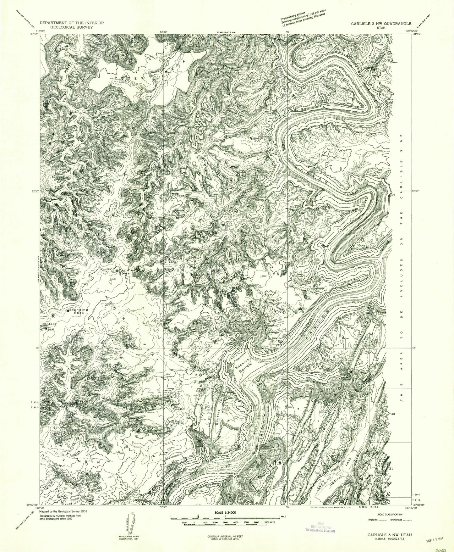
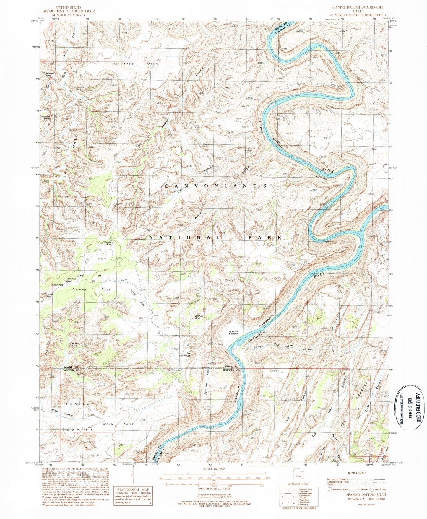
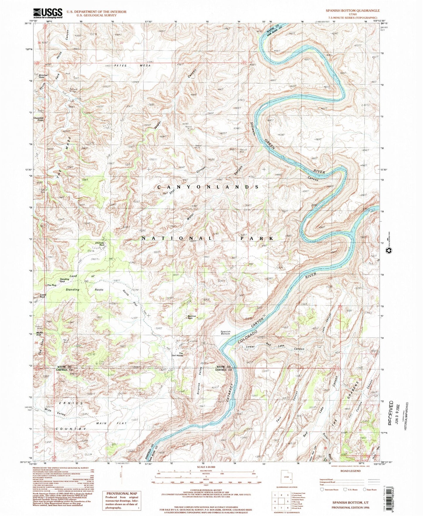
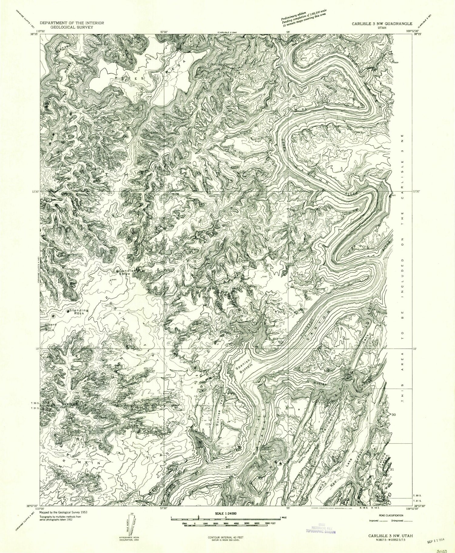
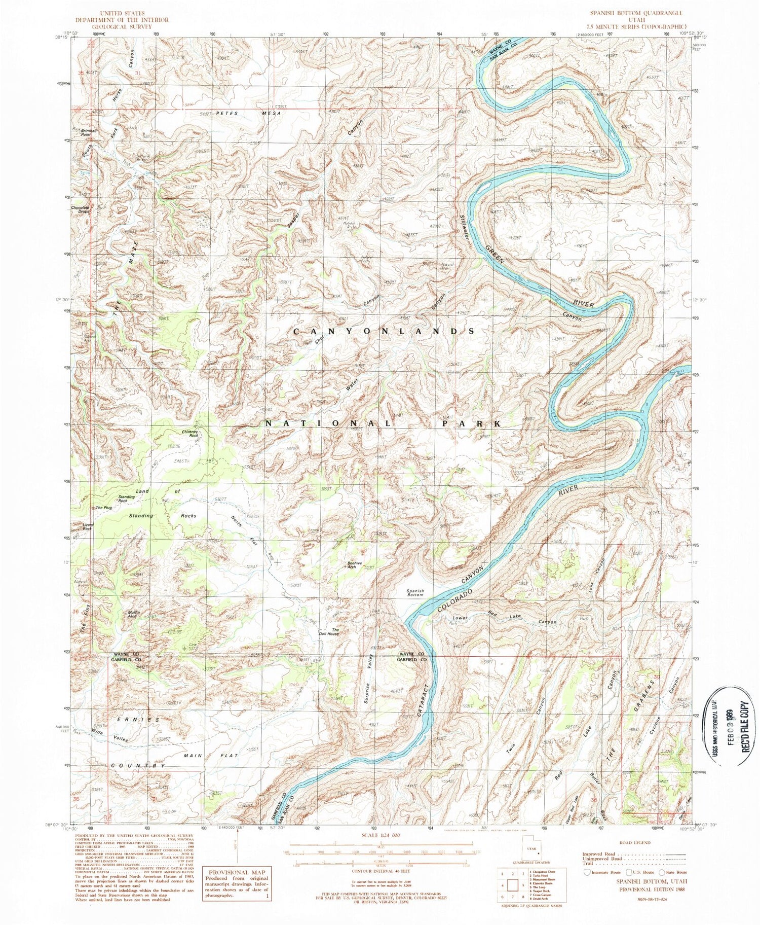
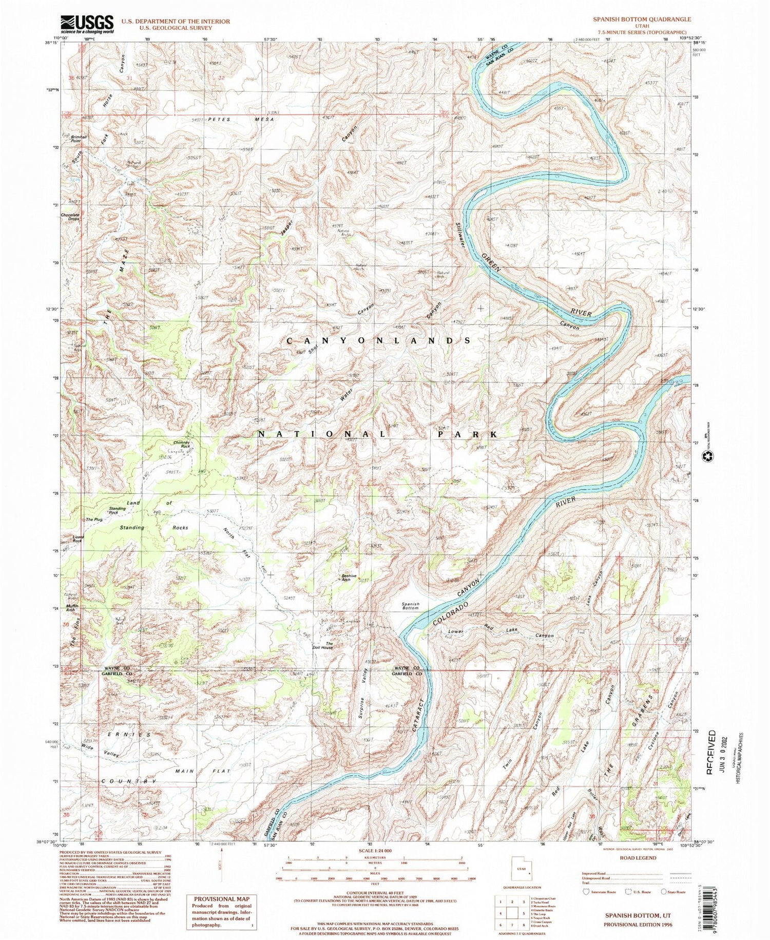
USGS Classic Spanish Bottom Utah 7.5'x7.5' Topo Map
Couldn't load pickup availability
Historical USGS topographic quad map of Spanish Bottomin the states of Utah, Wyoming, Colorado. Scale: 1:24000. Print size: 24" x 27"
This quadrangle is in the following counties: Garfield, San Juan, Wayne.
The map contains contour lines, roads, rivers, towns, lakes, and grids including latitude / longitude and UTM / MGRS. Printed on high-quality waterproof paper with UV fade-resistant inks.
Contains the following named places: Lower Red Lake Canyon, Butler Wash, Chimney Rock, East Fork Twin Canyon, Green River, Lens Canyon, Lizard Rock, Main Flat, North Flat, Petes Mesa, Spanish Bottom, Standing Rock, Stillwater Canyon, Suprise Valley, Twin Canyon, West Fork Twin Canyon, Land of Standing Rocks, Aztec Canyon, Beehive Arch, Chocolate Drops, Shot Canyon, Water Canyon, The Doll House, The Plug, Jasper Canyon, Brown Betty Rapids, Cave Cliff, Meander Canyon, Rim View, Sin-av-to-weap, Land of Standing Rocks, Canyonlands National Park, The Confluence, Confluence Overlook, The Doll House, Red Lake Canyon, Muffin Arch, Land of Standing Rocks, Thieves Cache Arch, Green River, Green River