MyTopo
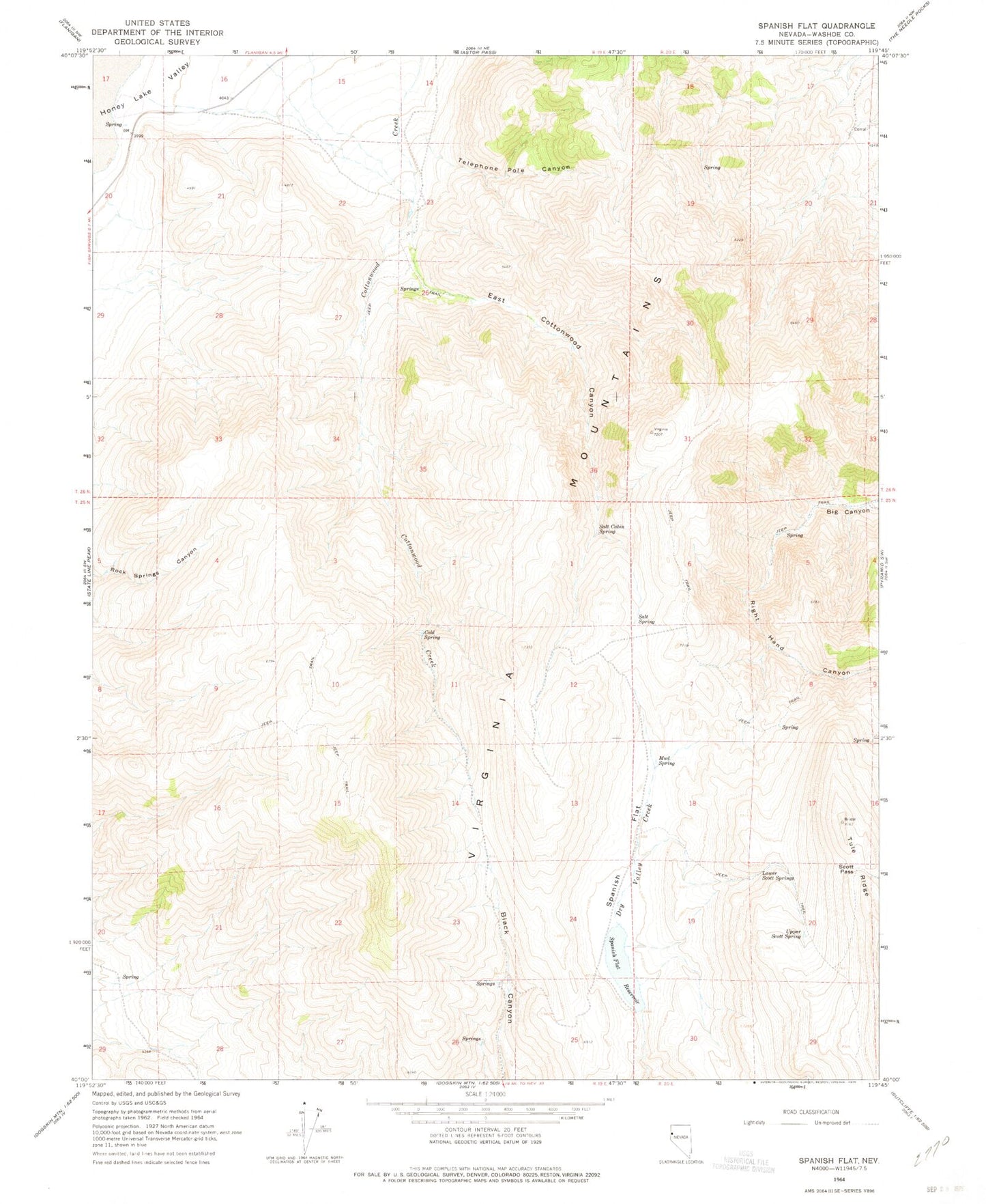
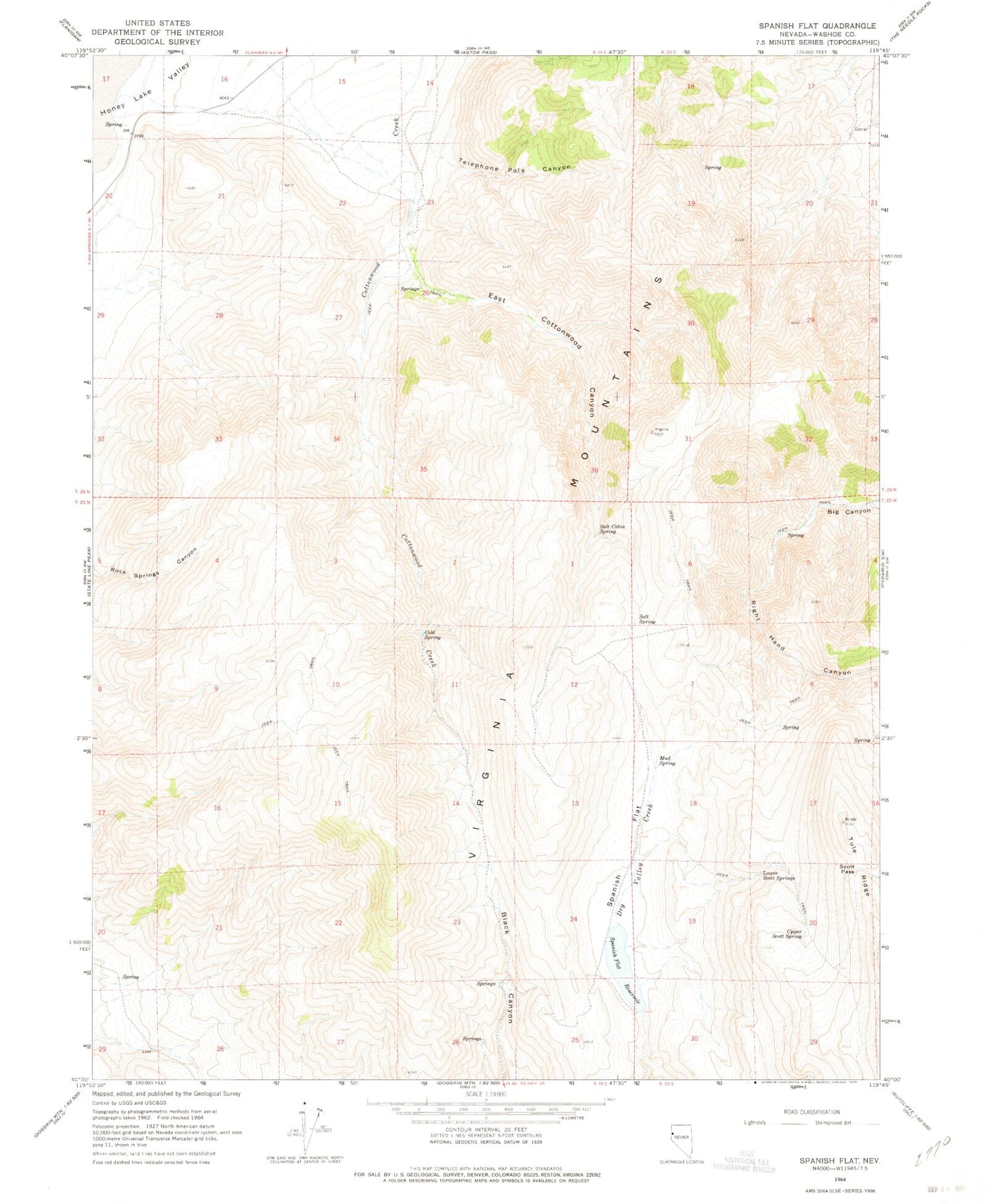
Classic USGS Spanish Flat Nevada 7.5'x7.5' Topo Map
Couldn't load pickup availability
Historical USGS topographic quad map of Spanish Flat in the state of Nevada. Map scale may vary for some years, but is generally around 1:24,000. Print size is approximately 24" x 27"
This quadrangle is in the following counties: Washoe.
The map contains contour lines, roads, rivers, towns, and lakes. Printed on high-quality waterproof paper with UV fade-resistant inks, and shipped rolled.
Contains the following named places: Cold Spring, East Cottonwood Canyon, Government Trough Spring, Lower Scott Springs, Mocho Spring Number One, Mud Spring, Newcome Spring, Picket Corral, Red Light Canyon, Right Hand Canyon, Salt Cabin Spring, Salt Spring, Scott Pass, Spanish Flat, Spanish Flat Dam, Spanish Flat Reservoir, Telephone Pole Canyon, Upper Scott Spring, Virginia Mountains