
MyTopo
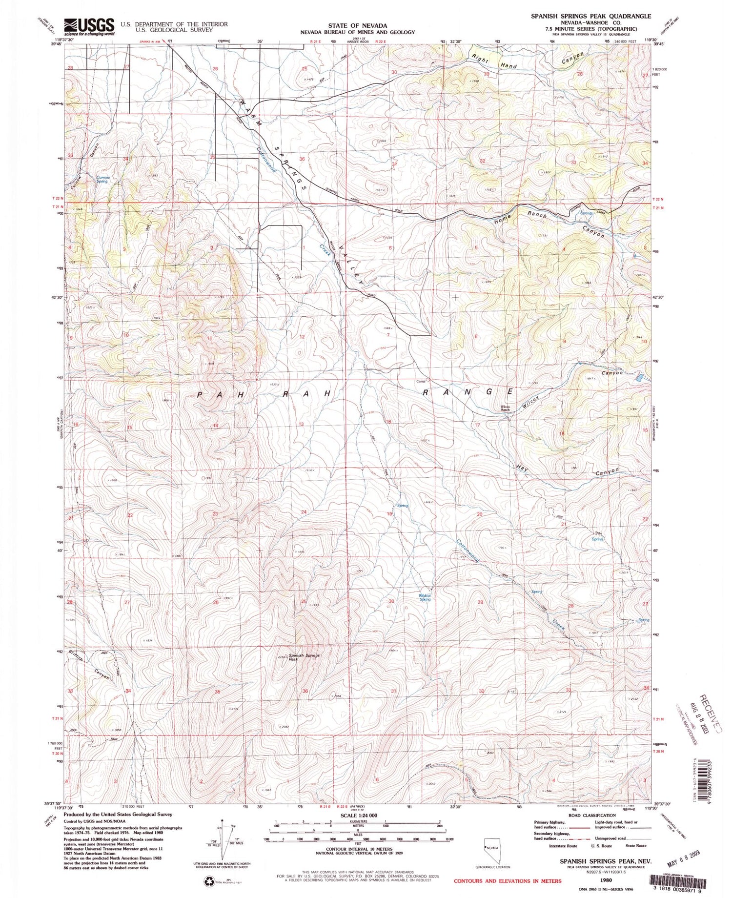
Classic USGS Spanish Springs Peak Nevada 7.5'x7.5' Topo Map
Couldn't load pickup availability
Historical USGS topographic quad map of Spanish Springs Peak in the state of Nevada. Map scale may vary for some years, but is generally around 1:24,000. Print size is approximately 24" x 27"
This quadrangle is in the following counties: Washoe.
The map contains contour lines, roads, rivers, towns, and lakes. Printed on high-quality waterproof paper with UV fade-resistant inks, and shipped rolled.
Contains the following named places: Cottonwood Canon, Curnow Canyon, Curnow Spring, Donatelli Mine, Hay Canyon, Home Ranch Canyon, McClellans Creek, Mud Spring, Right Hand Canyon, Sleepy Joe Mine, Spanish Springs Peak, Sugar Loaf, Warm Springs-Truckee Canyon Division, Wilcox Canyon, Wilcox Ranch, Wild Horse Spring, Wildcat Spring, Wofford Airport


