MyTopo
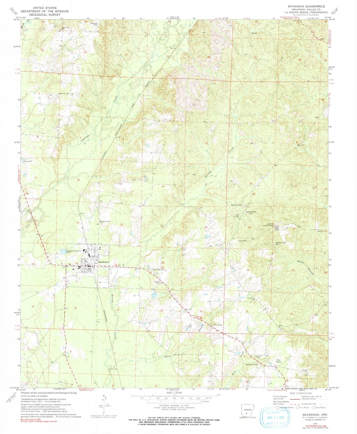
Classic USGS Sparkman Arkansas 7.5'x7.5' Topo Map
Couldn't load pickup availability
Historical USGS topographic quad map of Sparkman in the state of Arkansas. Map scale may vary for some years, but is generally around 1:24,000. Print size is approximately 24" x 27"
This quadrangle is in the following counties: Dallas.
The map contains contour lines, roads, rivers, towns, and lakes. Printed on high-quality waterproof paper with UV fade-resistant inks, and shipped rolled.
Contains the following named places: City of Sparkman, Ebenezer Church, Erby Cemetery, First Baptist Church, Harmony Church Cemetery, Holeman Cemetery, Horse Branch, Key Hill Lookout Tower, Macedonia Church, Mount Carmel Cemetery, New Hope, New Hope Baptist Church, Old New Hope Cemetery, Pine Grove, Sardis Methodist Church, Shady Grove Baptist Church, Sparkman, Sparkman Cemetery, Sparkman Elementary School, Sparkman Fire Department, Sparkman Fire Station Old Station, Sparkman High School, Sparkman Memorial Cemetery, Sparkman Police Department, Sparkman Post Office, Township of Nix, Township of Owen, Williams Cemetery, ZIP Code: 71763