MyTopo
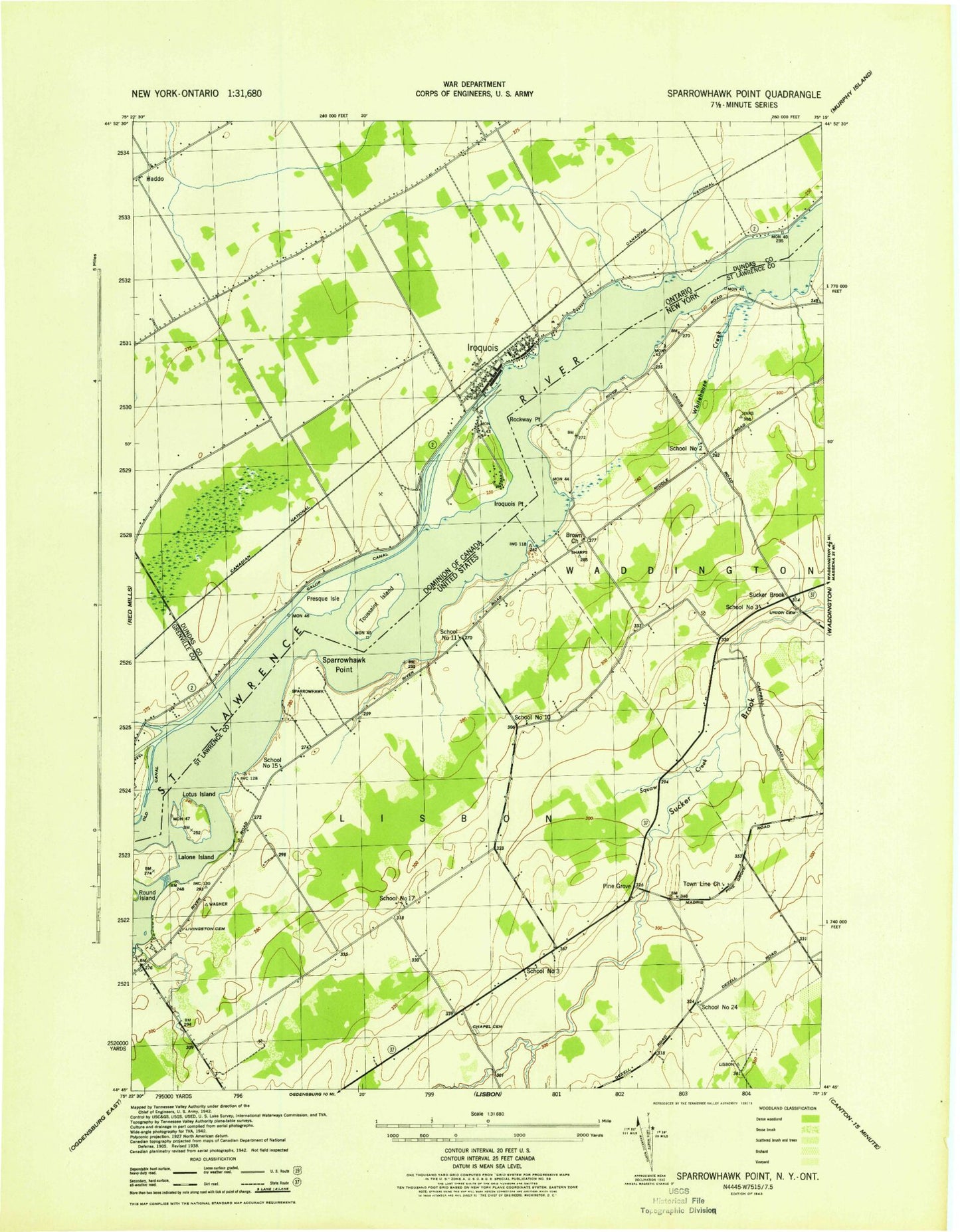
Classic USGS Sparrowhawk Point New York 7.5'x7.5' Topo Map
Couldn't load pickup availability
Historical USGS topographic quad map of Sparrowhawk Point in the state of New York. Map scale may vary for some years, but is generally around 1:24,000. Print size is approximately 24" x 27"
This quadrangle is in the following counties: St. Lawrence.
The map contains contour lines, roads, rivers, towns, and lakes. Printed on high-quality waterproof paper with UV fade-resistant inks, and shipped rolled.
Contains the following named places: Brown Church, Iroquois Dam, Iroquois Organic Farm, Keystone Dairy, Leading Light, Lisbon Beach, Livingston Cemetery, Lotus Island, Martin Cemetery, Nevin Memorial Church, O'Brian Farms, O'Neill Cemetery, Pine Grove, Rockway Point, School Number 10, School Number 11, School Number 15, School Number 17, School Number 2, School Number 24, School Number 3, Sparrowhawk Point, Squaw Creek, Sucker Brook, Union Cemetery, Whitehouse Bay