MyTopo
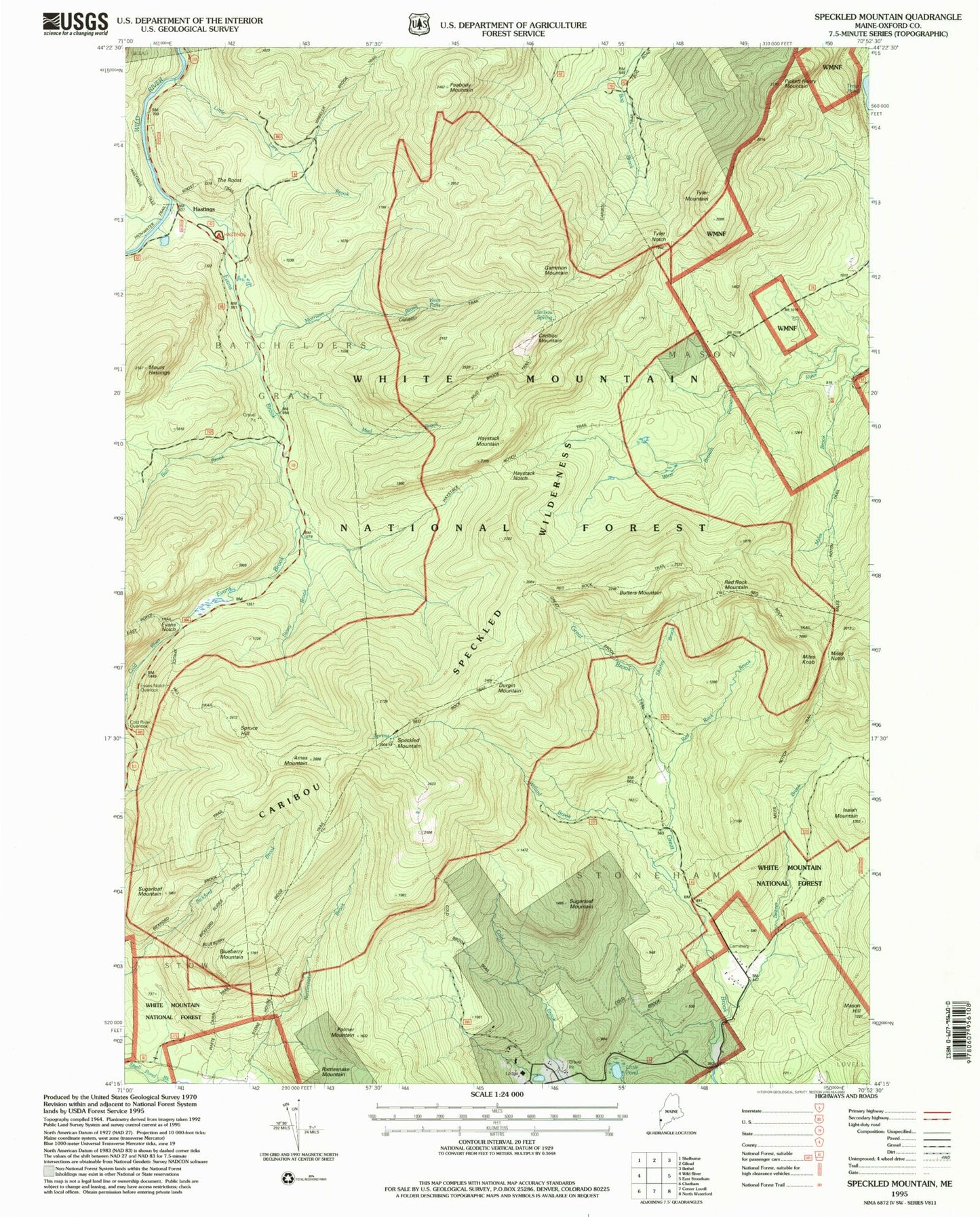
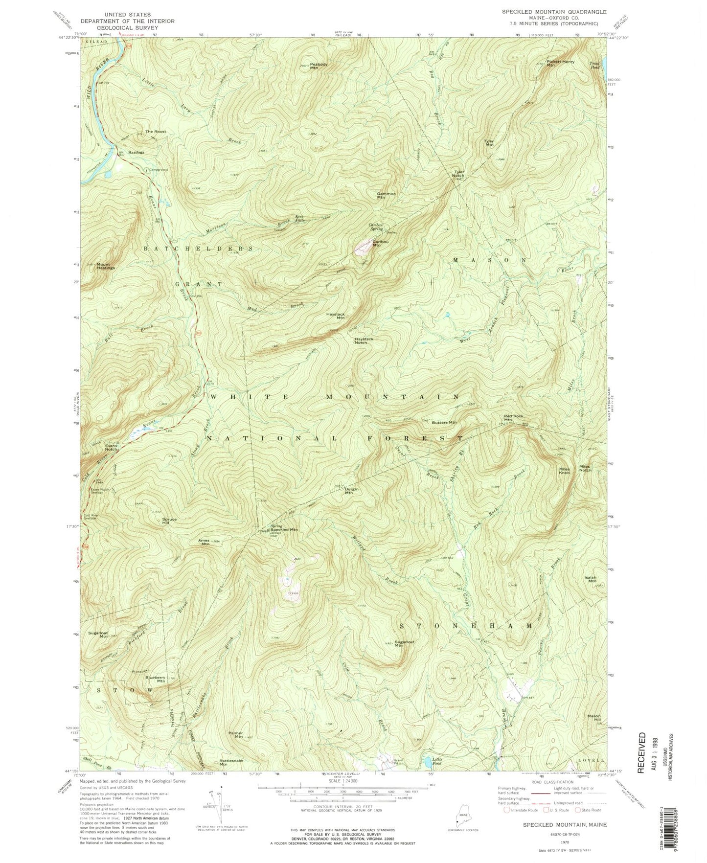
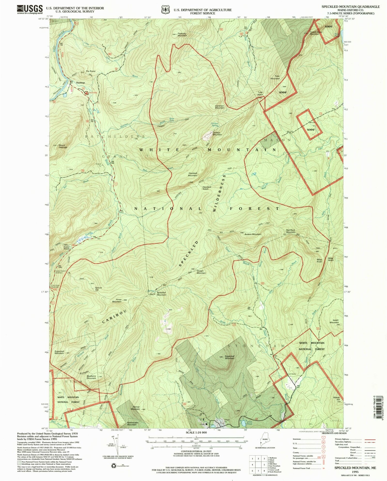
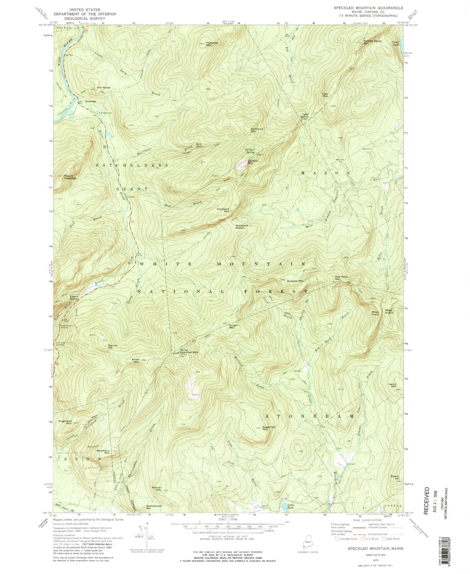
Classic USGS Speckled Mountain Maine 7.5'x7.5' Topo Map
Couldn't load pickup availability
Historical USGS topographic quad map of Speckled Mountain in the state of Maine. Typical map scale is 1:24,000, but may vary for certain years, if available. Print size: 24" x 27"
This quadrangle is in the following counties: Oxford.
The map contains contour lines, roads, rivers, towns, and lakes. Printed on high-quality waterproof paper with UV fade-resistant inks, and shipped rolled.
Contains the following named places: Stony Brook, Tyler Notch, Ames Mountain, Beaver Brook, Bickford Brook Trail, Blueberry Mountain, Blueberry Ridge Trail, Bull Brook, Butters Mountain, Caribou Mountain, Caribou Spring, Caribou Trail, Cold Brook Trail, Cold River Overlook, Durgin Mountain, Evans Brook, Evans Notch, Evans Notch Overlook, Gammon Mountain, Great Brook Trail, Hastings, Hastings Trail, Mount Hastings, Haystack Mountain, Haystack Notch, Haystack Notch Trail, Isaiah Mountain, Kees Falls, Little Lary Brook, Little Pond, Mason Hill, Miles Brook, Miles Knob, Miles Notch, Miles Notch Trail, Morrison Brook, Mud Brook, Mud Brook Trail, Palmer Mountain, Peabody Mountain, Pickett Henry Mountain, Rattlesnake Mountain, Red Rock Brook, Red Rock Mountain, Red Rock Trail, Roost Trail, Shirley Brook, Speckled Mountain, Spruce Hill, Spruce Hill Trail, Stone House Trail, Sugarloaf Mountain, Sugarloaf Mountain, The Roost, Tyler Mountain, Wheeler Brook Trail, White Cairn Trail, Willard Brook, Hastings Campground, White Mountain National Forest Caribou Shelter, Town of Stoneham, Caribou-Speckled Mountain Wilderness, Batchelders Grant Township, Mason Township, Hut Road Cemetery