MyTopo
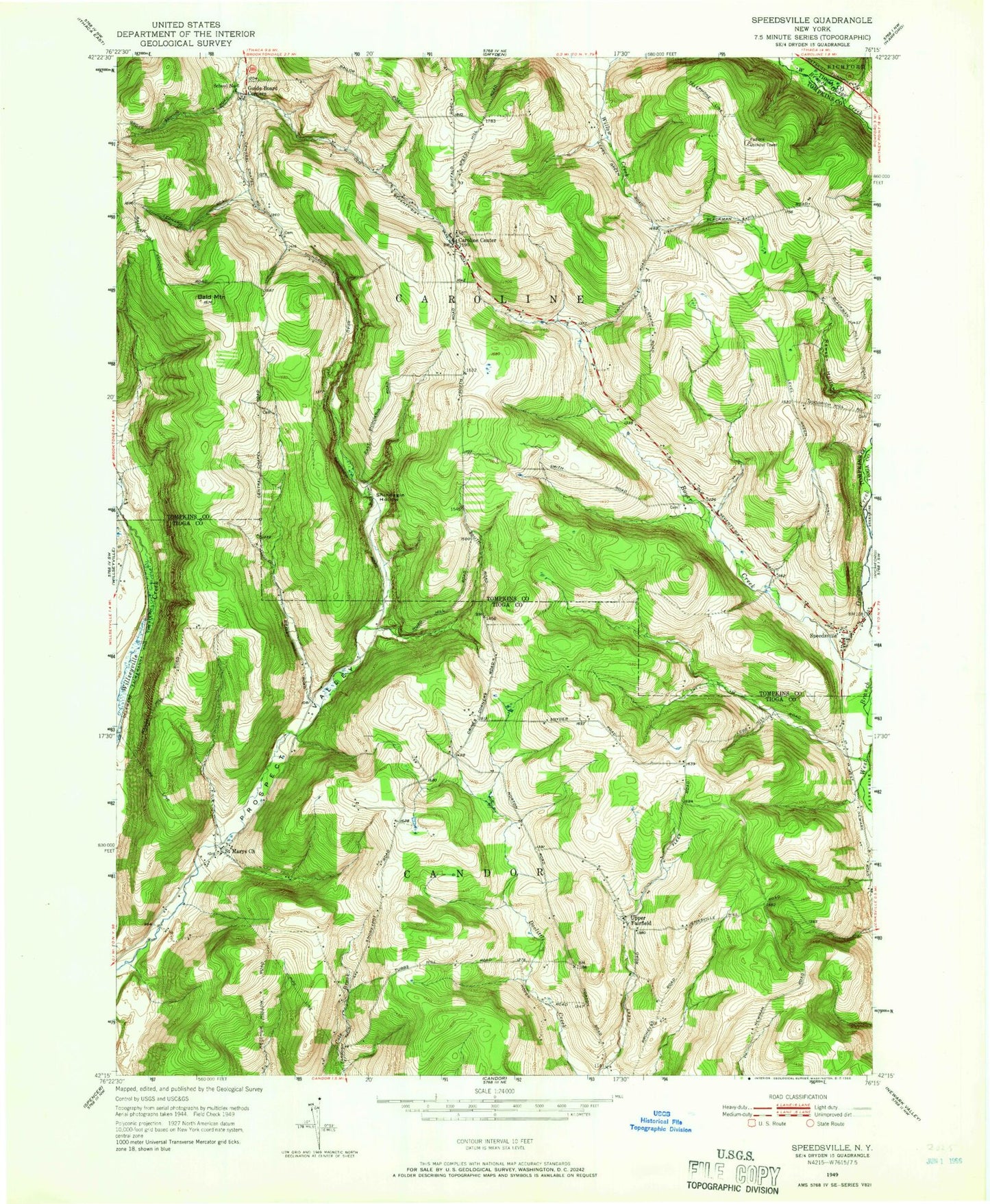
Classic USGS Speedsville New York 7.5'x7.5' Topo Map
Couldn't load pickup availability
Historical USGS topographic quad map of Speedsville in the state of New York. Typical map scale is 1:24,000, but may vary for certain years, if available. Print size: 24" x 27"
This quadrangle is in the following counties: Tioga, Tompkins.
The map contains contour lines, roads, rivers, towns, and lakes. Printed on high-quality waterproof paper with UV fade-resistant inks, and shipped rolled.
Contains the following named places: Bald Mountain, Caroline Center, Danby Creek, Fairfield State Forest, Guide Board Corners, Potato Hill State Forest, Prospect Valley, Saint Marys Church, Shindagin Hollow, Shindagin Hollow State Forest, Speedsville, Upper Fairfield, Padlock Lookout Tower, Town of Caroline, Fairfield Cemetery, Caroline Center Cemetery, Caroline Centre Church, Goodrich Hill Cemetery, Speedsville Cemetery, Central Chapel Cemetery, Blair Family Plot, MacCormick Secure Center, Speedsville Volunteer Fire Company, Bald Mountain, Caroline Center, Danby Creek, Fairfield State Forest, Guide Board Corners, Potato Hill State Forest, Prospect Valley, Saint Marys Church, Shindagin Hollow, Shindagin Hollow State Forest, Speedsville, Upper Fairfield, Padlock Lookout Tower, Town of Caroline, Fairfield Cemetery, Caroline Center Cemetery, Caroline Centre Church, Goodrich Hill Cemetery, Speedsville Cemetery, Central Chapel Cemetery, Blair Family Plot, MacCormick Secure Center, Speedsville Volunteer Fire Company