MyTopo
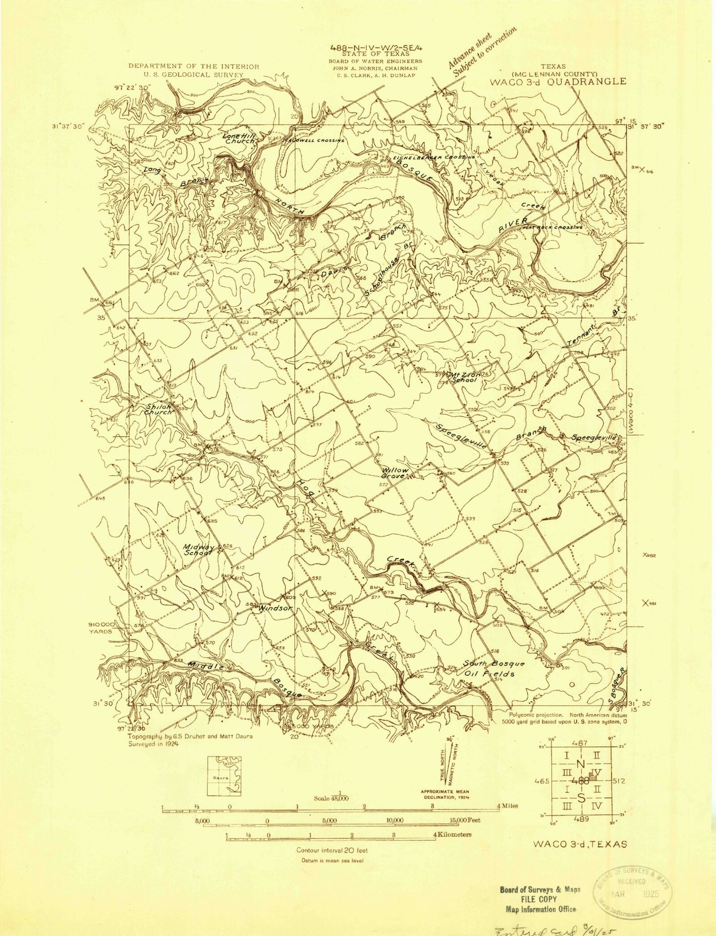
Classic USGS Speegleville Texas 7.5'x7.5' Topo Map
Couldn't load pickup availability
Historical USGS topographic quad map of Speegleville in the state of Texas. Map scale may vary for some years, but is generally around 1:24,000. Print size is approximately 24" x 27"
This quadrangle is in the following counties: McLennan.
The map contains contour lines, roads, rivers, towns, and lakes. Printed on high-quality waterproof paper with UV fade-resistant inks, and shipped rolled.
Contains the following named places: Boyd Field Airport, Caldwell Crossing, China Spring High School, Cougar Stadium, Davis Branch, Eichelberger Crossing, Evergreen Cemetery, Highland, Hog Creek, Live Oak Creek, Long Branch, McLennan Cemetery, Ocee, Pecan Creek, Schoolhouse Branch, Scott Airport, Shiloh Church, Speegleville, Speegleville United Methodist Church, Spring Branch, Val Verde Camp, Wales Air Field, Willow Grove, Willow Grove Census Designated Place, Willowgrove Baptist Church, Windsor, ZIP Code: 76712