MyTopo
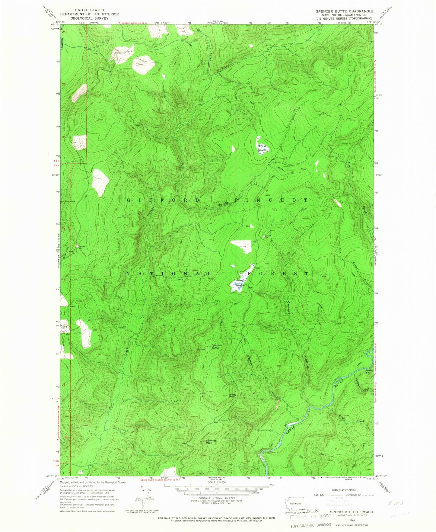
Classic USGS Spencer Butte Washington 7.5'x7.5' Topo Map
Couldn't load pickup availability
Historical USGS topographic quad map of Spencer Butte in the state of Washington. Typical map scale is 1:24,000, but may vary for certain years, if available. Print size: 24" x 27"
This quadrangle is in the following counties: Skamania.
The map contains contour lines, roads, rivers, towns, and lakes. Printed on high-quality waterproof paper with UV fade-resistant inks, and shipped rolled.
Contains the following named places: Breezy Point, Chickoon Creek, Crab Creek, Cussed Hollow, Elk Creek, Lower Falls, Spencer Butte, Spencer Creek, Spencer Meadow, Spencer Peak, Wright Creek, Wright Meadow, Wildcat Trail, Mount Adams Viewpoint, Clearwater Overlook, Lower Falls Campground, Spencer Butte Lookout, Clear Creek Lookout