MyTopo
Classic USGS Spencer Flats Florida 7.5'x7.5' Topo Map
Couldn't load pickup availability
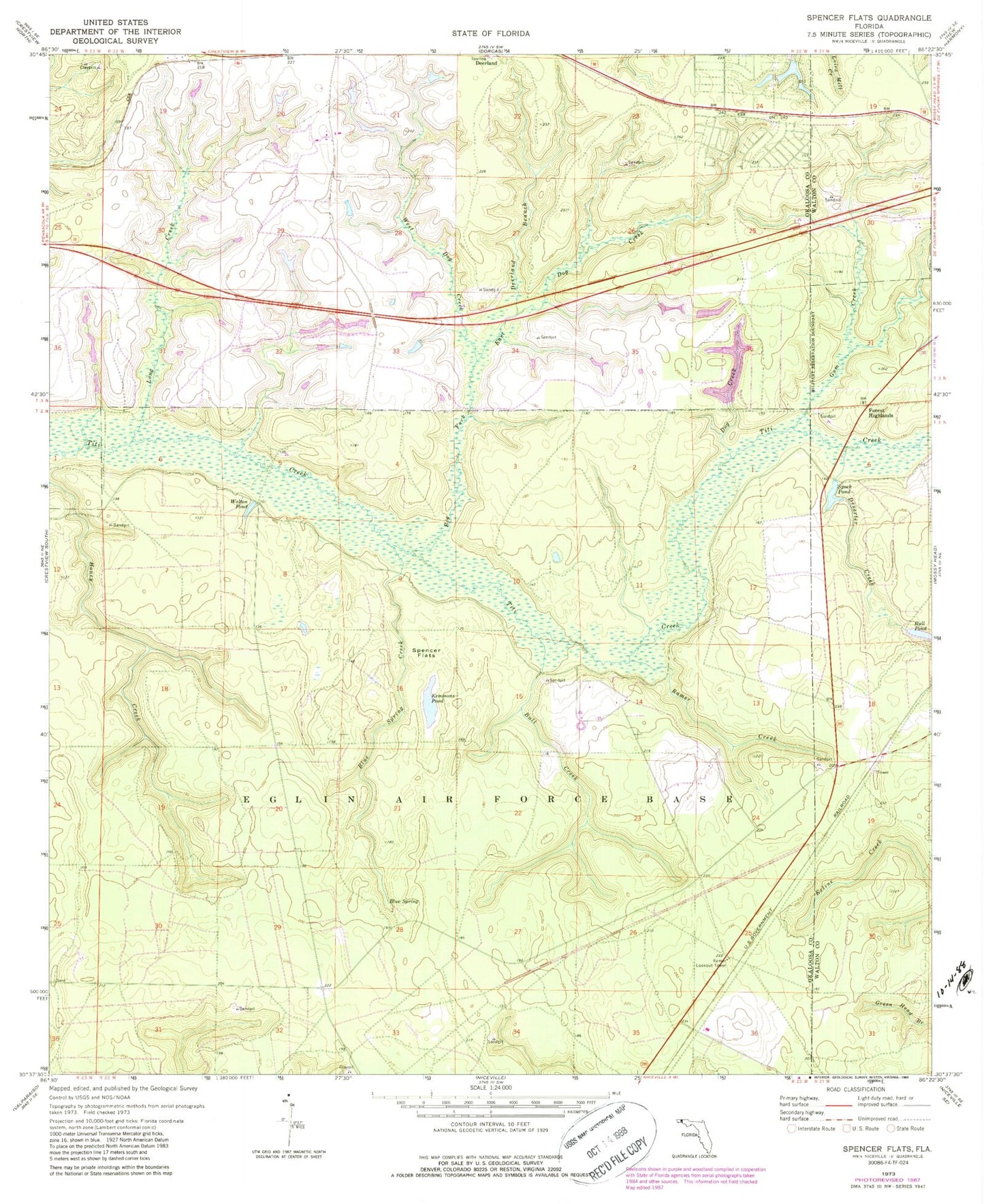
Historical USGS topographic quad map of Spencer Flats in the state of Florida. Map scale may vary for some years, but is generally around 1:24,000. Print size is approximately 24" x 27"
This quadrangle is in the following counties: Okaloosa, Walton.
The map contains contour lines, roads, rivers, towns, and lakes. Printed on high-quality waterproof paper with UV fade-resistant inks, and shipped rolled.
Contains the following named places: Big Fork, Blue Spring, Blue Spring Creek, Bull Creek, Bull Pond, Deerland Branch, Deserter Creek, Dog Creek, East Dog Creek, Forest Highlands, Gum Creek, Kemmons Pond, Long Creek, Ramer Creek, Ramer Lookout Tower, Speck Pond, Spencer Flats, Walton County Fire Rescue Station 11B, Walton Pond, West Dog Creek