MyTopo
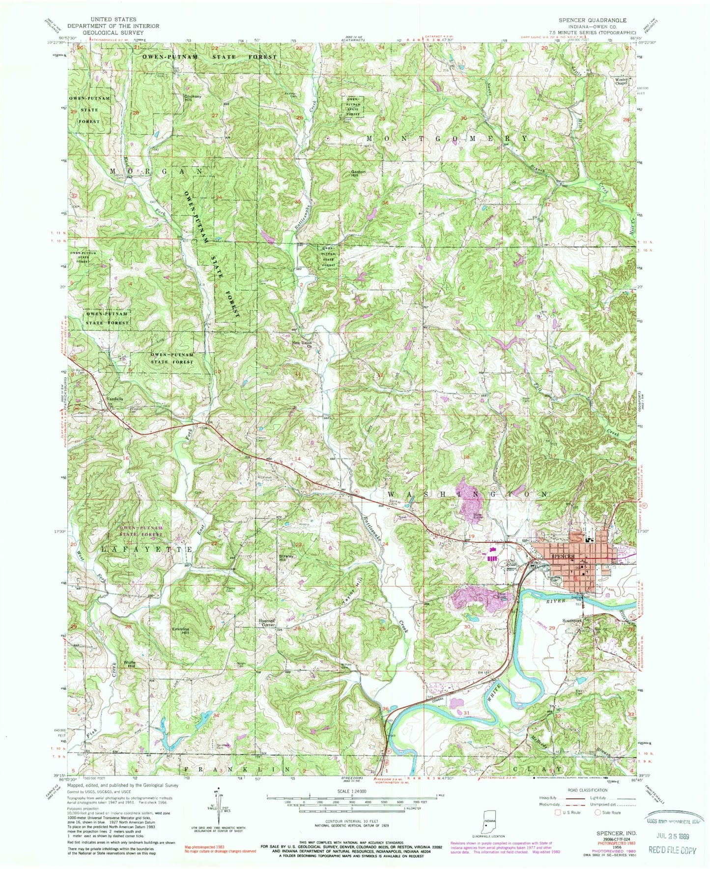
Classic USGS Spencer Indiana 7.5'x7.5' Topo Map
Couldn't load pickup availability
Historical USGS topographic quad map of Spencer in the state of Indiana. Map scale may vary for some years, but is generally around 1:24,000. Print size is approximately 24" x 27"
This quadrangle is in the following counties: Owen.
The map contains contour lines, roads, rivers, towns, and lakes. Printed on high-quality waterproof paper with UV fade-resistant inks, and shipped rolled.
Contains the following named places: Blair Cemetery, Cloyd Cemetery, Cooksey Hill, Cottons Little Pine Lake, Cottons Little Pine Lake Dam, Dugan Lake, Dugan Lake Dam, East Fork Fish Creek, Elliston Creek, Emmins Hill, Fender Cemetery, Galimore Cemetery, Gaston Hill, Hancock Corner, Kaufman Cemetery, McBride Branch, Miller Airport, Mount Moriah Cemetery, Naans Branch, New Union Church, Owen County, Owen County Courthouse, Owen County Emergency Medical Services, Owen County Sheriff's Department, Owen Valley Community High School, Owen Valley Fire Territory Station 4, Owen Valley Middle School, Palestine Cemetery, Pleasant Grove Cemetery, Ralph Ketchum Lake, Ralph Ketchum Lake Dam, Rattlesnake Creek, River Hill Cemetery, Riverside Cemetery, Rose Cemetery, Saint Walley Cemetery, Southport, Spears Cemetery, Spencer, Spencer 520 Quarry, Spencer Police Department, Spencer Post Office, Spencer Quarry, Straley Hill, Taylor Hill, Thomas Lake, Thomas Lake Dam, Timber Trails Airport, Tipton Cemetery, Town of Spencer, Township of Montgomery, Township of Washington, Vandalia, Wesley Chapel, West Fork Fish Creek, Witham Cemetery, Wolfe Hill, Wright Cemetery, ZIP Code: 47460