MyTopo
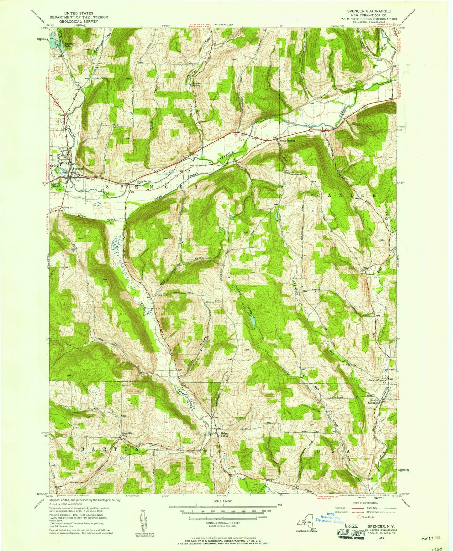
Classic USGS Spencer New York 7.5'x7.5' Topo Map
Couldn't load pickup availability
Historical USGS topographic quad map of Spencer in the state of New York. Map scale may vary for some years, but is generally around 1:24,000. Print size is approximately 24" x 27"
This quadrangle is in the following counties: Tioga.
The map contains contour lines, roads, rivers, towns, and lakes. Printed on high-quality waterproof paper with UV fade-resistant inks, and shipped rolled.
Contains the following named places: Baptist Society Cemetery, Bliven Creek, Cass Hill Cemetery, Chambers Creek, Dean Creek, Dry Brook, Empire Lake, Evergreen Cemetery, Faith Bible Chapel, Ferris Cemetery, Gay Hollow, Guthrie Medical Center, Halsey Valley, Halsey Valley Cemetery, Halsey Valley Fire Company, Hill Top Lake, Hollybrook Country Club, Jewell Farms, Kohn Airport, Lake Diana, Locust Woods Farm, Michigan Creek, Miller Creek, Nichols Park, Nichols Pond, Old Cemetery, Owl Creek, Pipe Creek Cemetery, Saikkonen Airport, Saint Paul's Lutheran Church, Seelytown Creek, Siren Farms, Snyder Cemetery, South Branch Catatonk Creek, Spencer, Spencer Federated Church, Spencer Library, Spencer Post Office, Spencer-Van Etten Middle School, Straits Corners, Straits Corners Baptist Church, Sulphur Spring, Sulphur Springs Creek, Town of Spencer, Tyler Hollow, Village of Spencer, West Candor, Wood Cemetery, Woodford Cemetery, ZIP Code: 14883