MyTopo
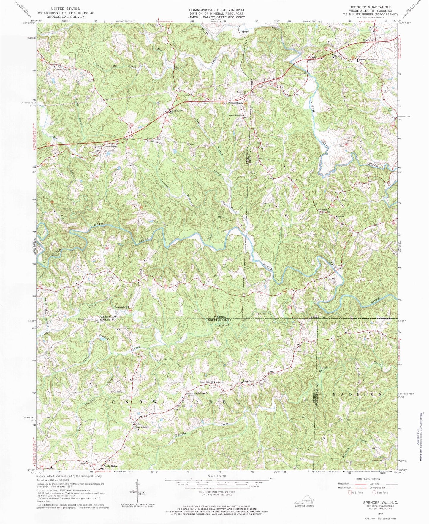
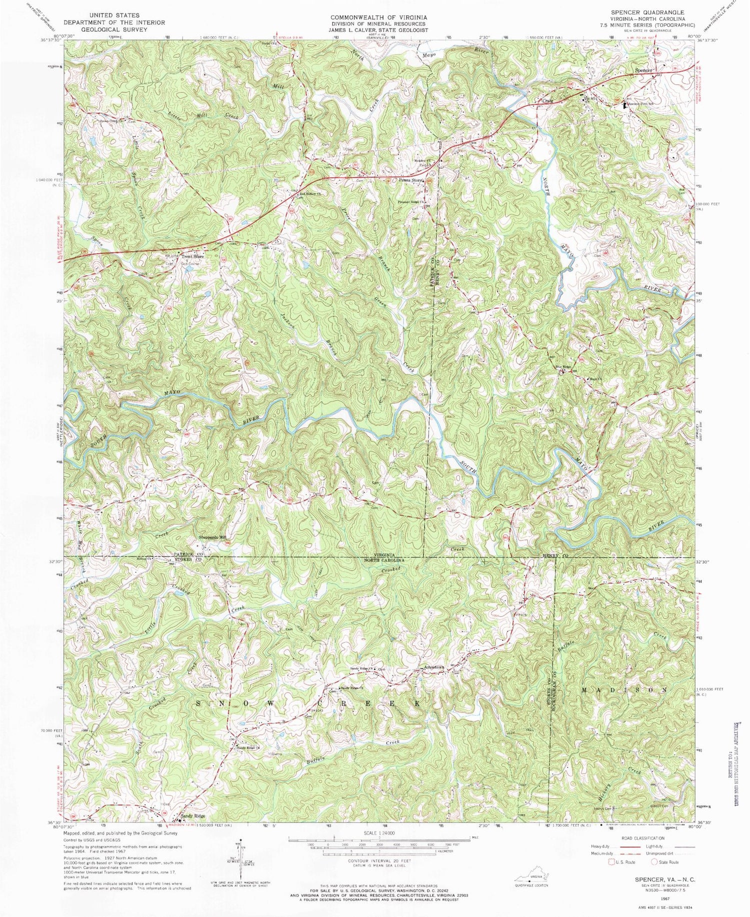
Classic USGS Spencer Virginia 7.5'x7.5' Topo Map
Couldn't load pickup availability
Historical USGS topographic quad map of Spencer in the states of Virginia, North Carolina. Map scale may vary for some years, but is generally around 1:24,000. Print size is approximately 24" x 27"
This quadrangle is in the following counties: Henry, Patrick, Rockingham, Stokes.
The map contains contour lines, roads, rivers, towns, and lakes. Printed on high-quality waterproof paper with UV fade-resistant inks, and shipped rolled.
Contains the following named places: Amostown, Amostown School, Blue Ridge Church, Brier Hill School, Covington Airport, Craig, Crooked Creek, Gibson Cemetery, Goin School, Goinstown, Gordon Trent Golf Club, Green Creek, Harris Cemetery, Hilltop Church, Hylton School, Jackson Branch, Joyce Store, Kelleys Mill, Koger Creek, Little Crooked Creek, Little Mill Creek, Little Spoon Creek, Mayo Church, Mayo School, Meadow Church, Mill Creek, Old Well Church, Old Well Crossing, Penn Siding, Penns Store, Pine Tree School, Pleasant Ridge Church, Price Branch, Red Hollow Church, Sandy Ridge Church, Sandy Ridge Elementary School, Sandy Ridge School, Scales Plantation, Sheppards Mill, South Crooked Creek, Spencer, Spencer Penn Elementary School, Spencer Post Office, Spoon Creek, Spoon Creek Church, Stella Church, Tilleys Mill Pond, Trent Store, White Mud Branch, ZIP Codes: 24082, 24165, 27046