MyTopo
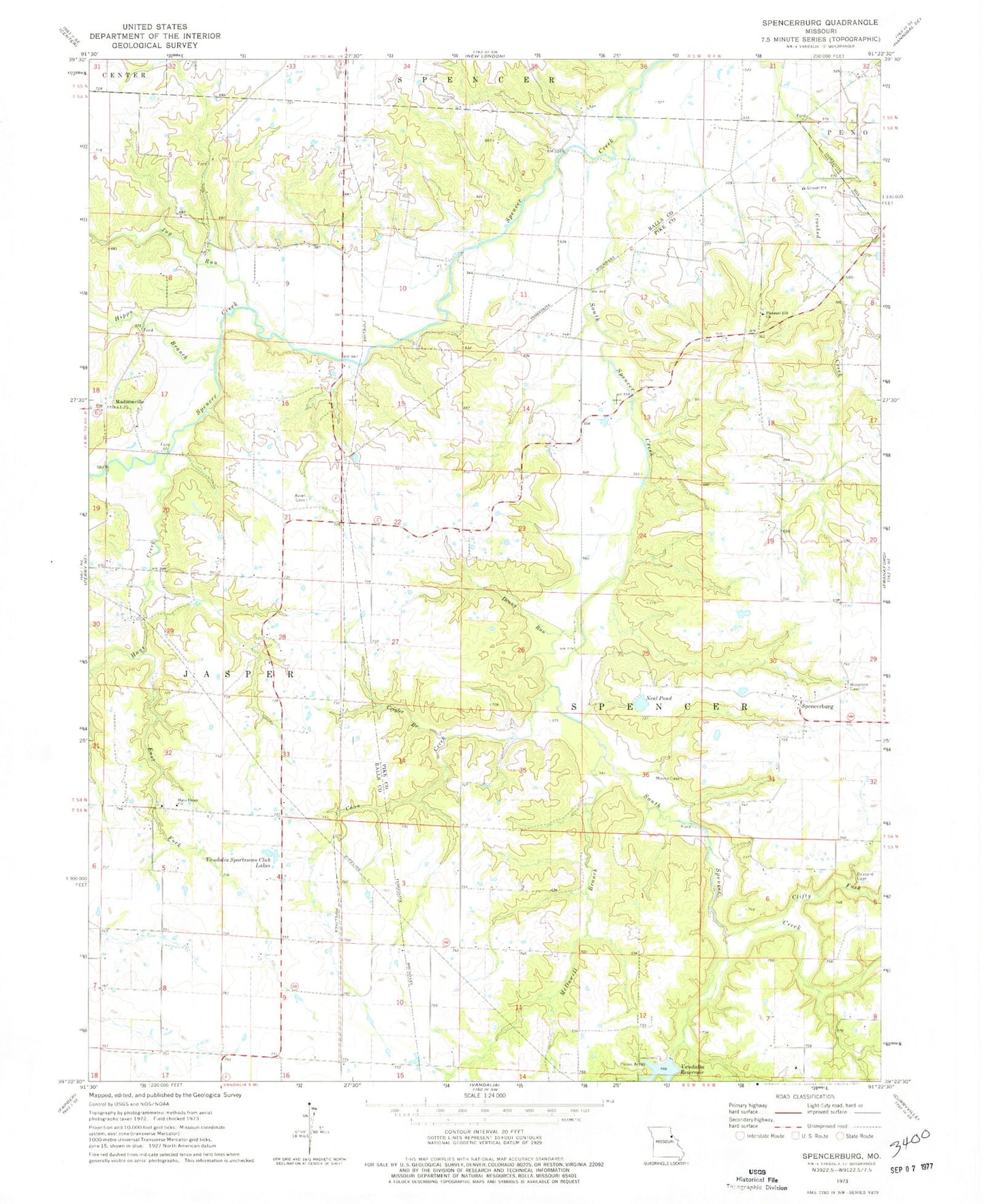
Classic USGS Spencerburg Missouri 7.5'x7.5' Topo Map
Couldn't load pickup availability
Historical USGS topographic quad map of Spencerburg in the state of Missouri. Map scale may vary for some years, but is generally around 1:24,000. Print size is approximately 24" x 27"
This quadrangle is in the following counties: Pike, Ralls.
The map contains contour lines, roads, rivers, towns, and lakes. Printed on high-quality waterproof paper with UV fade-resistant inks, and shipped rolled.
Contains the following named places: Adiel Cemetery, Adiel Church, Brice School, Bridgewater School, Clifty Fork, Coon Creek, Crigler Branch, Denny Run, East Fork, Elk Lick Springs, Elk Lick Springs Post Office, Hays Creek Church, Hippo Branch, Jug Run, Lewis Lake, Lewis Lake Dam, Lick School, Madisonville, Madisonville School, McDowell Branch, Neal Pond, Pleasant Hill Church, Rose School, Scott School, Seely School, South Spencer Creek, Spencerburg, Township of Spencer, Vandalia Lake Dam, Vandalia Sportsman Club Lakes, Weldon H. 'Pete' Steiner Reservoir