MyTopo
Classic USGS Sperati Point North Dakota 7.5'x7.5' Topo Map
Regular price
$16.95
Regular price
Sale price
$16.95
Unit price
per
Couldn't load pickup availability
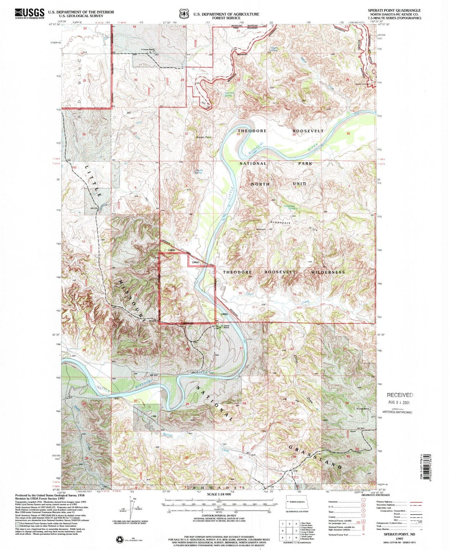
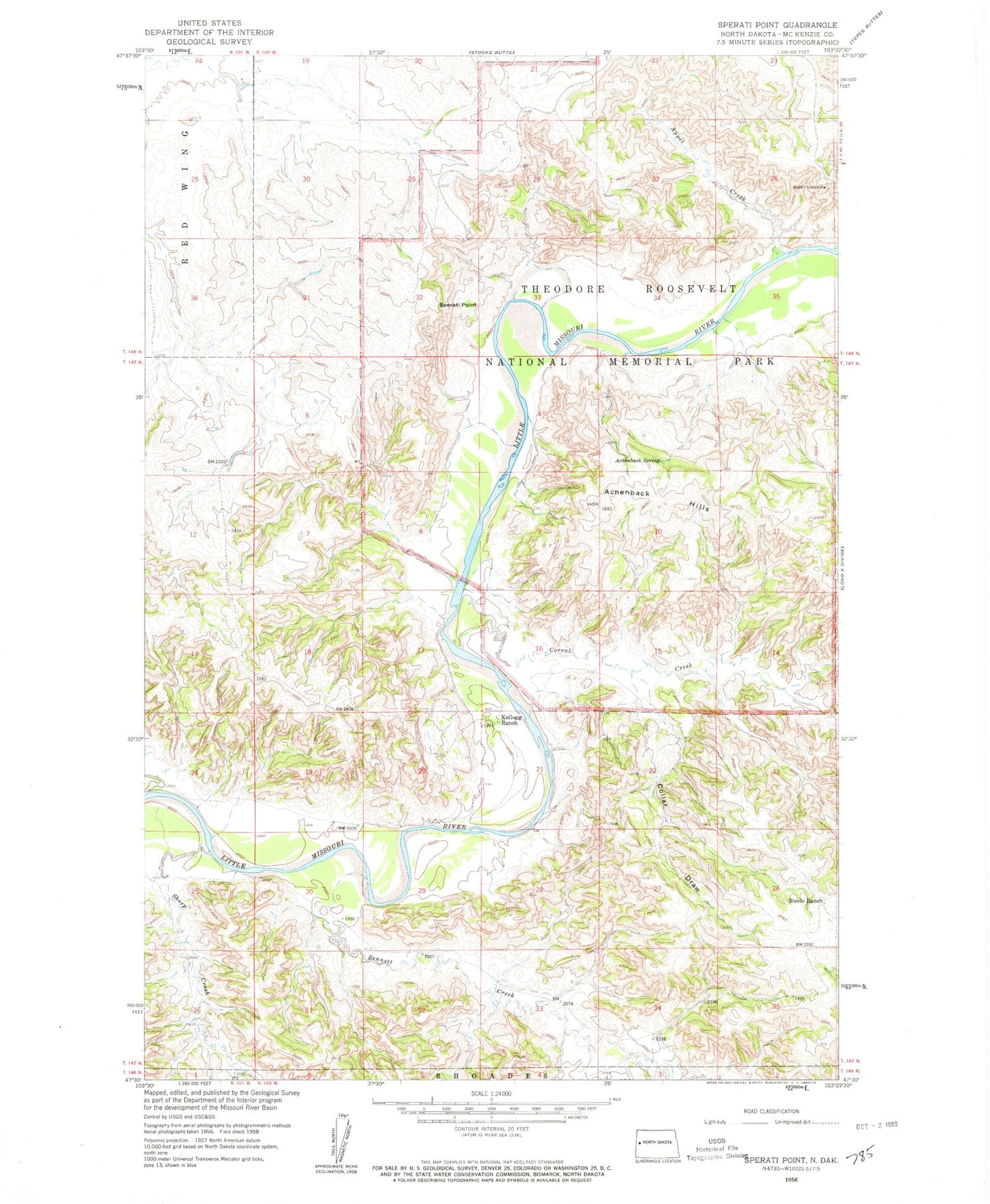
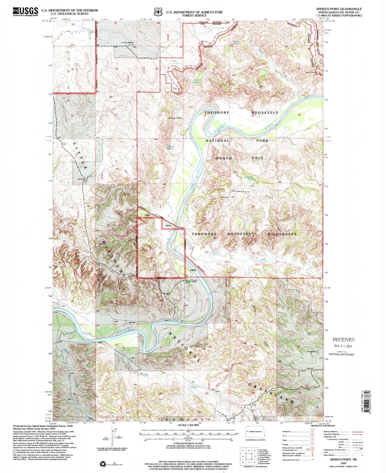
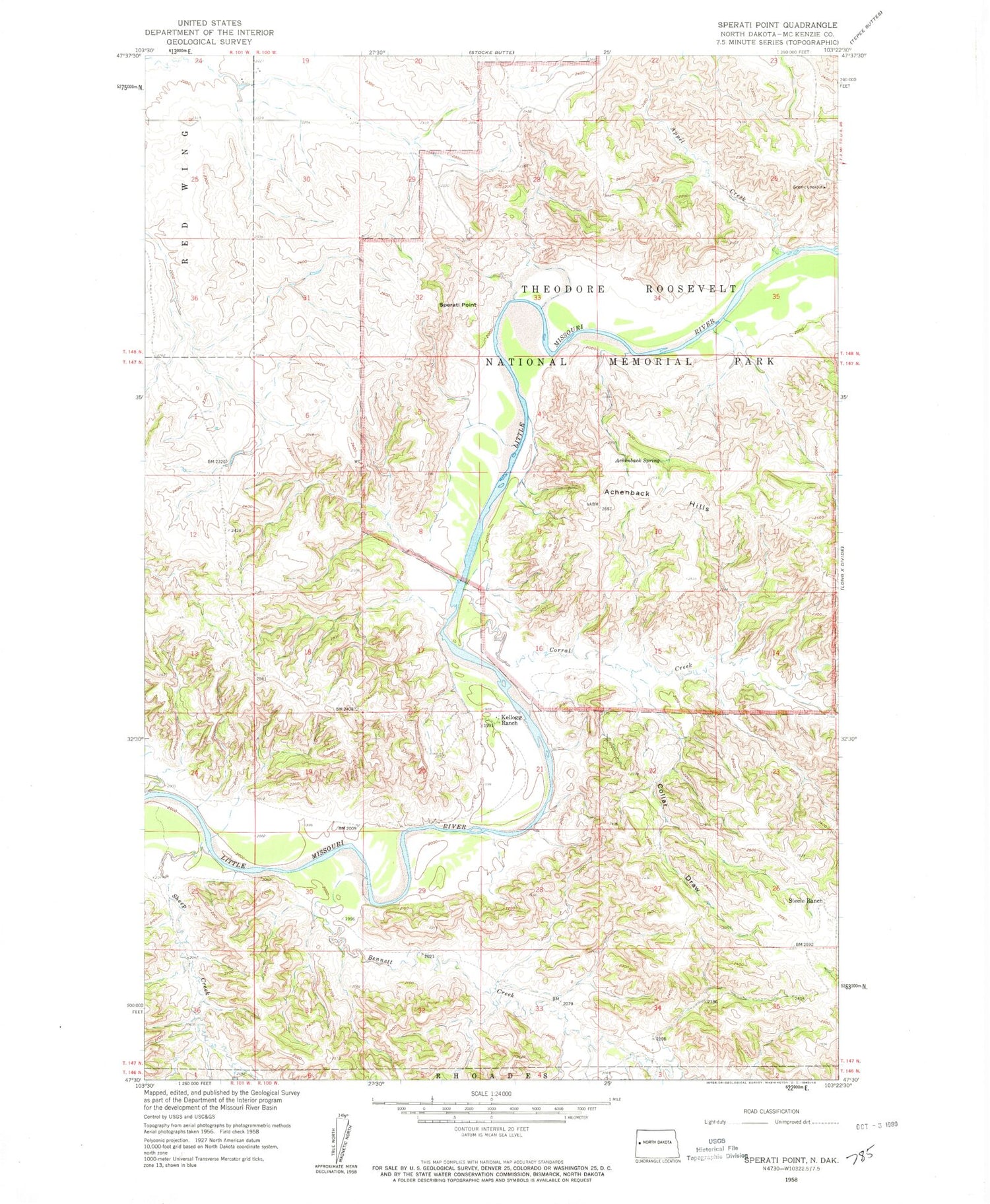
Historical USGS topographic quad map of Sperati Point in the state of North Dakota. Typical map scale is 1:24,000, but may vary for certain years, if available. Print size: 24" x 27"
This quadrangle is in the following counties: McKenzie.
The map contains contour lines, roads, rivers, towns, and lakes. Printed on high-quality waterproof paper with UV fade-resistant inks, and shipped rolled.
Contains the following named places: Achenbach Hills, Achenbach Spring, Appel Creek, Bennett Creek, Collar Draw, Corral Creek, Kellogg Ranch, Sheep Creek, Sperati Point, Steele Ranch, Hagan Spring, Overlook Spring, Mandal Spring, H Lange Ranch, Theodore Roosevelt Wilderness, O Larson Ranch, Ceynar Ranch