MyTopo
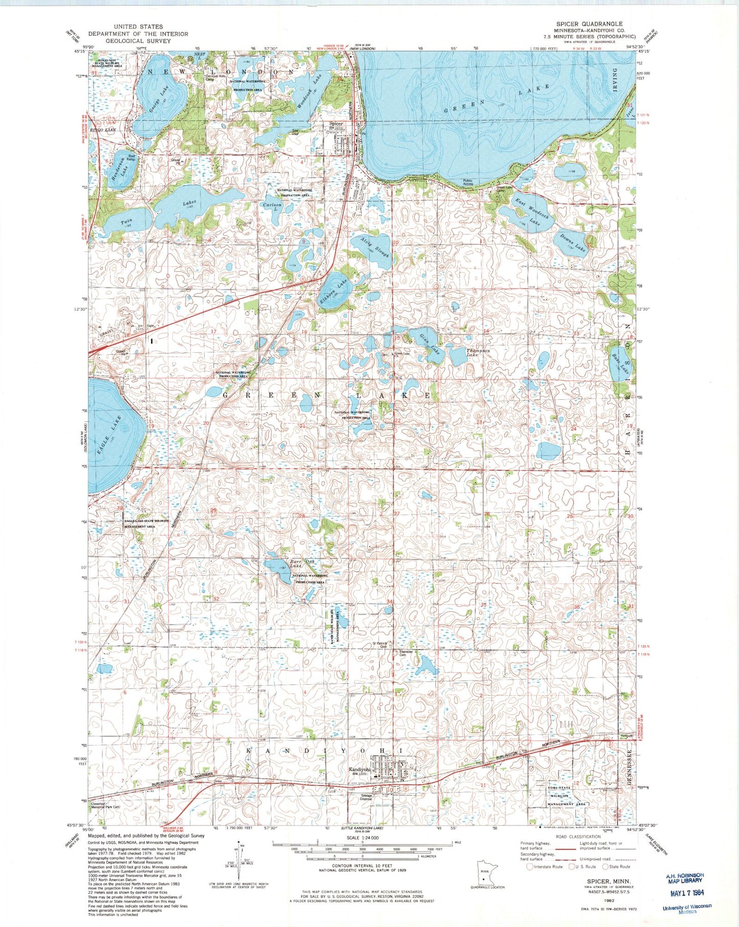
Classic USGS Spicer Minnesota 7.5'x7.5' Topo Map
Couldn't load pickup availability
Historical USGS topographic quad map of Spicer in the state of Minnesota. Map scale may vary for some years, but is generally around 1:24,000. Print size is approximately 24" x 27"
This quadrangle is in the following counties: Kandiyohi.
The map contains contour lines, roads, rivers, towns, and lakes. Printed on high-quality waterproof paper with UV fade-resistant inks, and shipped rolled.
Contains the following named places: Alvig Slough, Bass Lake, Burr Oak Lake, Carlson Lake, Church of Christ, City of Kandiyohi, City of Spicer, Decision Hills Camp, Downs Lake, Eagle Lake State Wildlife Management Area, East Woodcock Lake, Ebenezer Cemetery, Ebenezer Lutheran Church, Elkhorn Lake, Elkhorn Lake Rearing Pond Dam, Faith Lutheran Church, George Lake, Gina Lake, Green Lake Baseball Diamonds, Green Lake Camp, Green Lake Church, Green Lake Lutheran Cemetery, Green Lake Mall, Henderson Lake, Kandi State Wildlife Management Area, Kandiyohi, Kandiyohi Fire Department, Kandiyohi Post Office, Saint Patrick Catholic Church, Saint Patrick Cemetery, School Number 28, School Number 44, School Number 51, School Number 60, School Number 78, Spicer, Spicer City Cemetery, Spicer City Hall, Spicer City Park, Spicer Family Cemetery, Spicer Fire Department, Spicer Health Center, Spicer Library, Spicer Post Office, Thompson Lake, Township of Green Lake, Twin Lakes, Woodcock Lake, Yohi State Wildlife Management Area, ZIP Codes: 56251, 56288