MyTopo
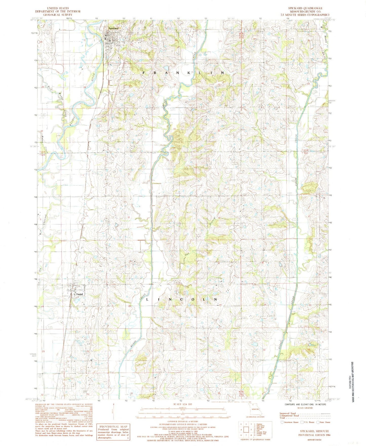
Classic USGS Spickard Missouri 7.5'x7.5' Topo Map
Couldn't load pickup availability
Historical USGS topographic quad map of Spickard in the state of Missouri. Map scale may vary for some years, but is generally around 1:24,000. Print size is approximately 24" x 27"
This quadrangle is in the following counties: Grundy.
The map contains contour lines, roads, rivers, towns, and lakes. Printed on high-quality waterproof paper with UV fade-resistant inks, and shipped rolled.
Contains the following named places: Amick School, Atteberry Cemetery, Bethel Cemetery, Boswell Cemetery, Brainard Cemetery, Carpenter Cemetery, City of Spickard, Crockett Cemetery, Denslow School, East Honey Creek, Gehlbach School, Herbert School, James Clark Cemetery, King Cemetery, Locust Grove Cemetery, Locust Grove School, Martin Cemetery, Moore Cemetery, North Evans Cemetery, Oak Ridge School, Owl Branch, Paint Lick Church, Proctor Cemetery, South Evans Cemetery, South Evans Church, Speer Cemetery, Spickard, Spickard Cemetery, Spickard Elementary School, Spickard Fire Department, Spickard Post Office, Steinhoff Lake Dam, Stepp Cemetery, Terry George School, Tindall, Tindall School, Town of Tindall, Township of Franklin, Township of Lincoln, Tracy Cemetery, Veatch Lake Dam, West Honey Creek, West Muddy Creek, William Clark Cemetery, Williams Pond, Williams School, Wise Cemetery, Woods Creek, Wooley Cemetery, Wyandotte, ZIP Code: 64679