MyTopo
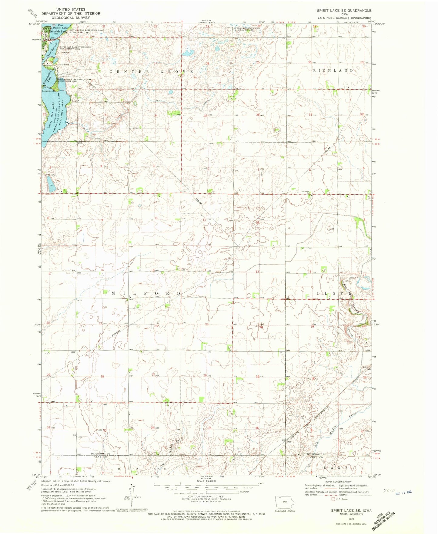
Classic USGS Spirit Lake SE Iowa 7.5'x7.5' Topo Map
Couldn't load pickup availability
Historical USGS topographic quad map of Spirit Lake SE in the state of Iowa. Map scale may vary for some years, but is generally around 1:24,000. Print size is approximately 24" x 27"
This quadrangle is in the following counties: Clay, Dickinson.
The map contains contour lines, roads, rivers, towns, and lakes. Printed on high-quality waterproof paper with UV fade-resistant inks, and shipped rolled.
Contains the following named places: Adventist Church, Arnolds Park, Bull Ditch, Crows Nest Resort, D T Farms, East Okoboji Lake Wildlife Management Area, Ems Farms, Gingles Point, Korey Halbur Wildlife Management Area, Kruses Beach, Lower Gar Lake Wildlife Management Area, M R Farms, Minnewashta Lake, Minnewashta Lake State Game Mgt Area, N J Farms, Olson Farm, Orrs Campe Winakawin, Richland Cemetery, Spring Run State Game Management Area, Swenson Farms, Township of Milford, Upper Gar Lake, Upper Gar Lake State Game Management Area, Woodlyn Hills Golf Course