MyTopo
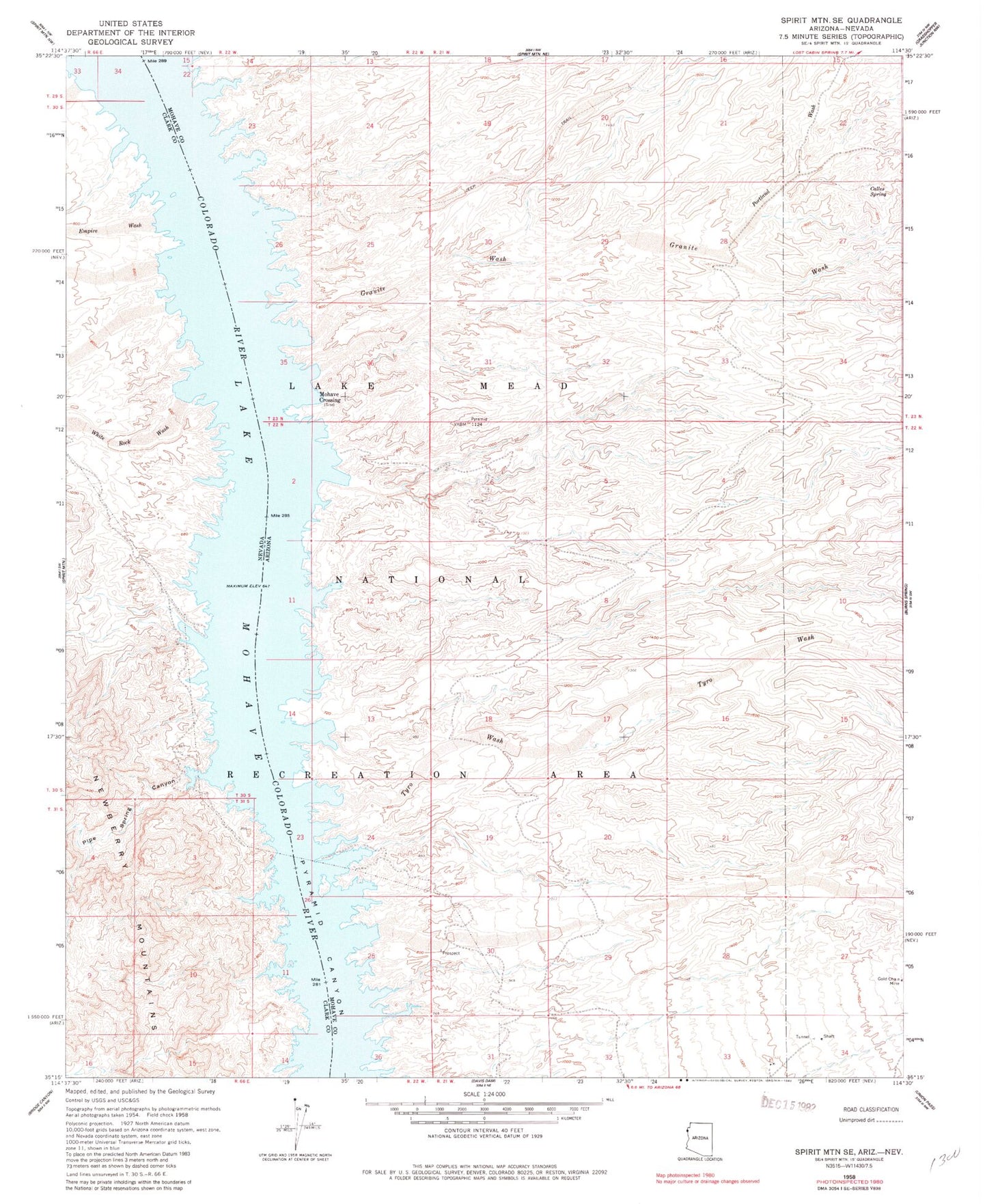
Classic USGS Spirit Mountain SE Arizona 7.5'x7.5' Topo Map
Couldn't load pickup availability
Historical USGS topographic quad map of Spirit Mountain SE in the states of Arizona, Nevada. Map scale may vary for some years, but is generally around 1:24,000. Print size is approximately 24" x 27"
This quadrangle is in the following counties: Clark, Mohave.
The map contains contour lines, roads, rivers, towns, and lakes. Printed on high-quality waterproof paper with UV fade-resistant inks, and shipped rolled.
Contains the following named places: Burro Cove, Cactus Cove, Calles Spring, Camp Thurman Coves, Chemeheuve Cove, Chili Pepper Cove, Cholla Cove, Clam Cove, Cottonwood Island, Cottonwood Valley, Coyote Cove, Desert Cove, Eighty-Three Dollar Cove, Empire Cove, Empire Wash, Forty-Niner Cove, Gasoline Alley, Gold Chain Mine, Gold Cove, Granite Cove, Granite Wash, Green Light Cove, Indian Cove, Jeep Cove, Katherine Powerline Cove, Lone Tree Cove, Lost Cabin Wash, Mine Shaft Cove, Mohave Crossing, Mohave Crossing Cove, Mohave Crossing Light, North Haystack Cove, Pack Rat Cove, Pipe Spring Canyon, Portland Cove, Portland Wash, Prospect Cove, Pyramid Cove, Pyrite Cove, Quartz Coves, Rams Head Cove, Rattlesnake Cove, Red Light Cove, Roman Cove, Seven-Eleven Cove, Shoshone Cove, Sidewinder Cove, Silver Cut Meadows, South Haystack Cove, Spirit Cove, Tokyo Bay, Totem Pole Cove, Trout Cove, Turtle Cove, Tyro Cove, Tyro Wash, White Rock Wash, White Rock Wash Cove, Willow Cove, Yoke Cove