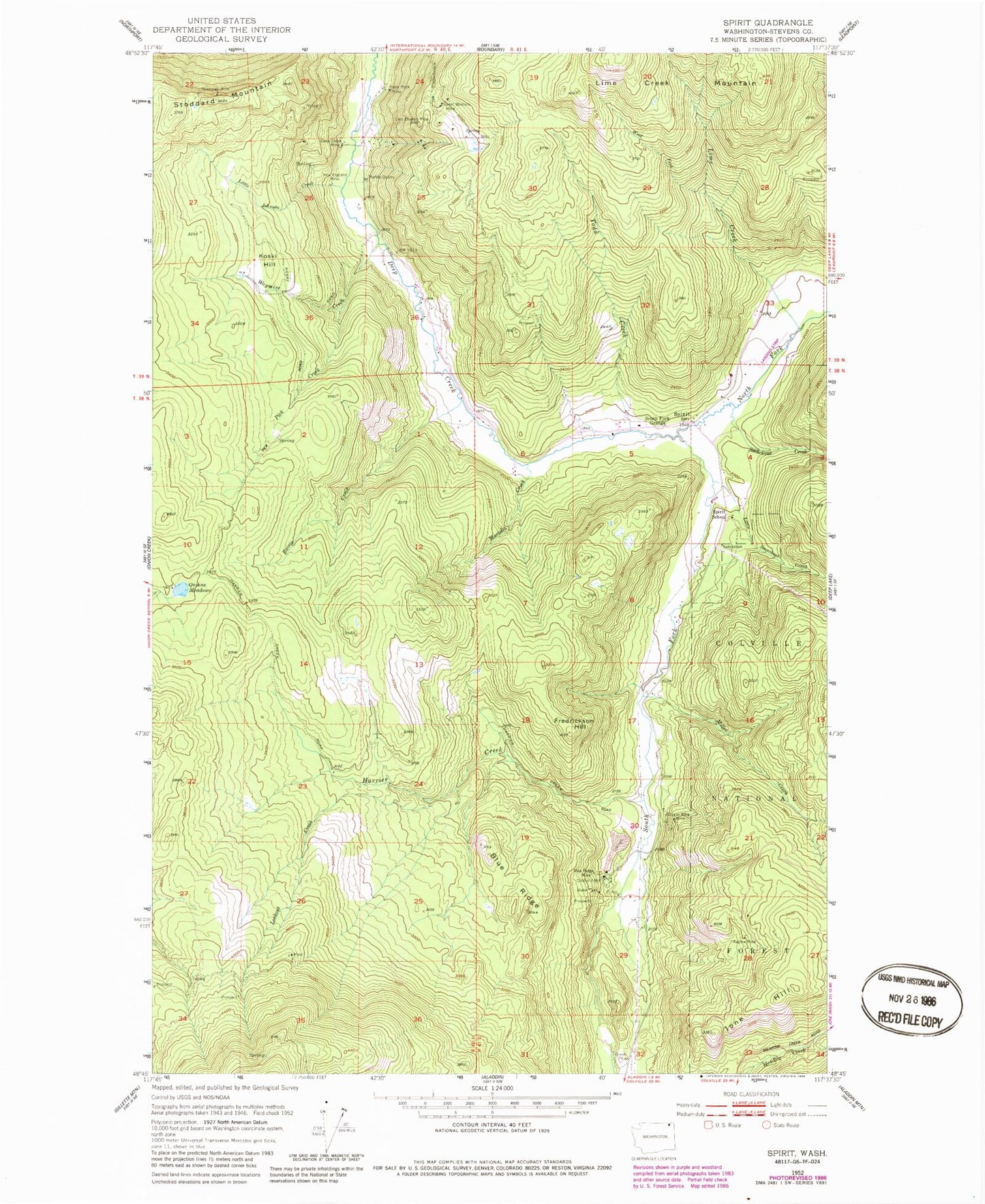
MyTopo
Classic USGS Spirit Washington 7.5'x7.5' Topo Map
Couldn't load pickup availability
Historical USGS topographic quad map of Spirit in the state of Washington. Map scale may vary for some years, but is generally around 1:24,000. Print size is approximately 24" x 27"
This quadrangle is in the following counties: Stevens.
The map contains contour lines, roads, rivers, towns, and lakes. Printed on high-quality waterproof paper with UV fade-resistant inks, and shipped rolled.
Contains the following named places: Black Rock Mine, Blue Ridge, Blue Ridge Mine, Copper King Mine, Deep Creek Mine, Frederickson Hill, Goldfield Mill, Great Western Mine, Harrier Creek, Ione Hill, Koski Hill, Last Chance Mine 3057, Lime Creek, Little Johnson Creek, Little Smackout Creek, Lookout Creek, Magma Mine, Marble Quarry, Martella Creek, Miller Creek, New England Mine, North Fork Deep Creek, Pick Creek, Quinns Meadows, Raisio Creek, Smackout Creek, South Fork Deep Creek, South Fork Grange, Spirit, Spirit School, Stevens County Fire District 10, Stonewall Mine, Todd Creek, Waymire Creek, West Fork Lime Creek