MyTopo
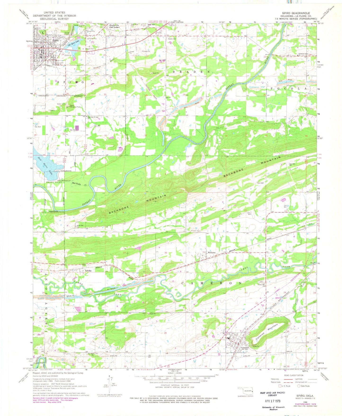
Classic USGS Spiro Oklahoma 7.5'x7.5' Topo Map
Couldn't load pickup availability
Historical USGS topographic quad map of Spiro in the state of Oklahoma. Map scale may vary for some years, but is generally around 1:24,000. Print size is approximately 24" x 27"
This quadrangle is in the following counties: Le Flore.
The map contains contour lines, roads, rivers, towns, and lakes. Printed on high-quality waterproof paper with UV fade-resistant inks, and shipped rolled.
Contains the following named places: Cameron, Cameron Elementary School, Cameron High School, Cameron Mountain, Cameron Post Office, Cedar Creek, Christian Grove Church, Emergency Medical Services of Le Flore County Station 5 Spiro, Fair Hill Church, Fairhill Cemetery, First Baptist Church, French Cemetery, Green Hill Church, Greenhill Cemetery, Hog Eye Volunteer Fire Department, Holi-Tuska Creek, Lakeview Baptist Church, Murry Spur Church, New Hope Garden of Memories Cemetery, New Spiro Lake, New Spiro Lake Dam, Old Spiro Lake, Old Spiro Lake Dam, Royal Oak Cemetery, Royal Oak Church, Skullyville, Spiro, Spiro Fire Department, Spiro Police Department, Spiro Post Office, Tahona, Town of Cameron, Town of Spiro, Township of Cameron, United Methodist Church, Wards Cemetery, Williams, ZIP Code: 74932