MyTopo
Classic USGS Split Rock Lake Montana 7.5'x7.5' Topo Map
Regular price
$16.95
Regular price
Sale price
$16.95
Unit price
per
Couldn't load pickup availability
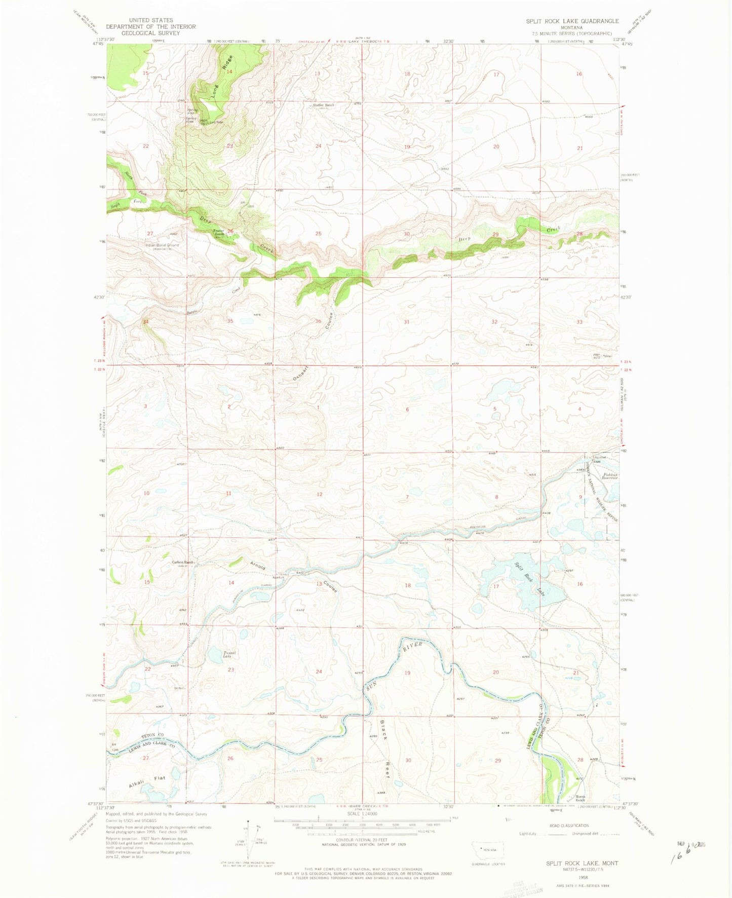
Historical USGS topographic quad map of Split Rock Lake in the state of Montana. Map scale may vary for some years, but is generally around 1:24,000. Print size is approximately 24" x 27"
This quadrangle is in the following counties: Lewis and Clark, Teton.
The map contains contour lines, roads, rivers, towns, and lakes. Printed on high-quality waterproof paper with UV fade-resistant inks, and shipped rolled.
Contains the following named places: Arnold Coulee, Battle Creek, Black Reef, Carlson Ranch, Frazier Ranch, Long Ridge, North Fork Deep Creek, Oxheart Coulee, Pishkun Canal, South Fork Deep Creek, Split Rock Lake, Split Rock Lake Dam, Stetler Ranch, Tunnel Lake