MyTopo
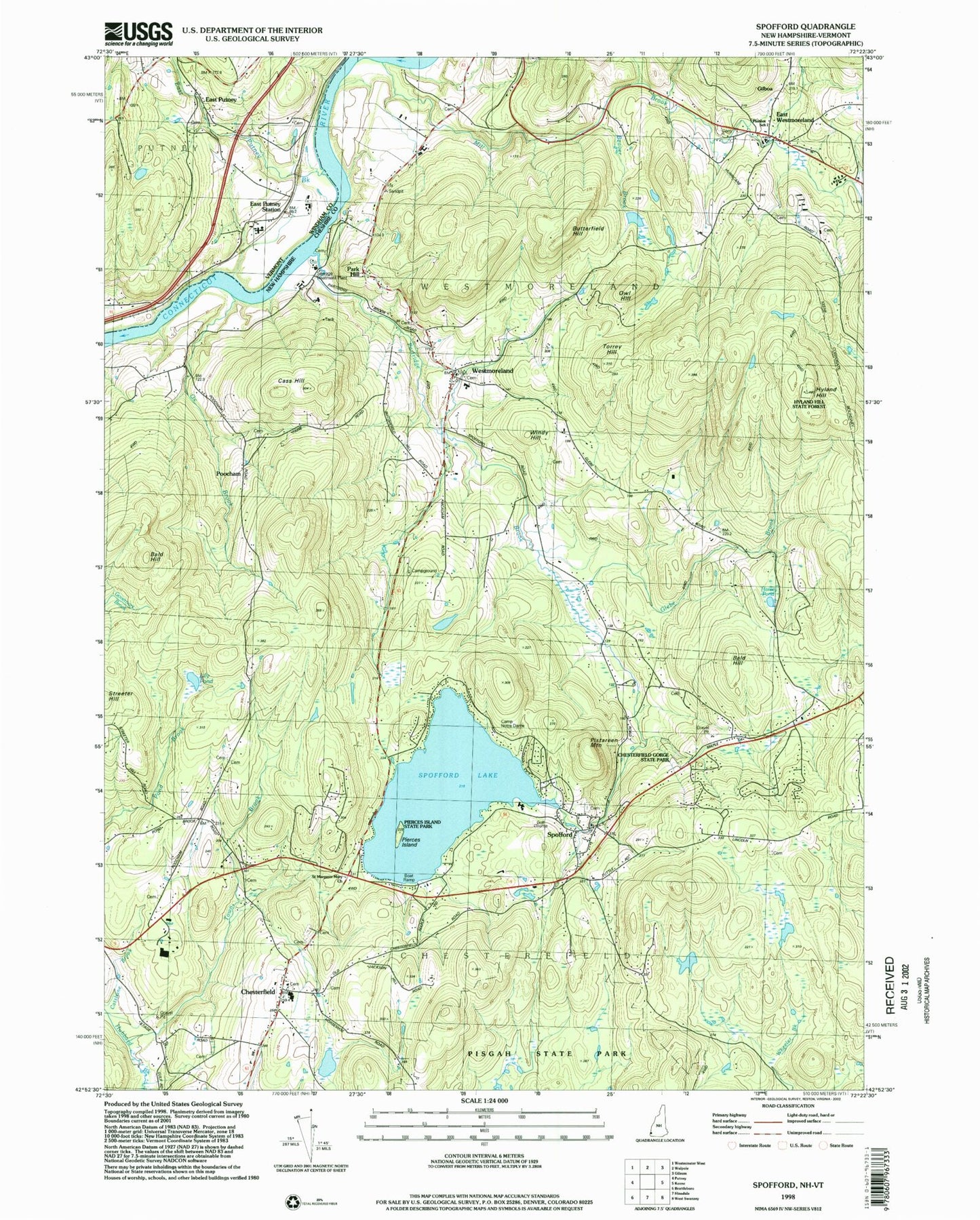
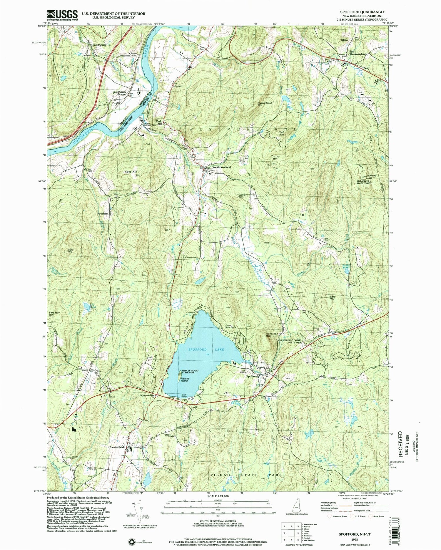
Classic USGS Spofford New Hampshire 7.5'x7.5' Topo Map
Couldn't load pickup availability
Historical USGS topographic quad map of Spofford in the states of New Hampshire, Vermont. Typical map scale is 1:24,000, but may vary for certain years, if available. Print size: 24" x 27"
This quadrangle is in the following counties: Cheshire, Windham.
The map contains contour lines, roads, rivers, towns, and lakes. Printed on high-quality waterproof paper with UV fade-resistant inks, and shipped rolled.
Contains the following named places: Hubbard Brook, Bald Hill, Bald Hill, Beaver Brook, Butterfield Hill, Camp Notre Dame, Cass Hill, Chesterfield, Corner School, East Westmoreland, Gilboa, Glebe Brook, Harvey Pond, Hyland Hill, Mill Brook, Owl Hill, Ox Brook, Park Hill, Partridge Brook, Pinnacle Pond, Pistareen Mountain, Poocham, Spofford, Spofford Lake, Streeter Hill, Torrey Hill, Town Brook, Westmoreland, Windy Hill, Town of Chesterfield, Town of Westmoreland, Spofford Lake Dam, Chesterfield Post Office, Spofford Post Office, Westmoreland Post Office, Asbury United Methodist Church, Chesterfield School, Chesterfield Gorge State Park, Hyland Hill State Forest, North Cemetery, Park Hill Common, Park Hill Meeting House, Pierces Island, Pierces Island State Park, Pine Grove Springs Country Club, Reformed Bible Church, Roads End Farm Ski Area, Saint Margaret Mary Church, Spofford United Methodist Church, Westmoreland School, Pioneer Junior Academy, Lily Pond, Pilgrim's Home Airfield, Spofford Fire Precinct, Chesterfield Fire and Rescue Center Station, Westmoreland Fire Department, Chesterfield Police Department, South Village Cemetery, East Putney, East Putney Brook, East Putney Station, Alpin Cemetery, East Putney Brook Stone Arch Bridge, East Putney Cemetery