MyTopo
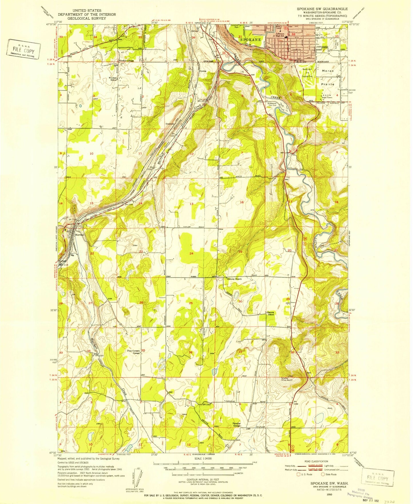
Classic USGS Spokane SW Washington 7.5'x7.5' Topo Map
Couldn't load pickup availability
Historical USGS topographic quad map of Spokane SW in the state of Washington. Map scale may vary for some years, but is generally around 1:24,000. Print size is approximately 24" x 27"
This quadrangle is in the following counties: Spokane.
The map contains contour lines, roads, rivers, towns, and lakes. Printed on high-quality waterproof paper with UV fade-resistant inks, and shipped rolled.
Contains the following named places: All Saints Middle School, Comstock School, Cowles, Fowlers Northwest 40 Airport, Geiger Heights, Hamblen Elementary School, Hangman Valley, High Drive Parkway, Homeport Airport, Jefferson Elementary School, KCKO-AM (Spokane), KEYF-AM (Dishman), KJRB-AM (Spokane), KSPO-AM (Dishman), Magpie Flats Heliport, Manito Golf Country Club, Marshall, Marshall Creek, Marshall Post Office, Minnie Creek, Mullan Hill Airport, Mullan Military Road Historical Monument, Overlook, Ox Meadows Airport, Rosa Butte, Southside Montessori Elementary School, Spokane County, Spokane County Fire District 3 Station 34 Marshall, Spokane County Fire District 3 Station 35 Paradise, Spokane Memorial Gardens, Spokane South Division, Windsor Elementary School, ZIP Code: 99020