MyTopo
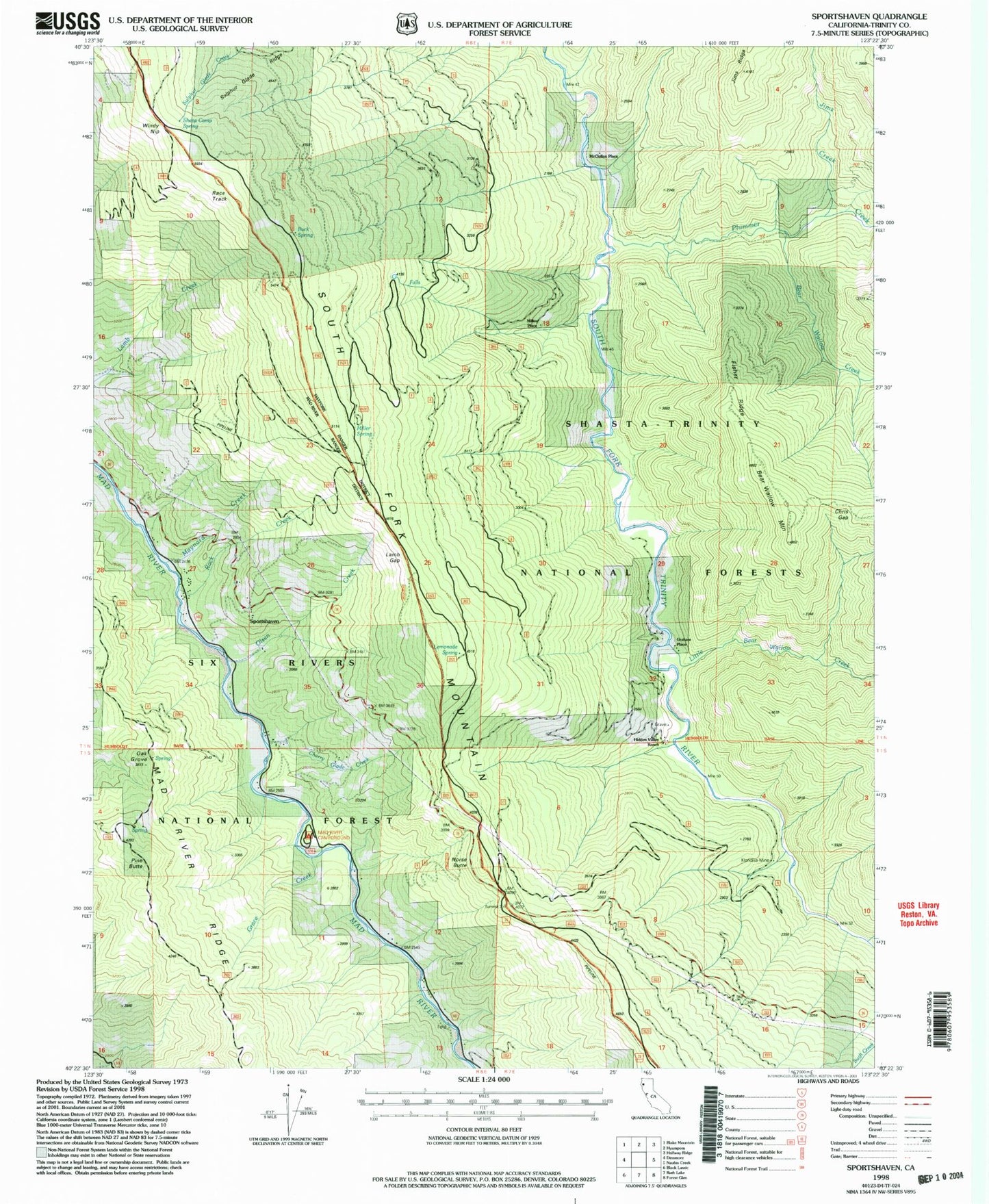
Classic USGS Sportshaven California 7.5'x7.5' Topo Map
Couldn't load pickup availability
Historical USGS topographic quad map of Sportshaven in the state of California. Map scale may vary for some years, but is generally around 1:24,000. Print size is approximately 24" x 27"
This quadrangle is in the following counties: Trinity.
The map contains contour lines, roads, rivers, towns, and lakes. Printed on high-quality waterproof paper with UV fade-resistant inks, and shipped rolled.
Contains the following named places: Bear Wallow Creek, Bear Wallow Mountain, Buck Spring, Cherry Glade Creek, Chris Gap, Feldmiller Ranch, Fisher Ridge, Grace Creek, Graham Place, Grunerts Place, Hidden Valley Ranch, Jims Creek, Jims Ridge, Klondike Mine, Lamb Gap, Lemonade Spring, Little Bear Wallow Creek, Mad River Campground, Mad River Census Designated Place, Maynard Creek, McClellan Place, Miller Place, Miller Spring, Miller Spring Recreation Site, Norgaar, Norse Butte, Oak Grove, Olsen Creek, Pine Butte, Plummer Creek, Rock Creek, Sand Place, Sheep Camp Spring, Sids Place, Sportshaven, Sulphur Glade Ridge, Windy Nip