MyTopo
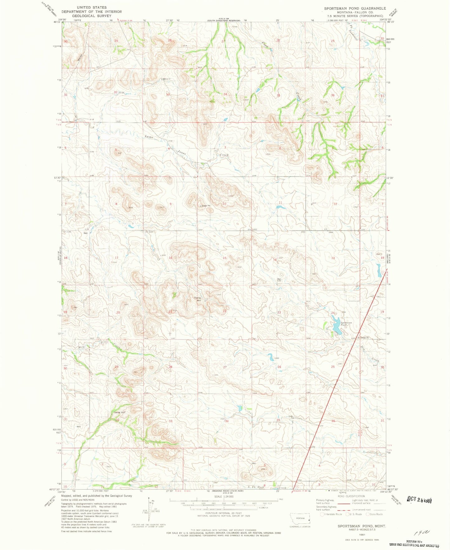
Classic USGS Sportsman Pond Montana 7.5'x7.5' Topo Map
Couldn't load pickup availability
Historical USGS topographic quad map of Sportsman Pond in the state of Montana. Map scale may vary for some years, but is generally around 1:24,000. Print size is approximately 24" x 27"
This quadrangle is in the following counties: Fallon.
The map contains contour lines, roads, rivers, towns, and lakes. Printed on high-quality waterproof paper with UV fade-resistant inks, and shipped rolled.
Contains the following named places: 04N59E05DACA01 Well, 05N58E04DB__01 Well, 05N58E10CBCC01 Well, 05N58E13DA__01 Well, 05N58E14BBBB01 Well, 05N58E16BDCD01 Well, 05N58E18AA__01 Well, 05N58E26DA__01 Well, 05N58E33BAAA01 Well, 05N58E35CA__01 Well, Bearhorn Butte, Boots Post Office, Red Hill School, Sportsman Dam, Sportsman Pond