MyTopo
Classic USGS Spot Mountain Idaho 7.5'x7.5' Topo Map
Couldn't load pickup availability
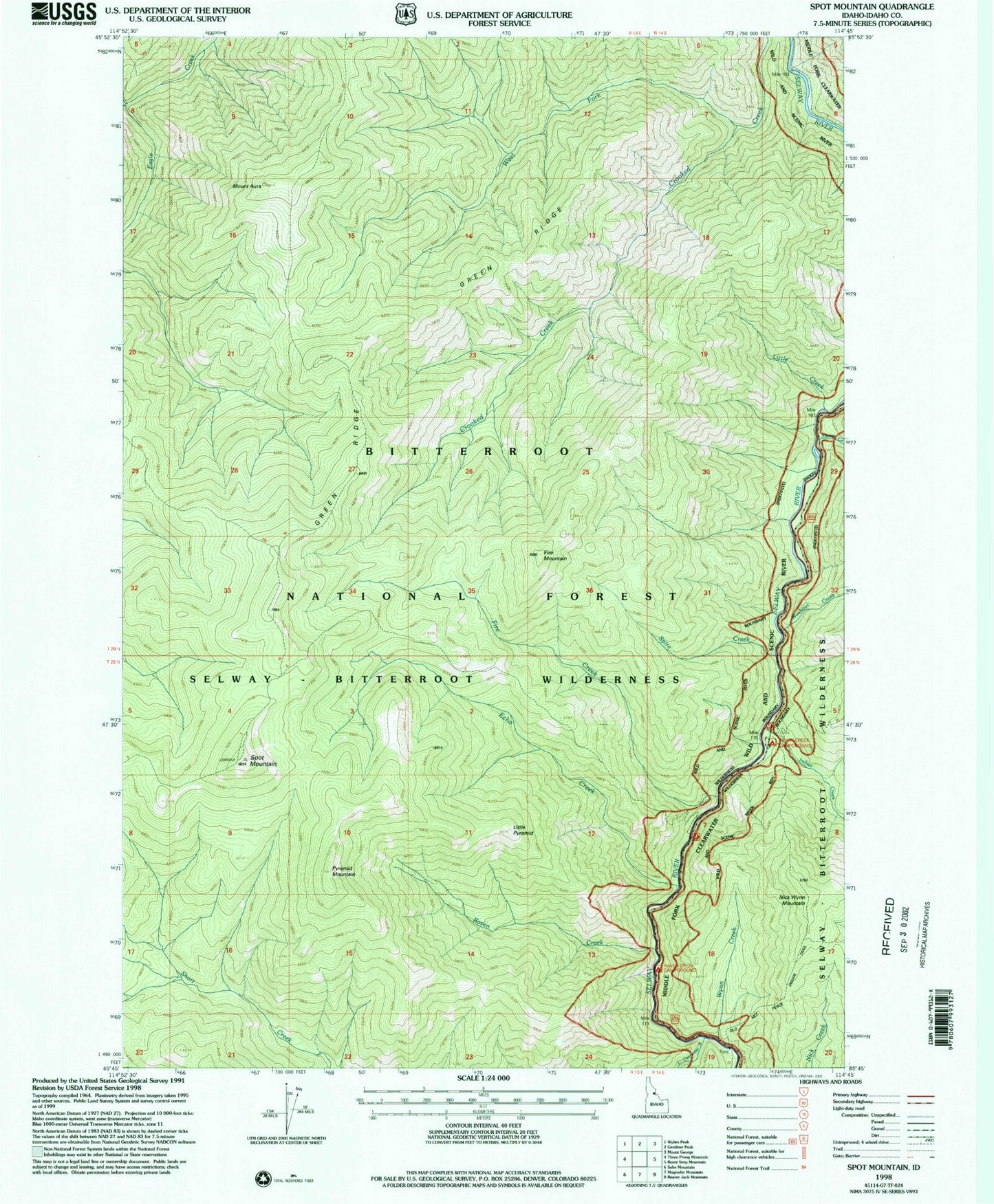
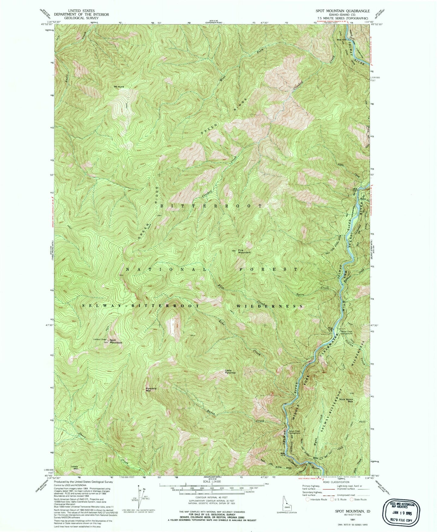
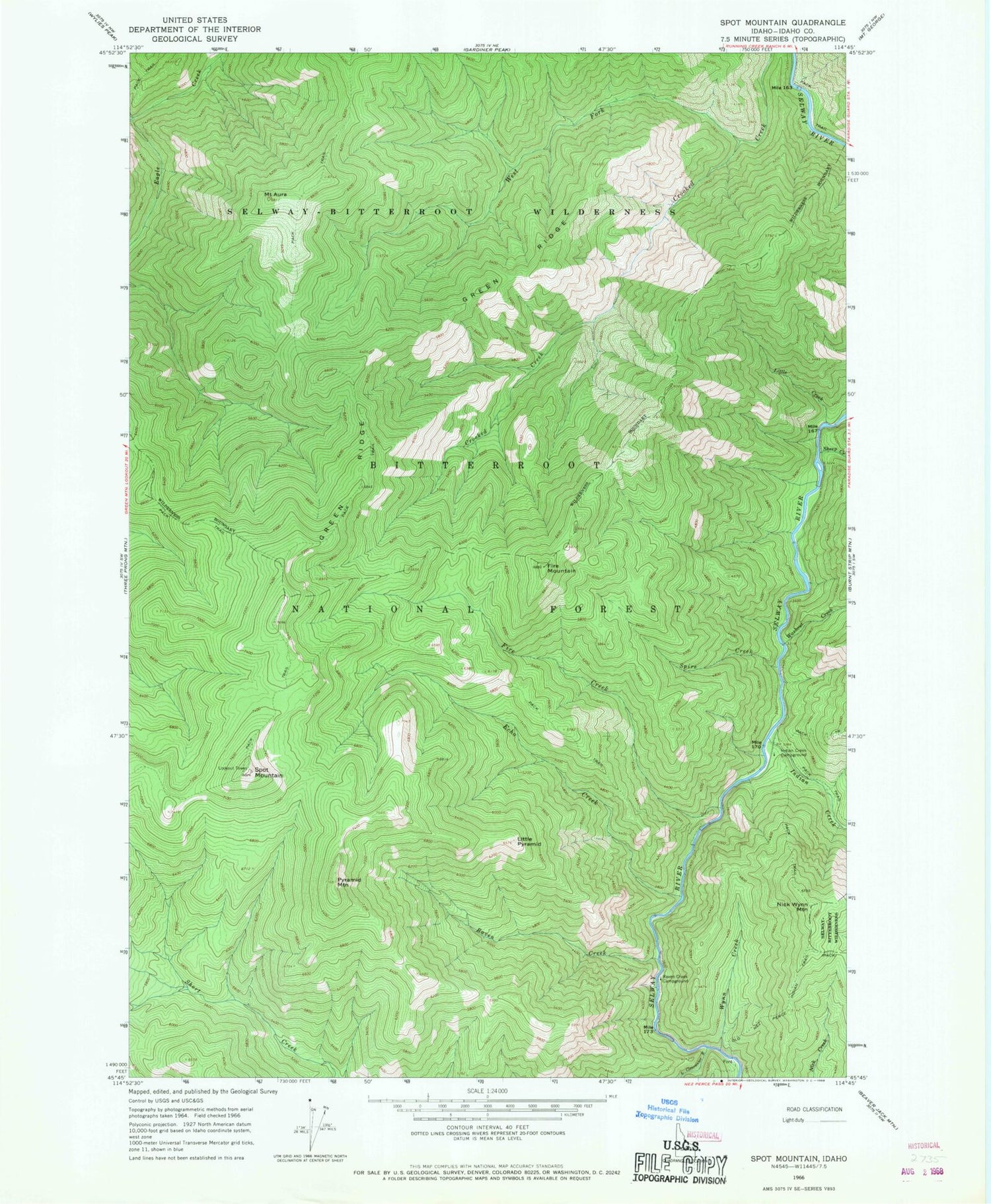
Historical USGS topographic quad map of Spot Mountain in the state of Idaho. Typical map scale is 1:24,000, but may vary for certain years, if available. Print size: 24" x 27"
This quadrangle is in the following counties: Idaho.
The map contains contour lines, roads, rivers, towns, and lakes. Printed on high-quality waterproof paper with UV fade-resistant inks, and shipped rolled.
Contains the following named places: Mount Aura, Echo Creek, Fire Creek, Fire Mountain, Green Ridge, Indian Creek, Indian Creek Campground, Little Clearwater River, Little Creek, Little Pyramid, Nick Wynn Mountain, Pyramid Mountain, Raven Creek, Raven Creek Campground, Sheep Creek, Spire Creek, Spot Mountain, Washout Creek, West Fork Crooked Creek, Wynn Creek, Mount Aura, Echo Creek, Fire Creek, Fire Mountain, Green Ridge, Indian Creek, Indian Creek Campground, Little Clearwater River, Little Creek, Little Pyramid, Nick Wynn Mountain, Pyramid Mountain, Raven Creek, Raven Creek Campground, Sheep Creek, Spire Creek, Spot Mountain, Washout Creek, West Fork Crooked Creek, Wynn Creek