MyTopo
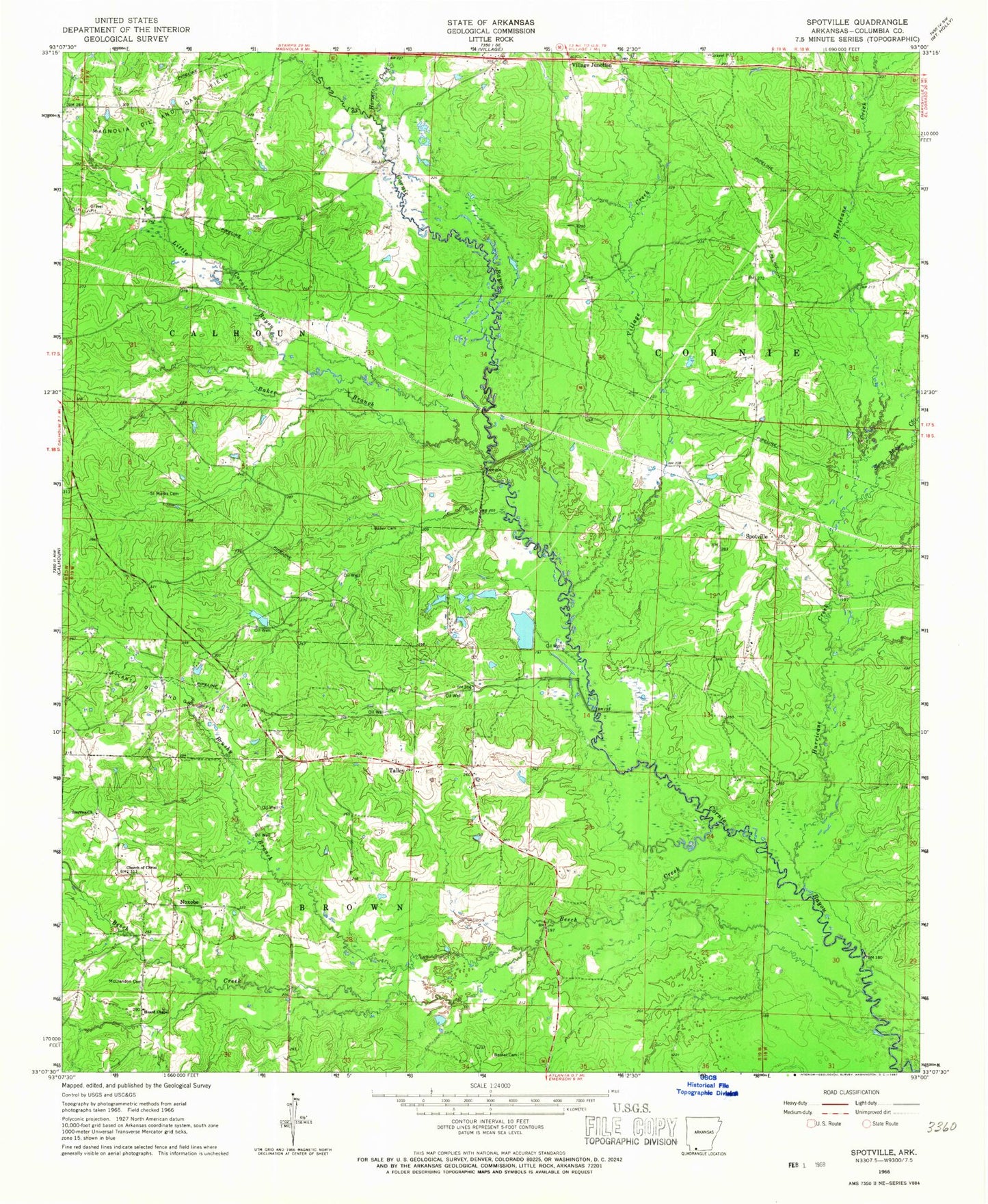
Classic USGS Spotville Arkansas 7.5'x7.5' Topo Map
Couldn't load pickup availability
Historical USGS topographic quad map of Spotville in the state of Arkansas. Map scale may vary for some years, but is generally around 1:24,000. Print size is approximately 24" x 27"
This quadrangle is in the following counties: Columbia.
The map contains contour lines, roads, rivers, towns, and lakes. Printed on high-quality waterproof paper with UV fade-resistant inks, and shipped rolled.
Contains the following named places: Atlanta Oil and Gas Field, Baker Branch, Baker Cemetery, Beech Creek, Bethel Cemetery, Bethel Church, Bethlehem Church, Brushy Branch, Church of Christ, Harper Creek, Heard Chapel, Hurricane Creek, Jameson Bridge, Little Cornie Bayou, McClendon Cemetery, Nebo School, Noxobe, Pine Tree Oil and Gas Field, Riley Branch, Saint Marks Cemetery, Saint Marks Church, Scott Branch, Slow Motion Creek, Smyrna Church, Spotville, Spotville School, Talley, Talley School, Tanyard Branch, Township of Calhoun, Township of Cornie, Village Creek, Village Junction, Zion Church