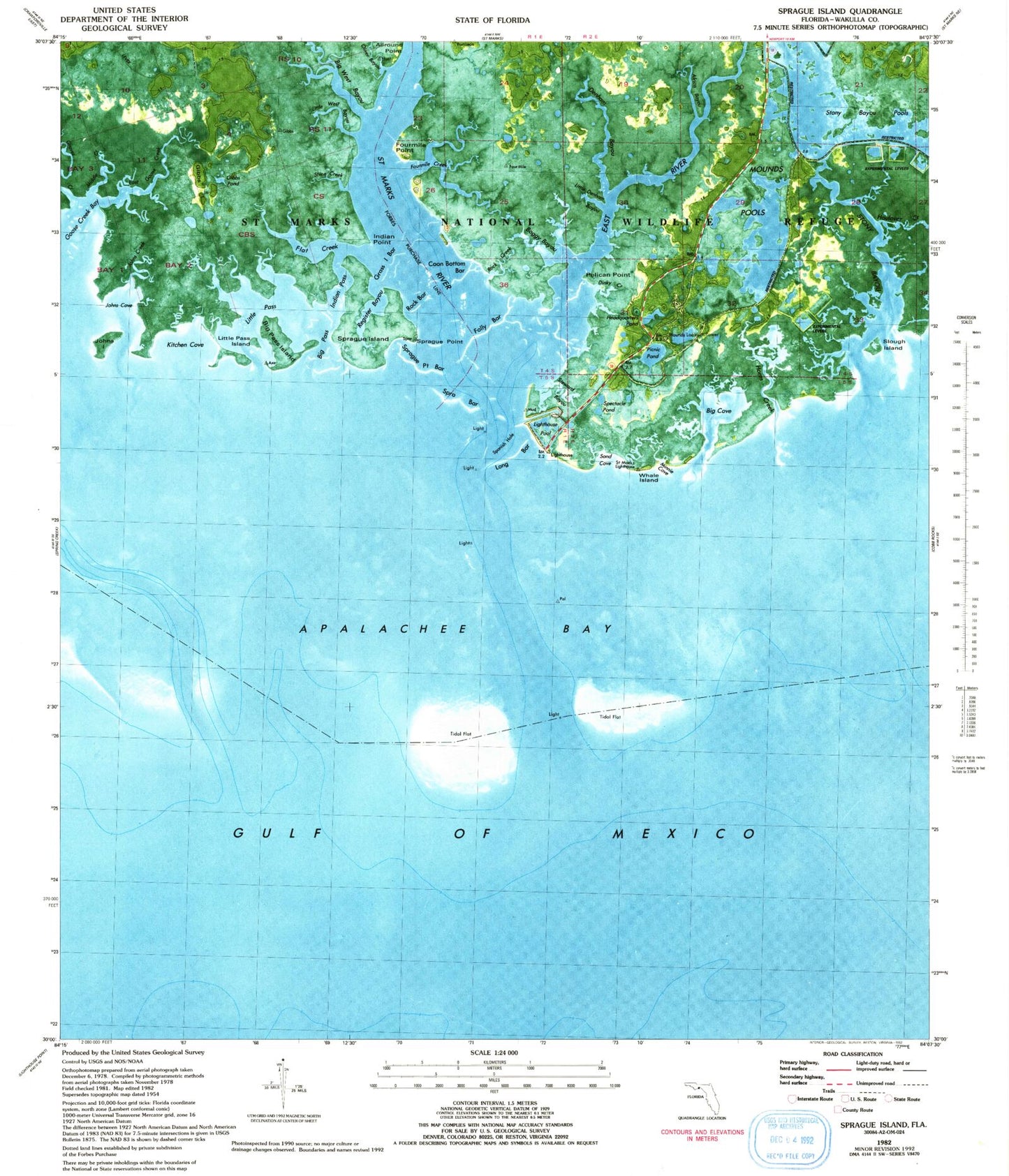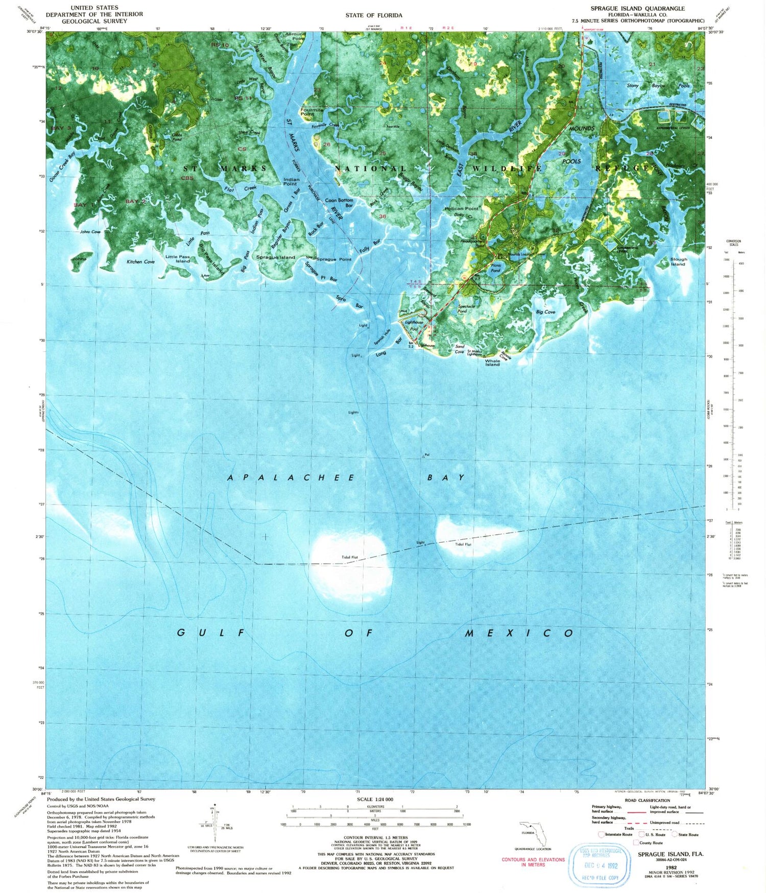
MyTopo
Classic USGS Sprague Island Florida 7.5'x7.5' Topo Map
Couldn't load pickup availability
Historical USGS topographic quad map of Sprague Island in the state of Florida. Map scale may vary for some years, but is generally around 1:24,000. Print size is approximately 24" x 27"
This quadrangle is in the following counties: Wakulla.
The map contains contour lines, roads, rivers, towns, and lakes. Printed on high-quality waterproof paper with UV fade-resistant inks, and shipped rolled.
Contains the following named places: Africa Bayou, Apalachee Bay, Big Cove, Big Pass, Big Pass Island, Big West Bayou, Bird Racks, Boggy Bayou, Denham Bayou, East Goose Creek, East River, Flat Creek, Four Mile Creek, Four Mile Point, Gibbs Island, Gibbs Pond, Graves Creek, Haulover Creek, Headquarters Pond, Horns Creek, Indian Pass, Indian Point, Johns Cove, Johns Creek, Johns Island, Kitchen Cove, Lighthouse Pool, Little Denham Bayou, Little Pass, Little Pass Island, Little West Bayou, Middle Creek, Minnie Cove, Mound Lookout Tower, Mounds Pond, Mounds Pool, Oliver Bayou, Pelican Point, Picnic Pond, Register Bayou, Rock Creek, Saint Marks Light, Saint Marks National Wildlife Refuge, Saint Marks River, Sand Cove, Shine Creek, Slough Island, Spectacle Pond, Sprague Island, Sprague Point, Steward Bayou, Stony Bayou, Stony Bayou Pool