MyTopo
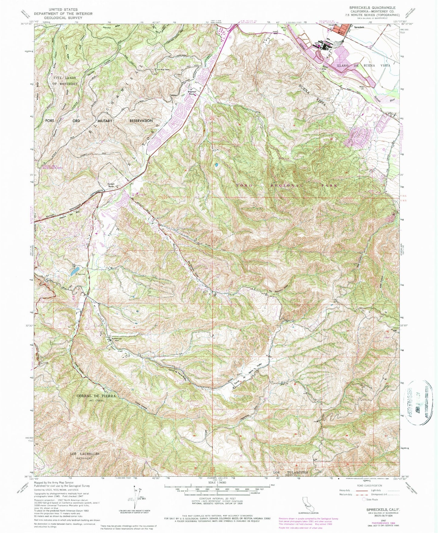
Classic USGS Spreckels California 7.5'x7.5' Topo Map
Couldn't load pickup availability
Historical USGS topographic quad map of Spreckels in the state of California. Typical map scale is 1:24,000, but may vary for certain years, if available. Print size: 24" x 27"
This quadrangle is in the following counties: Monterey.
The map contains contour lines, roads, rivers, towns, and lakes. Printed on high-quality waterproof paper with UV fade-resistant inks, and shipped rolled.
Contains the following named places: Canyon Del Rey, Barloy Canyon, Bingamin Ranch, Buena Vista, Calera Canyon, Corral de Tierra Valley, Rancho Corral de Tierra, El Chamisal, El Toro, El Toro Lake, Guidotti Ranch, Harper Creek, Jacks Ranger Station, Lookout Ridge, San Benancio Gulch, San Benancio Middle School, Kalte Canyon, Los Laurelles, Perry Ridge, Washington Elementary School, Watson Creek, Wildcat Ridge, Toro Regional Park, Laguna Seca Race Track, Lincoln School, Spreckels, Lincoln School (historical), Ambler Park, Barlow Canyon Trail, Bessie Canyon Trail, Corral de Tierra, Corral de Tierra Country Club, Cougar Ridge Trail, Creekside, East Ridge Trail, Gibson Trail, Keltron Park, Lost Valley Wilderness Area, Morgan Winery, Ollason Trail, Serra Village, Spreckels Memorial Park, Spreckels Post Office, Toro Pask Elementary School, Toro Park Shopping Center, Toro School for the Hearing Impaired, Toyon Ridge Trail, Toro Park Division, San Benancio Canyon, Spreckels Census Designated Place, Montessori Learning Center, Buena Vista Middle School, Monterey County Regional Fire District Station 1 - Toro, Spreckels Volunteer Fire Company