MyTopo
Classic USGS Spring Coulee Montana 7.5'x7.5' Topo Map
Couldn't load pickup availability
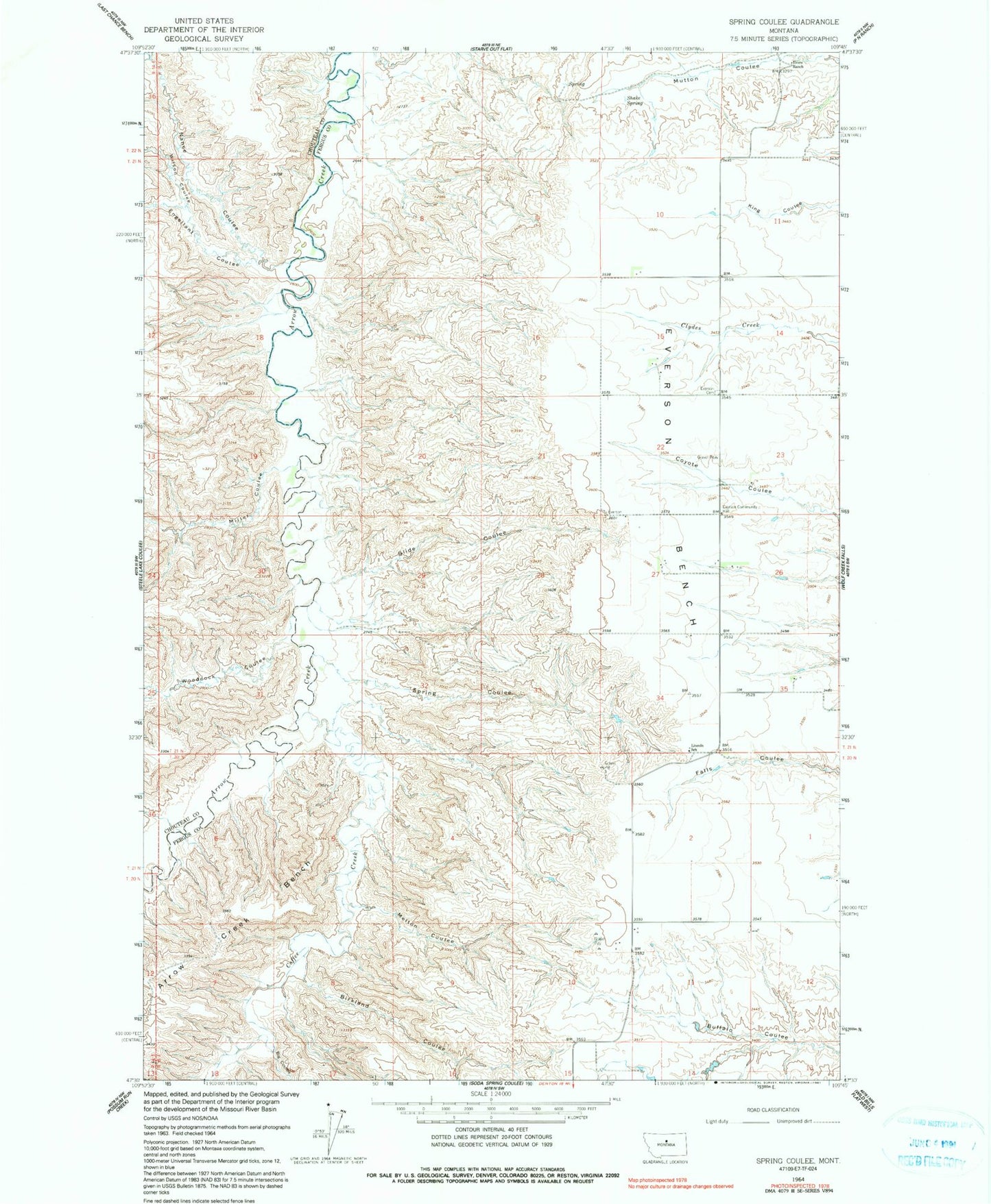
Historical USGS topographic quad map of Spring Coulee in the state of Montana. Map scale may vary for some years, but is generally around 1:24,000. Print size is approximately 24" x 27"
This quadrangle is in the following counties: Chouteau, Fergus.
The map contains contour lines, roads, rivers, towns, and lakes. Printed on high-quality waterproof paper with UV fade-resistant inks, and shipped rolled.
Contains the following named places: 20N15E10CDCD01 Well, 21N15E26BCDC01 Well, Big Coulee, Birkland Coulee, Coffee Creek, Coppedge School, Dossett Coulee, Engellant Coulee, Evers Ranch, Everson, Everson Bench, Everson Cemetery, Everson Community Hall, Everson Post Office, Lincoln School, Melton Coulee, Miller Coulee, Nance Coulee, Pleasant View School, Shake Spring, Slide Coulee, Spring Coulee, Wilson Coulee, Woodcock Coulee