MyTopo
Classic USGS Spring Creek Bay Montana 7.5'x7.5' Topo Map
Regular price
$16.95
Regular price
Sale price
$16.95
Unit price
per
Couldn't load pickup availability
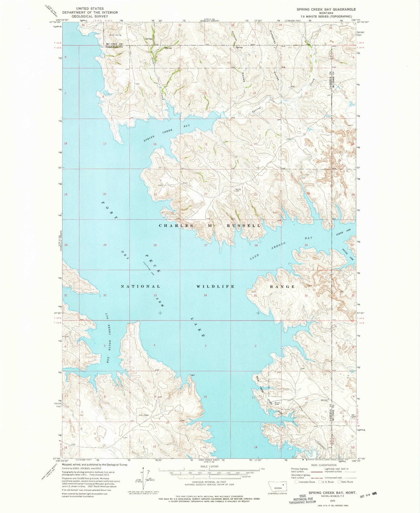
Historical USGS topographic quad map of Spring Creek Bay in the state of Montana. Map scale may vary for some years, but is generally around 1:24,000. Print size is approximately 24" x 27"
This quadrangle is in the following counties: Garfield, McCone.
The map contains contour lines, roads, rivers, towns, and lakes. Printed on high-quality waterproof paper with UV fade-resistant inks, and shipped rolled.
Contains the following named places: Box Elder Creek Bay, Dry Arm, Hay Coulee Post Office, Hay Coulee School, Humphrey Coulee, Polecat Coulee, Rock Creek Fishing Access Site, Rock Creek State Park, Sand Arroyo Bay, South Arm Sand Arroyo Bay, Spring Creek, Spring Creek Bay, Stole Creek