
MyTopo
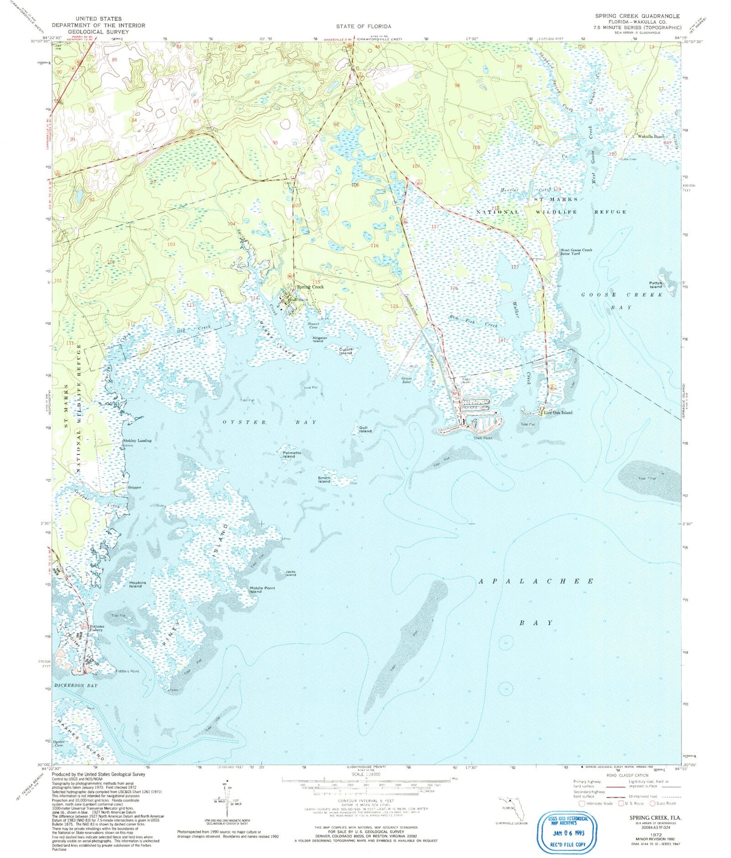
Classic USGS Spring Creek Florida 7.5'x7.5' Topo Map
Couldn't load pickup availability
Historical USGS topographic quad map of Spring Creek in the state of Florida. Map scale may vary for some years, but is generally around 1:24,000. Print size is approximately 24" x 27"
This quadrangle is in the following counties: Wakulla.
The map contains contour lines, roads, rivers, towns, and lakes. Printed on high-quality waterproof paper with UV fade-resistant inks, and shipped rolled.
Contains the following named places: Alligator Island, Apalachee Bay Volunteer Fire Department, Boggy Island, Bottoms Fishery, Cow Creek, Cutoff Island, Debra Nell Cemetery, Fiddlers Point, Gander Creek, Goose Creek Bay, Grass Inlet, Gull Island, Hopkins Island, Jacks Island, Live Oak Island, Mensler Creek, Middle Point Island, Old Creek, Oyster Bay, Oyster Cove, Palmetto Island, Pattys Island, Piney Island, Porter Island, Purify Creek, Red Fish Creek, Shady Sea Church, Shell Point, Shepherd Spring Creek, Skipper, Skipper Creek, Smith Cemetery, Smith Island, Spring Creek, Stokley Landing, Stuart Cove, Wakulla Beach, Wakulla County, Walker Creek, West Goose Creek, West Goose Creek Seine Yard


