MyTopo
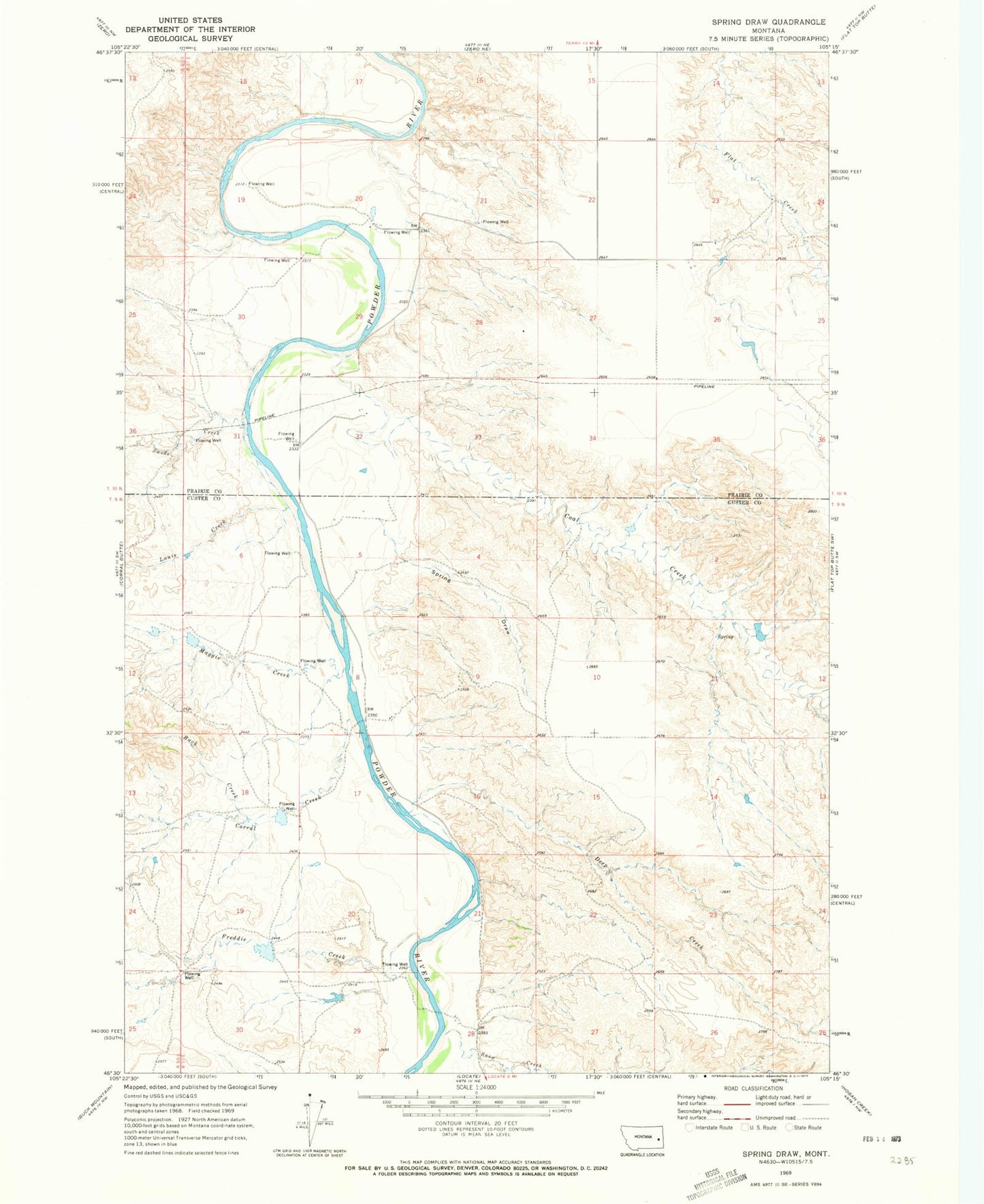
Classic USGS Spring Draw Montana 7.5'x7.5' Topo Map
Couldn't load pickup availability
Historical USGS topographic quad map of Spring Draw in the state of Montana. Map scale may vary for some years, but is generally around 1:24,000. Print size is approximately 24" x 27"
This quadrangle is in the following counties: Custer, Prairie.
The map contains contour lines, roads, rivers, towns, and lakes. Printed on high-quality waterproof paper with UV fade-resistant inks, and shipped rolled.
Contains the following named places: 09N51E28BD__01 Well, 10N51E19ACCB01 Well, 10N51E20DDAB01 Well, 10N51E26BABB01 Well, Buck Creek, Coal Creek, Coal Creek Number 2 Dam, Corral Creek, Deep Creek, Dondarlee Number 1 Dam, Freddie Creek, Griffin Dam, Louie Creek, Maggie Creek, N P Number 3 Dam, Snow Creek, Spring Draw, Sutherland, Sutherland Post Office, Sutherland School, Swede Creek, Ten Mile School, Young Number 1 Dam