MyTopo
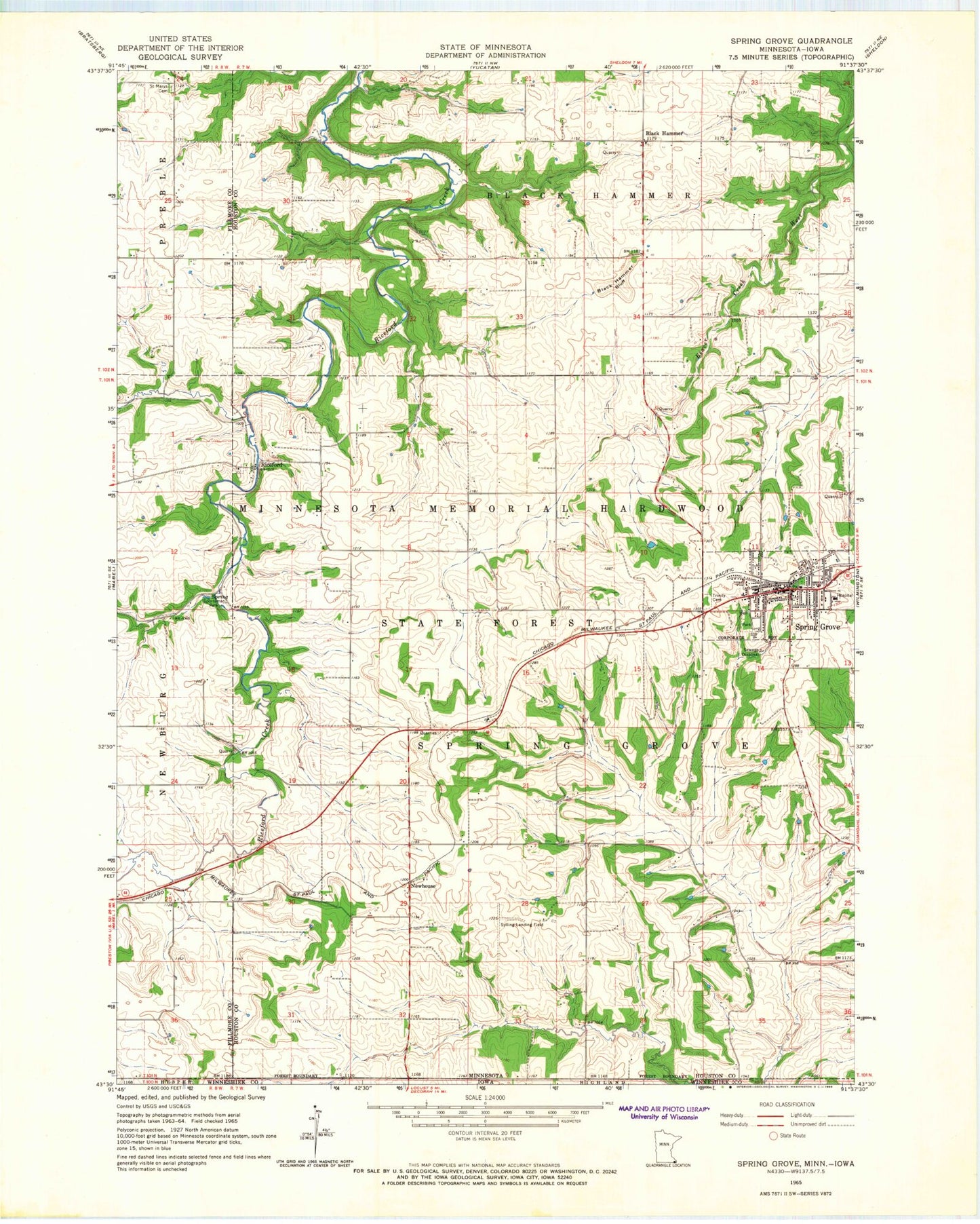
Classic USGS Spring Grove Minnesota 7.5'x7.5' Topo Map
Couldn't load pickup availability
Historical USGS topographic quad map of Spring Grove in the state of Minnesota. Map scale may vary for some years, but is generally around 1:24,000. Print size is approximately 24" x 27"
This quadrangle is in the following counties: Fillmore, Houston, Winneshiek.
The map contains contour lines, roads, rivers, towns, and lakes. Printed on high-quality waterproof paper with UV fade-resistant inks, and shipped rolled.
Contains the following named places: Bellview Cemetery, Black Hammer, Black Hammer Bluff, Black Hammer Lutheran Church Cemetery, Black Hammer Post Office, Calvary Evangelical Free Church, City of Spring Grove, Deters Farms Airport, Faith Lutheran Church, Gunderson Lutheran - Spring Grove Clinic, KQYB-FM (Spring Grove), Maranatha Fellowship, Newhouse, Newhouse Post Office, Old Black Hammer Cemetery, Onstad Trailer Park, Riceford, Riceford Norwegian Cemetery, Riceford Post Office, Saint Marys Cemetery, Sportsman Park, Spring Grove, Spring Grove City Hall, Spring Grove City Park, Spring Grove Fire Department, Spring Grove High School, Spring Grove Library, Spring Grove Lutheran Cemetery, Spring Grove Police Department, Spring Grove Post Office, Spring Grove Trinity Lutheran Church Cemetery, Supersaw Valley Campground, Sylling Landing Field, Township of Spring Grove, Trinity Lutheran Church, ZIP Code: 55974