MyTopo
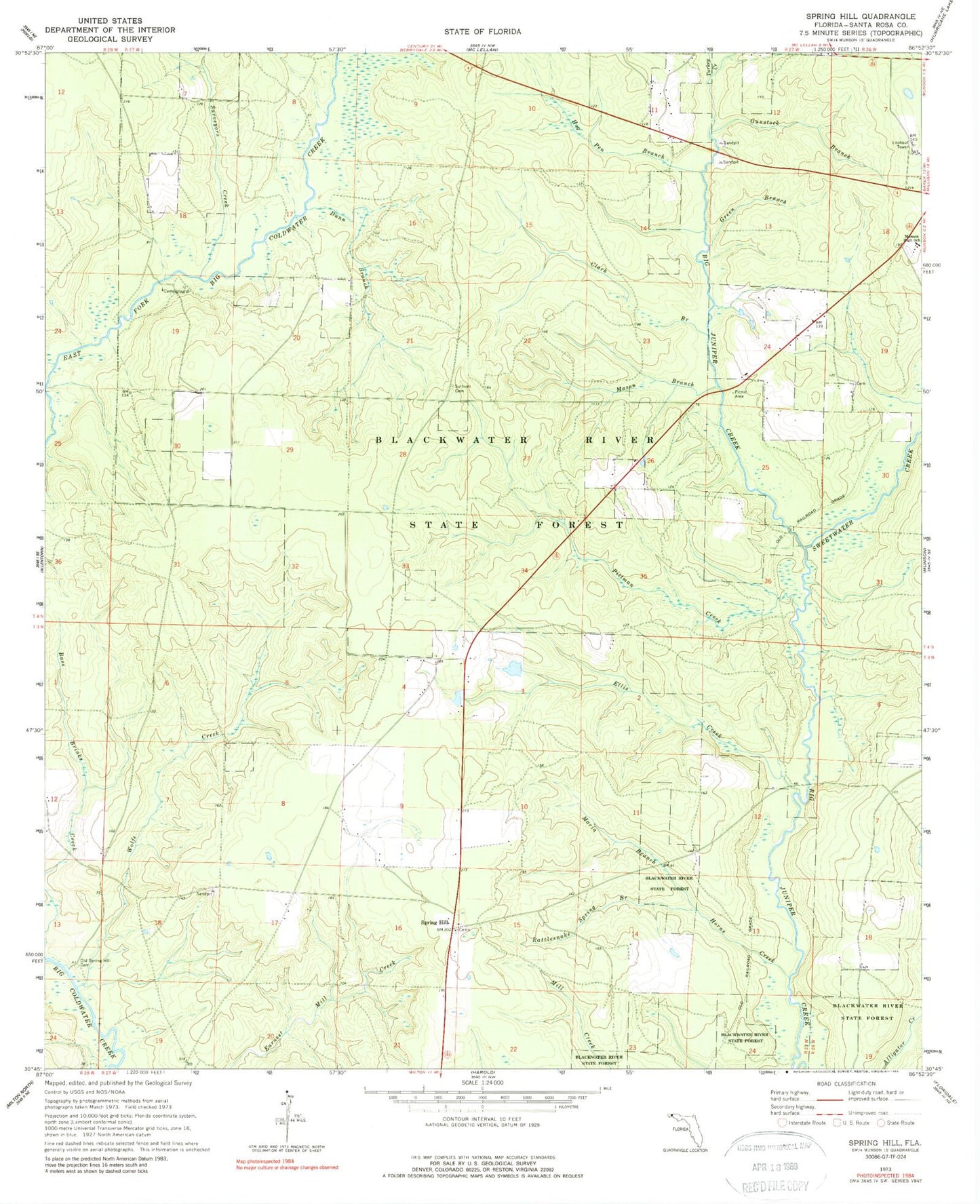
Classic USGS Spring Hill Florida 7.5'x7.5' Topo Map
Couldn't load pickup availability
Historical USGS topographic quad map of Spring Hill in the state of Florida. Map scale may vary for some years, but is generally around 1:24,000. Print size is approximately 24" x 27"
This quadrangle is in the following counties: Santa Rosa.
The map contains contour lines, roads, rivers, towns, and lakes. Printed on high-quality waterproof paper with UV fade-resistant inks, and shipped rolled.
Contains the following named places: Clark Branch, Dunn Branch, Ellis Creek, Green Branch, Gunstock Branch, Hog Pen Branch, Horns Creek, Maria Branch, Mason Branch, Munson Census Designated Place, Munson Division, Munson High School, Munson Lookout Tower, Munson Volunteer Fire Department Station 2, Munson-McLellen Division, Old Springhill Cemetery, Pittman Creek, Rattlesnake Spring Branch, Spring Hill, Springhill Census Designated Place, Sullivan Cemetery, Surveyors Creek, Sweetwater Creek, Turkey Creek, Wolfe Creek, ZIP Code: 32570