MyTopo
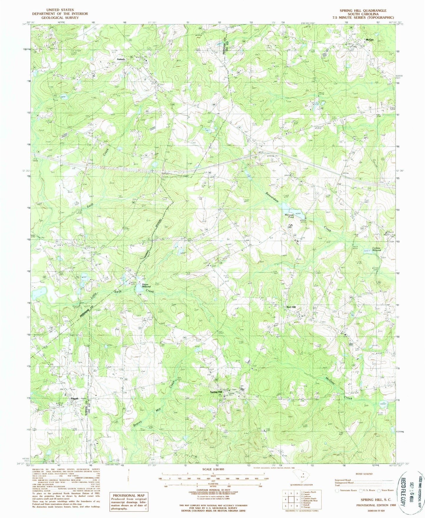
Classic USGS Spring Hill South Carolina 7.5'x7.5' Topo Map
Couldn't load pickup availability
Historical USGS topographic quad map of Spring Hill in the state of South Carolina. Map scale may vary for some years, but is generally around 1:24,000. Print size is approximately 24" x 27"
This quadrangle is in the following counties: Kershaw, Lee, Sumter.
The map contains contour lines, roads, rivers, towns, and lakes. Printed on high-quality waterproof paper with UV fade-resistant inks, and shipped rolled.
Contains the following named places: Antioch, Antioch Baptist Church, Antioch Elementary School, Ashwood Division, Central High School, Community Bible Church, Corbitts Millpond, Corbitts Millpond Dam D-1721, Elizabeth Church, Gospel Hill Church, Ionia School, Kershaw County Fire Station Antioch, Lee County Rural Fire Department Red Hill, McCaskill Cemetery, McLeod School, McLeods Lower Pond, McLeods Pond, McLeods Upper Pond, McLeods Upper Pond Dam D-2409, Mizpah Church, Mount Calvary Church, Newell Pond, Oak Grove School, Pine Grove Church, Pisgah, Pisgah Church, Red Hill, Red Hill Baptist Church, Reedy Branch School, Rock Hill Church, Rock Hill School, Saint Andrews Church, Saint James Church, Saint Johns Church, Saint Lukes Church, Saint Phillips Church, Saint Phillips School, Saints Church, Salem Church, Sand Hill Cemetery, Sandy Hill Plantation, Shiver Millpond, South Carolina Noname 28038 D-2536 Dam, South Carolina Noname 31016 D-2406 Dam, South Carolina Noname 31018 D-2408 Dam, Spring Hill, Spring Hill School, West Lee School, Windi Knoll Lake, Windi Knoll Lake D-1723 Dam, WQHB-TV (Sumter), Zion Hill Church