MyTopo
Classic USGS Spring Island South Carolina 7.5'x7.5' Topo Map
Couldn't load pickup availability
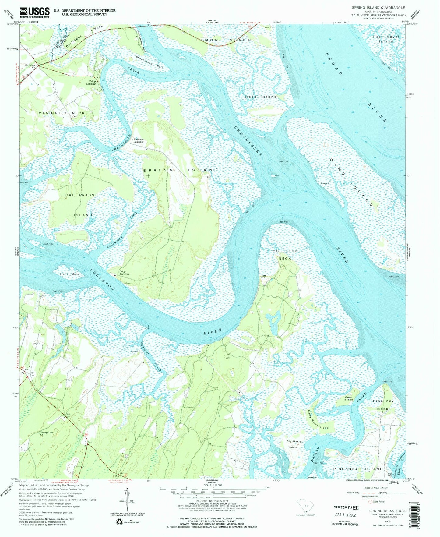
Historical USGS topographic quad map of Spring Island in the state of South Carolina. Typical map scale is 1:24,000, but may vary for certain years, if available. Print size: 24" x 27"
This quadrangle is in the following counties: Beaufort, Jasper.
The map contains contour lines, roads, rivers, towns, and lakes. Printed on high-quality waterproof paper with UV fade-resistant inks, and shipped rolled.
Contains the following named places: Bellinger Neck, Big Harry Island, Callawassie Creek, Chechessee Point, Chechessee Creek, Colleton Neck, Corn Island, Crane Island, Daws Island, Little Harry Island, Pinckney Neck, Rose Island, Saint Lukes Church, Sawmill Creek, Spring Island, Young Zion Church, Foot Point, Copp Landing, Pinckney Landing, Belfair School (historical), Foot Point Plantation, Foot Point School (historical), G G Dowling Bridge, Hog Bluff Plantation, Low Country Plaza Shopping Center, Pinckney Island School (historical), Spring Island School (historical), Victoria Bluff, Marine Railway Pond Dam D-2942, South Carolina Noname 07001 Dam Number One D-2940, South Carolina Noname 07001 Dam Number Two D-2941, Victoria Bluff, Edwards, Fripp Landing, Manigault Neck, Callawassie Island, Colleton River, Bluffton Division, Bluffton Fire Department Chelsea, Shell Point Census Designated Place, Callawassie Island Club House, Carolina House of Bluffton, Cherry Point Wastewater Treatment Plant, Hardeeville Church Road Plant, Pinckney Island National Wildlife Refuge