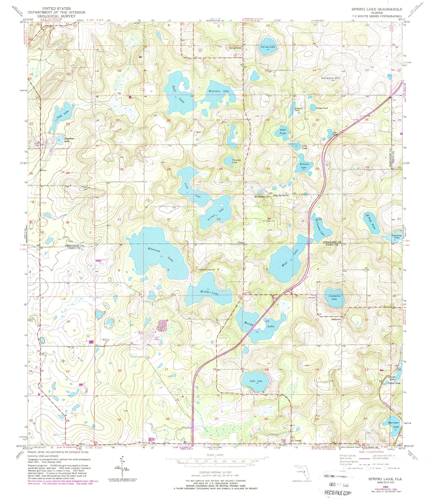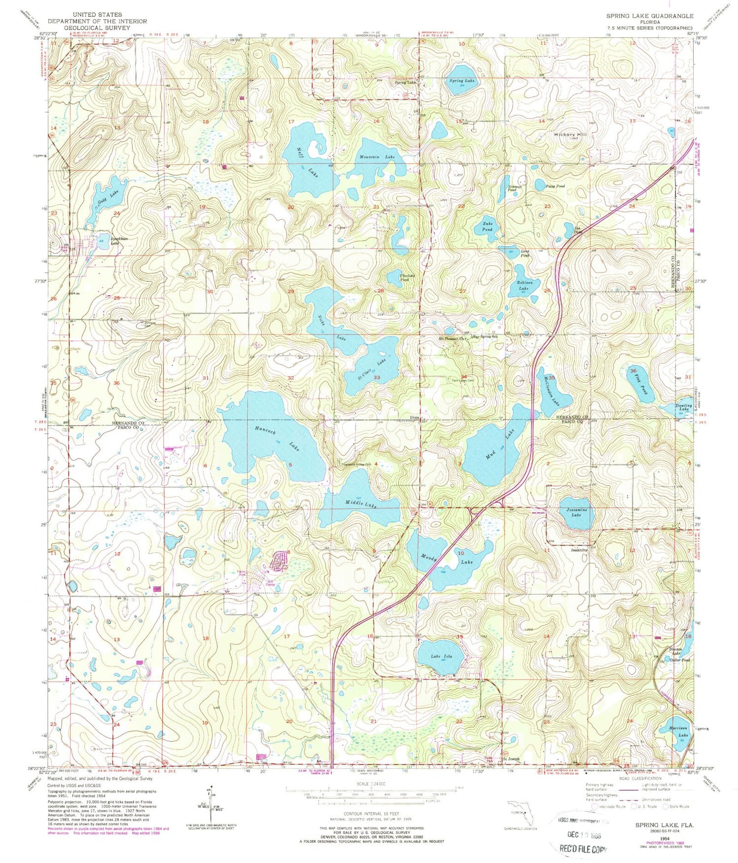
MyTopo
Classic USGS Spring Lake Florida 7.5'x7.5' Topo Map
Couldn't load pickup availability
Historical USGS topographic quad map of Spring Lake in the state of Florida. Map scale may vary for some years, but is generally around 1:24,000. Print size is approximately 24" x 27"
This quadrangle is in the following counties: Hernando, Pasco.
The map contains contour lines, roads, rivers, towns, and lakes. Printed on high-quality waterproof paper with UV fade-resistant inks, and shipped rolled.
Contains the following named places: Bay Spring School, Charlotte Pond, Chukuchatta, Dixie, Dollar Pond, Flag Pond, Gold Lake, Hancock Lake, Harrison Lake, Hickory Hill, Jessamine, Jessamine Lake, Johnson Cemetery, Lake Iola, Long Pond, McClendon Lake, Middle Lake, Moody Lake, Mount Pleasant Church, Mountain Lake, Mud Lake, Neff Fish Camp, Neff Lake, Nicks Lake, Patsy Pond, Robison Lake, Saint Clair Lake, Saint Joseph, Sea Pond, Simmon Pond, Sparkman Lake, Spring Lake, Spring Lake Census Designated Place, Spring Lake United Methodist Church, Townsend House Cemetery, Travelers Rest Volunteer Fire Rescue Station 33, Twin Lakes Cemetery, Zuke Pond