
MyTopo
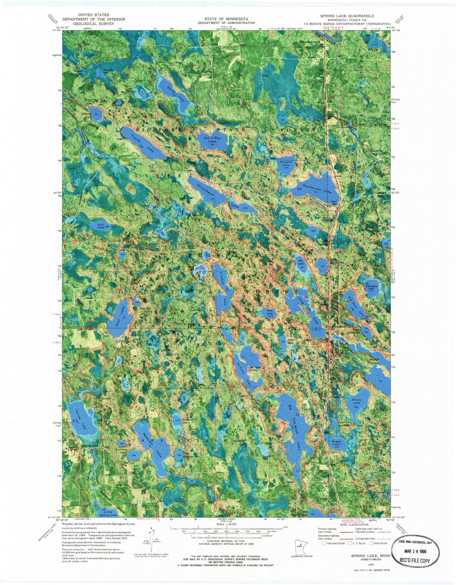
Classic USGS Spring Lake Minnesota 7.5'x7.5' Topo Map
Couldn't load pickup availability
Historical USGS topographic quad map of Spring Lake in the state of Minnesota. Map scale may vary for some years, but is generally around 1:24,000. Print size is approximately 24" x 27"
This quadrangle is in the following counties: Itasca.
The map contains contour lines, roads, rivers, towns, and lakes. Printed on high-quality waterproof paper with UV fade-resistant inks, and shipped rolled.
Contains the following named places: Ackerman Lakes, Arrowhead Lake, Backus Lake, Big Rose Lake, Big Too Much Lake, Boggy Lake, Border Impoundment, Crooked Lake, Crooked Lake Impoundment, David Lake, East Lake, East Lake Dam, East Lake Impoundment, Elbow Lake, Elm Lake, Fisher Lake, George Lake, Goodman Lake, Goodman Lake Impoundment, Gunderson Lake, Hatch Lake, Holland Lake, La Croix Number One Impoundment, La Croix Number Two Impoundment, Lac-a-Roy Lake, LaCroix Lake, Little Mud Lake, Little Peterson Lake, Little Rose Lake, Little Round Lake, Long Lake, Mount Tabor Camp, Park Lake, Peterson Lake, Pickerel Lake, Riverside Chapel, Riverside Church, Rock Lake, Spring Lake, Spring Lake Creek, Spring Lake Post Office, Spur Lake, Spur Lake Impoundment, Spur Lake Trail System, Township of Lake Jessie, Trestle Lake, Twin Lakes, Upper Hatch Lake


