MyTopo
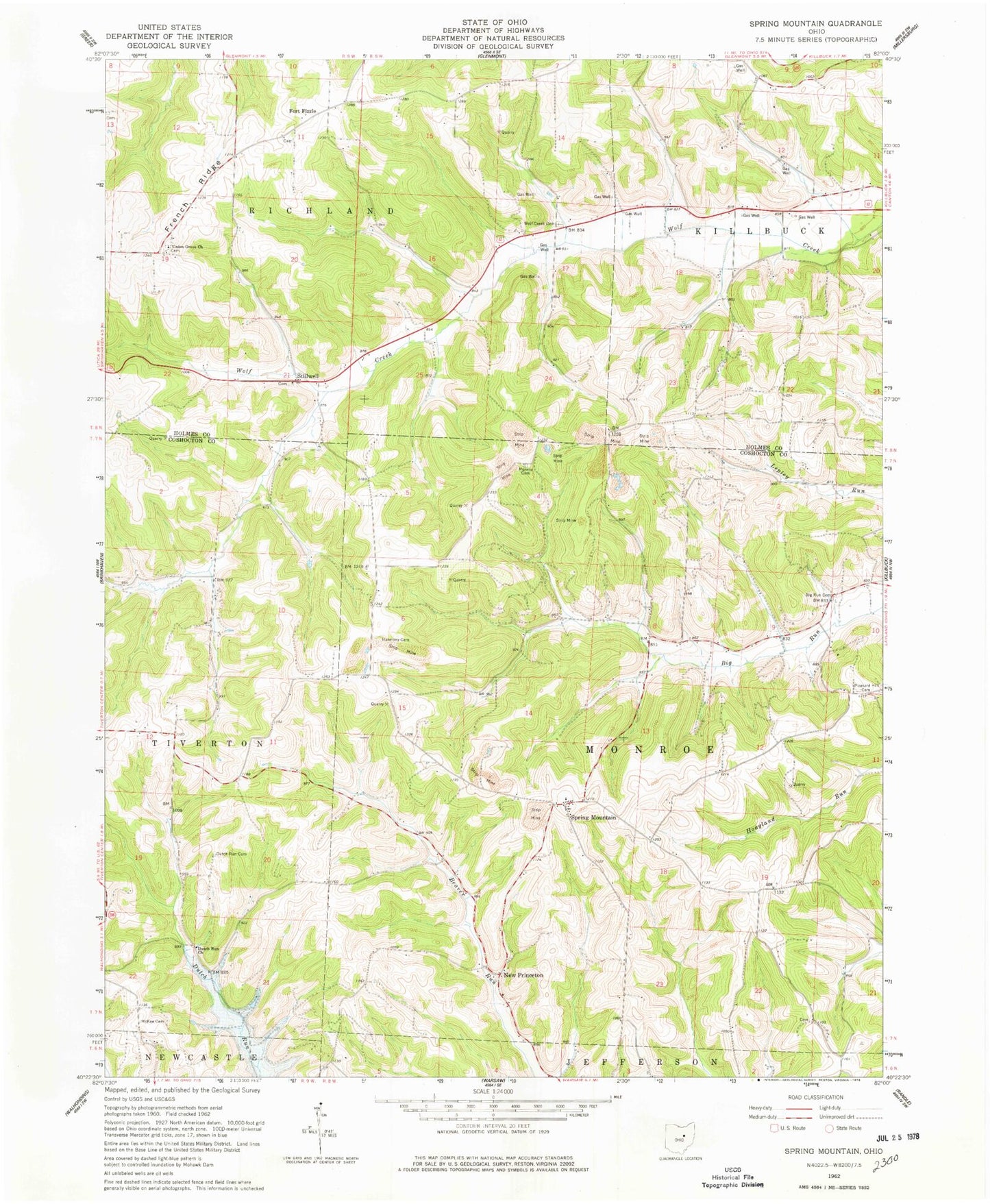
Classic USGS Spring Mountain Ohio 7.5'x7.5' Topo Map
Couldn't load pickup availability
Historical USGS topographic quad map of Spring Mountain in the state of Ohio. Map scale may vary for some years, but is generally around 1:24,000. Print size is approximately 24" x 27"
This quadrangle is in the following counties: Coshocton, Holmes.
The map contains contour lines, roads, rivers, towns, and lakes. Printed on high-quality waterproof paper with UV fade-resistant inks, and shipped rolled.
Contains the following named places: Barnes Cemetery, Big Run Cemetery, Big Run School, Bucy Cemetery, Dutch Run Cemetery, Dutch Run Church, Dutch Run School, Election School, Fort Fizzle, French Ridge, Harmony Cemetery, Harmony Church, Hazel Glen School, Lookout School, McKee Cemetery, McKelvey School, Monroe Cemetery, Monroe Church, New Princeton, New Princeton Post Office, Pleasant Hill Cemetery, Pleasant Hill Church, Pleasant Valley School, Rock Ridge School, Spring Mountain, Spring Mountain Cemetery, Spring Mountain Post Office, Stillwell, Stillwell Cemetery, Stilwell Post Office, Stuber School, Township of Monroe, Township of Richland, Union Grove Cemetery, Union Grove Church, Wolf Creek Cemetery, ZIP Code: 44637