MyTopo
Classic USGS Spring Seat Texas 7.5'x7.5' Topo Map
Couldn't load pickup availability
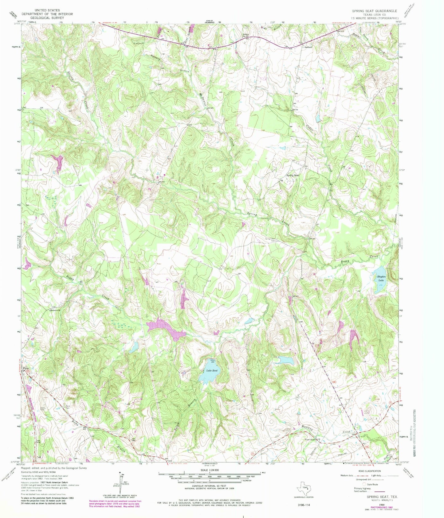
Historical USGS topographic quad map of Spring Seat in the state of Texas. Map scale may vary for some years, but is generally around 1:24,000. Print size is approximately 24" x 27"
This quadrangle is in the following counties: Leon.
The map contains contour lines, roads, rivers, towns, and lakes. Printed on high-quality waterproof paper with UV fade-resistant inks, and shipped rolled.
Contains the following named places: Bethanna Church, Boyd Branch, Buzzard Branch, Cryar Lake, Easterling Lake, Easterling Lake Dam, Evans Chapel, Flynn, Flynn Cemetery, Flynn Post Office, Flynn Volunteer Fire Department, Greer Branch, Hayden Lake, Hayden Mountain, Herbert Cryar Dam, Keith Lake, Keith Lake Dam, Lake Reed, Lake Reed Dam, McDaniel Creek, Nixon Branch, Redland, Redland Church, Seale Cemetery, Simms Lake, Simms Lake Dam, Smith Lake, Smith Lake Dam, Spring Creek, Spring Creek Cemetery, Spring Seat, Yellow Branch