
MyTopo
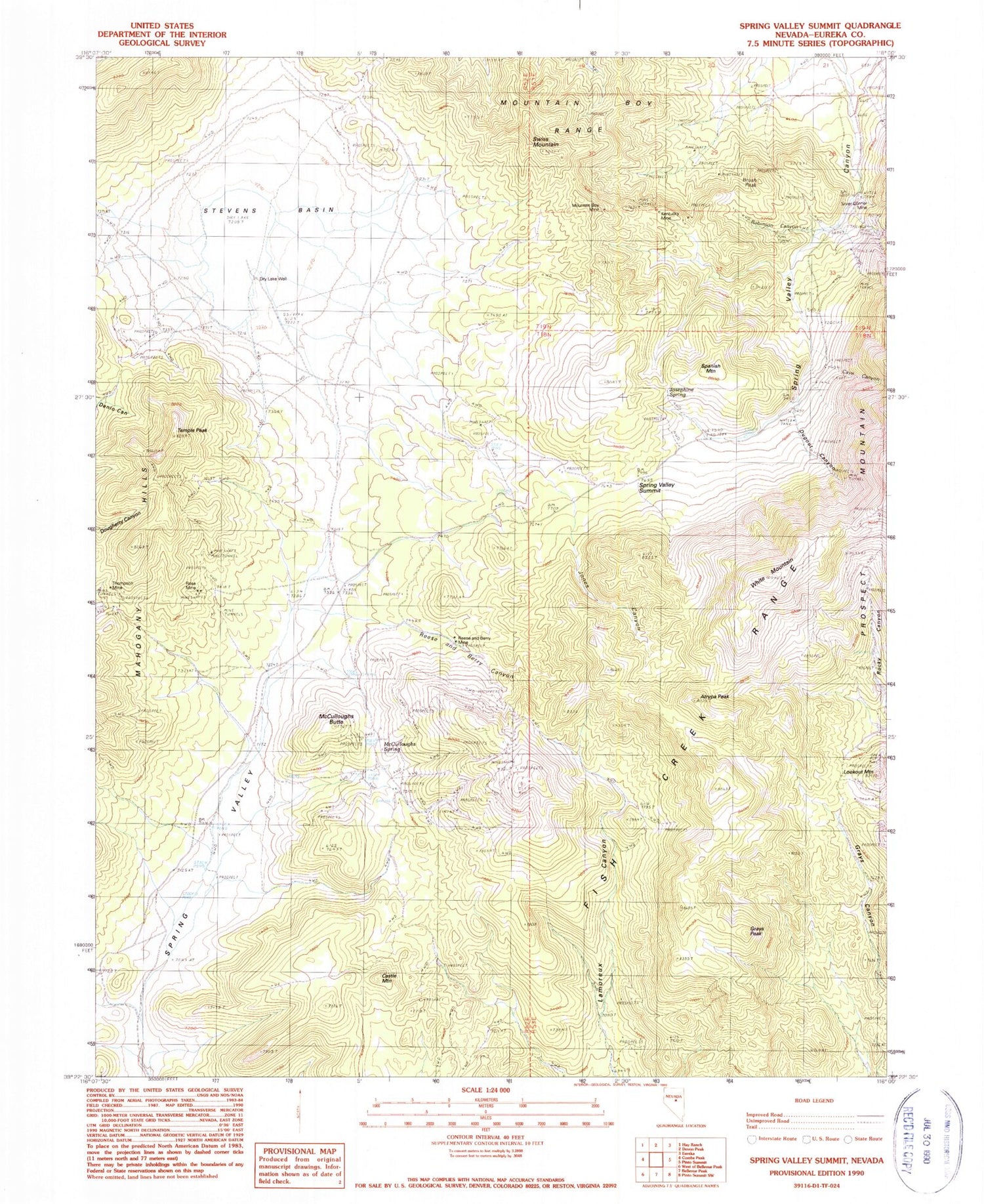
Classic USGS Spring Valley Summit Nevada 7.5'x7.5' Topo Map
Couldn't load pickup availability
Historical USGS topographic quad map of Spring Valley Summit in the state of Nevada. Map scale may vary for some years, but is generally around 1:24,000. Print size is approximately 24" x 27"
This quadrangle is in the following counties: Eureka.
The map contains contour lines, roads, rivers, towns, and lakes. Printed on high-quality waterproof paper with UV fade-resistant inks, and shipped rolled.
Contains the following named places: Atrypa Peak, Brush Peak, Castle Mountain, Cave Canyon, Dry Lake, Dry Lake Well, Dugout Canyon, Dugout Tunnels, Grays Peak, Jones Canyon, Josephine Spring, Kentucky Mine, Lookout Mountain, McCulloughs Butte, McCulloughs Spring, Mountain Boy Mine, Mountain Boy Range, Prospect, Prospect Mountain Tunnel, Prospect Post Office, Reese and Berry Canyon, Reese and Berry Mine, Robinson Canyon, Rose Mine, Silver Conner Mine, Spanish Mountain, Spring Valley, Spring Valley Canyon, Spring Valley Summit, Stevens Basin, Swiss Mountain, Temple Peak, White Mountain


