MyTopo
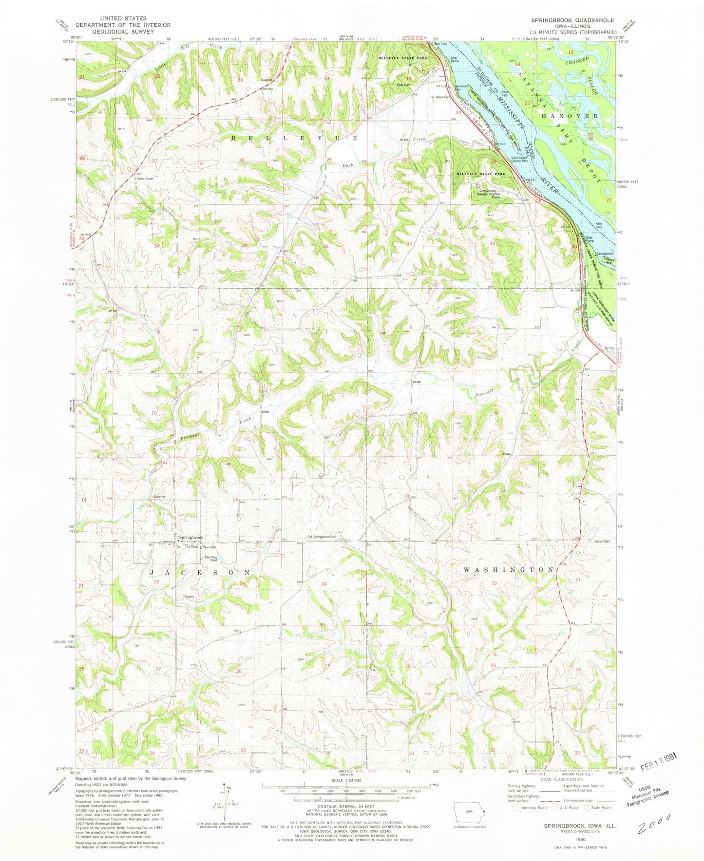
Classic USGS Springbrook Iowa 7.5'x7.5' Topo Map
Couldn't load pickup availability
Historical USGS topographic quad map of Springbrook in the states of Iowa, Illinois. Map scale may vary for some years, but is generally around 1:24,000. Print size is approximately 24" x 27"
This quadrangle is in the following counties: Jackson, Jo Daviess.
The map contains contour lines, roads, rivers, towns, and lakes. Printed on high-quality waterproof paper with UV fade-resistant inks, and shipped rolled.
Contains the following named places: Bellevue Butterfly Garden, Bellevue State Park, Bellvue Flying Circus Airport, City of Springbrook, Duck Creek, Duck Creek County Park, Dyas Cemetery, First Presbyterian Cemetery, Harrington Slough, Hazen Cemetery, Heim Farm Cemetery, Homan Farm Cemetery, Huff Farm Cemetery, Island Number 249, Monner Farm Cemetery, Old Springbrook Cemetery, Pleasant Creek, Pleasant Creek Use Area, Saint John's Lutheran Cemetery, Saint Peter and Paul Church, Saints Peter and Paul Cemetery, Shady Haven Camper Park and Marina, Springbrook, Springbrook Post Office, Springbrook Volunteer Fire Department, Township of Bellevue, Township of Jackson