MyTopo
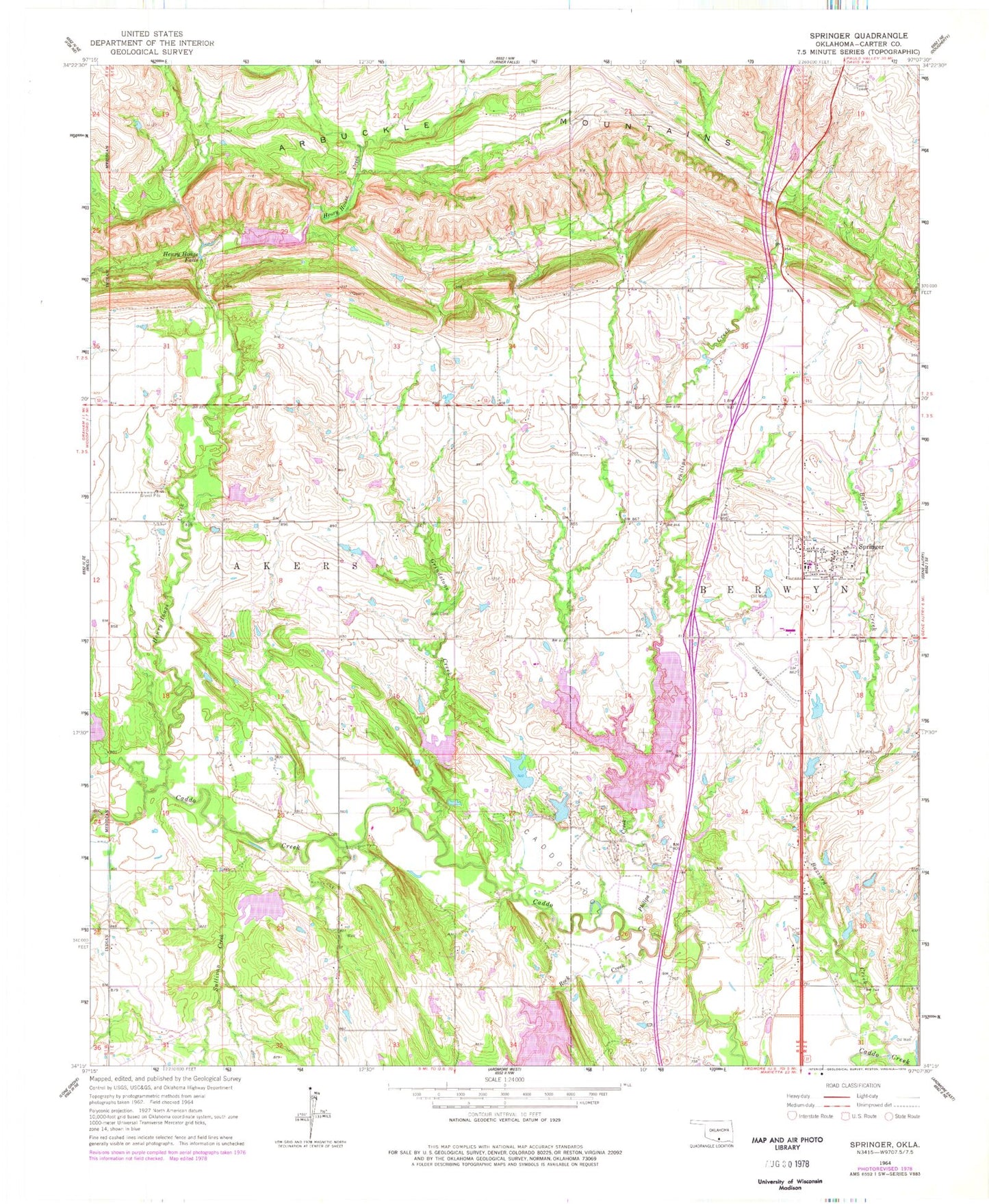
Classic USGS Springer Oklahoma 7.5'x7.5' Topo Map
Couldn't load pickup availability
Historical USGS topographic quad map of Springer in the state of Oklahoma. Map scale may vary for some years, but is generally around 1:24,000. Print size is approximately 24" x 27"
This quadrangle is in the following counties: Carter.
The map contains contour lines, roads, rivers, towns, and lakes. Printed on high-quality waterproof paper with UV fade-resistant inks, and shipped rolled.
Contains the following named places: Ardmore Club Lake, Ardmore North Division, Buzzard Creek, Caddo Creek Site 11 Dam, Caddo Creek Site 11 Reservoir, Caddo Creek Site 12 Dam, Caddo Creek Site 12 Reservoir, Caddo Creek Site 13 Dam, Caddo Creek Site 13 Reservoir, Caddo Creek Site 14 Dam, Caddo Creek Site 14 Reservoir, Caddo Creek Site 17 Dam, Caddo Creek Site 17 Reservoir, Caddo Creek Site 18 Dam, Caddo Creek Site 18 Reservoir, Caddo Creek Site 27 Dam, Caddo Creek Site 27 Reservoir, Caddo Pool Oil Field, Cobb Cemetery, D C Fitzgerald Dam, Fitzgerald Reservoir, Gaines Cemetery, Glenn, Glenn Cemetery, Grindstone Creek, Henry House Creek, Henry House Falls, Noble-Sea Cattle Company Dam, Noble-Sea Cattle Company Reservoir, Oknoname 01901 Dam, Oknoname 01901 Reservoir, Oknoname 01902 Dam, Oknoname 01902 Reservoir, Philips Creek, Rock Creek, Salt Branch, Smith Field, Springer, Springer Cemetery, Springer Elementary School, Springer Fire Department, Springer High School, Springer Post Office, Strader Ranch Airport, Sullivan Creek, Town of Springer