MyTopo
Classic USGS Springfield Idaho 7.5'x7.5' Topo Map
Couldn't load pickup availability
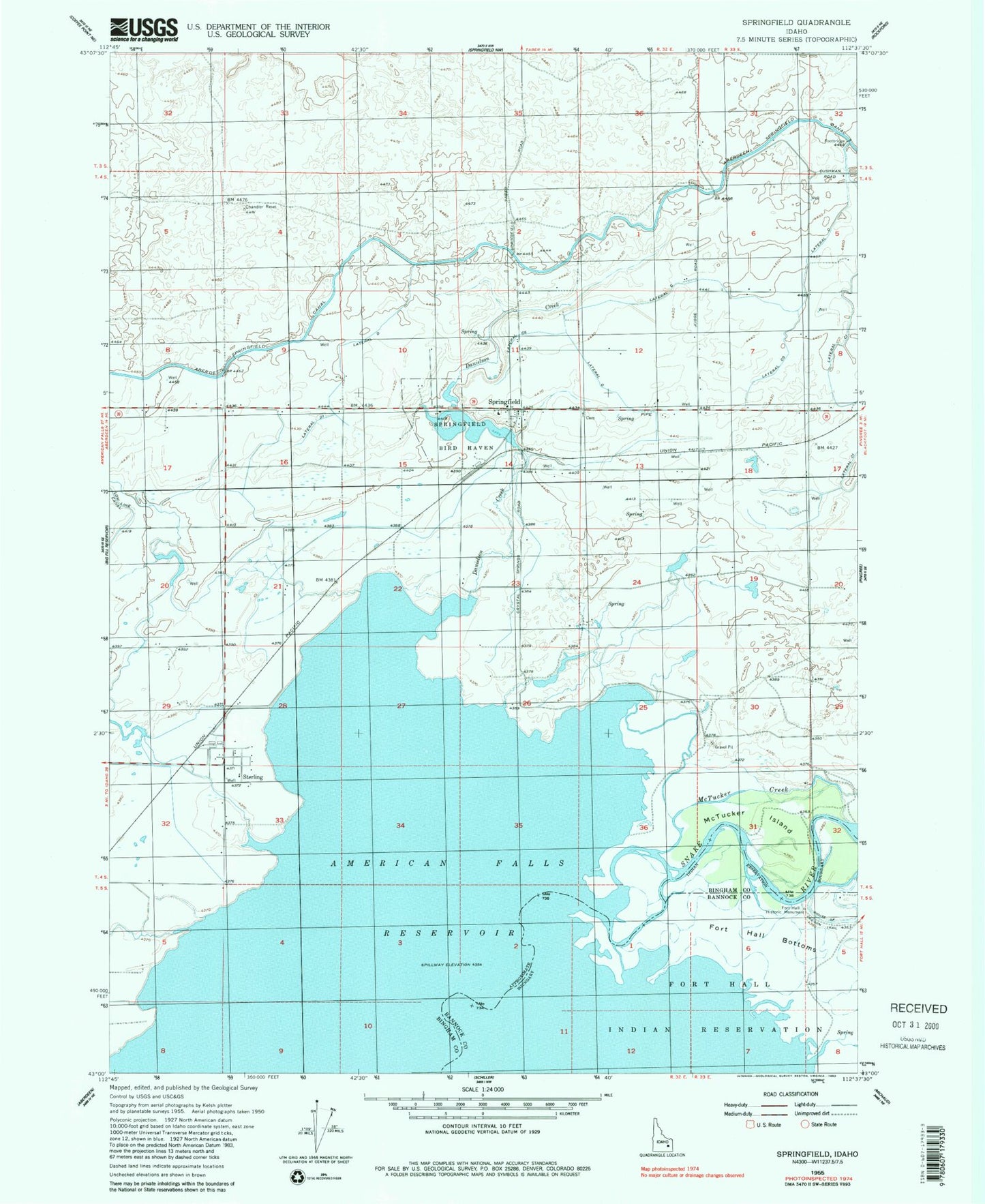
Historical USGS topographic quad map of Springfield in the state of Idaho. Map scale may vary for some years, but is generally around 1:24,000. Print size is approximately 24" x 27"
This quadrangle is in the following counties: Bannock, Bingham.
The map contains contour lines, roads, rivers, towns, and lakes. Printed on high-quality waterproof paper with UV fade-resistant inks, and shipped rolled.
Contains the following named places: Aberdeen - Springfield Fire Department Springfield Station, Danielson Creek, Fort Hall Historic Monument, Lateral C, Lateral C 1, Lateral C 5, Lateral C 6, Lateral C3, Lateral D, Lateral D 1, McTucker Creek, McTucker Island, Snake River Valley, Springfield, Springfield Bird Haven, Springfield Lake Access Area, Sterling, ZIP Code: 83277