MyTopo
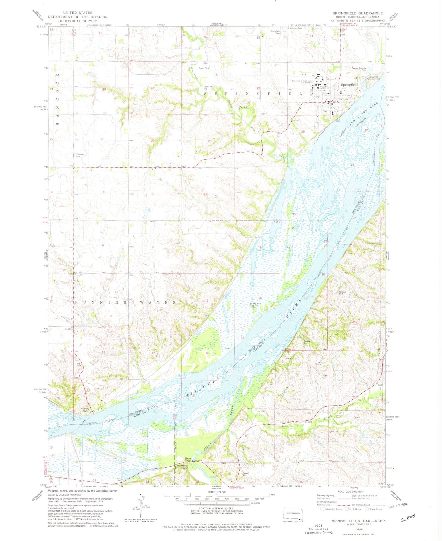
Classic USGS Springfield South Dakota 7.5'x7.5' Topo Map
Couldn't load pickup availability
Historical USGS topographic quad map of Springfield in the states of South Dakota, Nebraska. Map scale may vary for some years, but is generally around 1:24,000. Print size is approximately 24" x 27"
This quadrangle is in the following counties: Bon Homme, Knox.
The map contains contour lines, roads, rivers, towns, and lakes. Printed on high-quality waterproof paper with UV fade-resistant inks, and shipped rolled.
Contains the following named places: Bazile Creek, Bazile Creek State Wildlife Management Area, Breckenridge Post Office, City of Springfield, Emanuel Cemetery, Emanuel Creek, Emanuel Creek Recreation Area, Evelyn Lang Public Library, KSTI-FM (Springfield), Lost Creek, Maidens Leap, Mike Durfee State Prison, Running Water, Running Water Census Designated Place, Saint Vincents Cemetery, School Number 37, School Number 38, School Number 39, School Number 6, Springfield, Springfield Ambulance Service, Springfield Cemetery, Springfield City Hall, Springfield College Museum, Springfield Elementary School, Springfield Fire Department, Springfield Historical Society Museum, Springfield Police Department, Springfield Post Office, Springfield Recreation Area, Township of Running Water, Township of Springfield, University of South Dakota at Springfield, ZIP Code: 57062