MyTopo
Classic USGS Springville California 7.5'x7.5' Topo Map
Couldn't load pickup availability
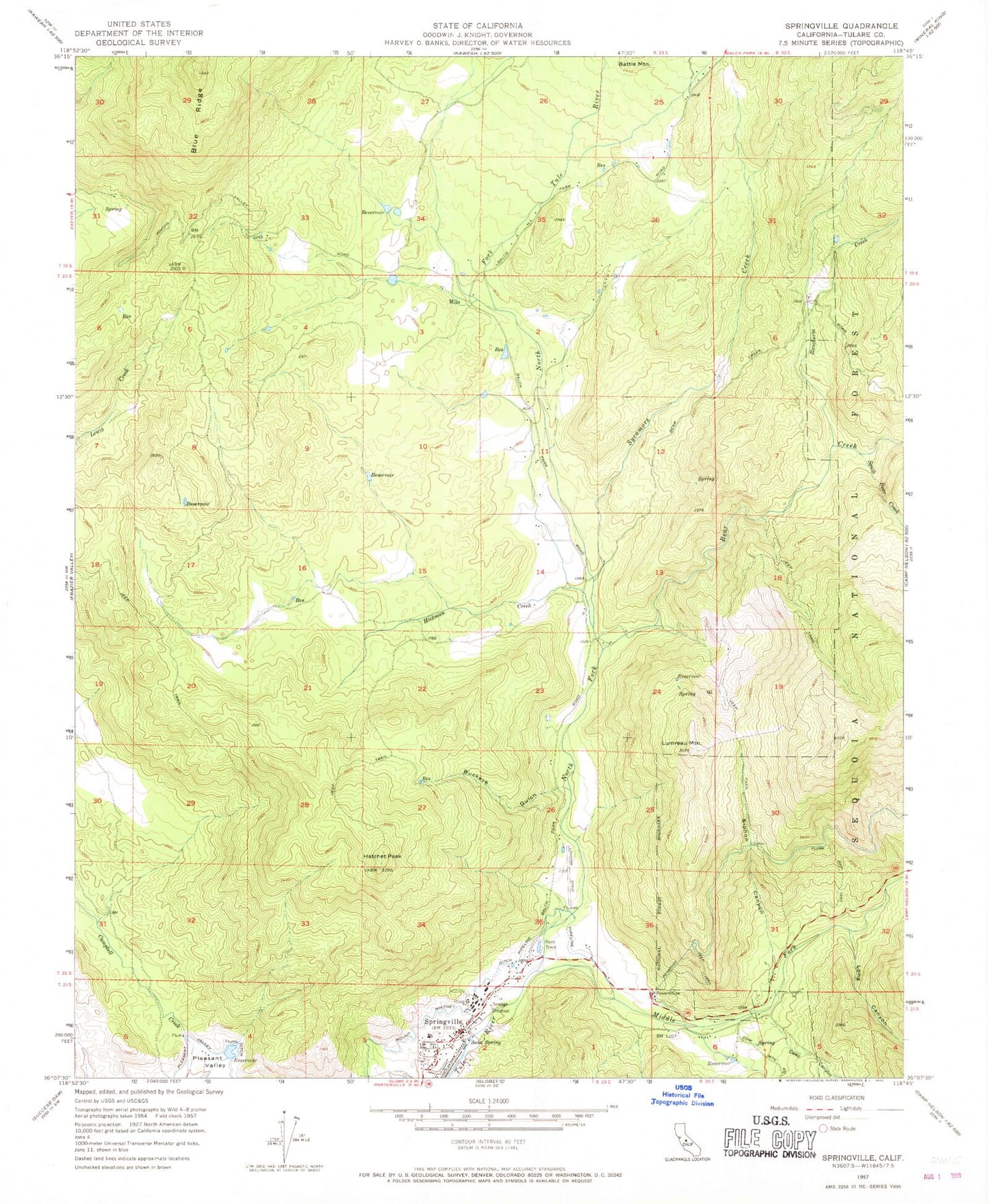
Historical USGS topographic quad map of Springville in the state of California. Map scale may vary for some years, but is generally around 1:24,000. Print size is approximately 24" x 27"
This quadrangle is in the following counties: Tulare.
The map contains contour lines, roads, rivers, towns, and lakes. Printed on high-quality waterproof paper with UV fade-resistant inks, and shipped rolled.
Contains the following named places: Bear Creek, Buckeye Gulch, Church of Christ at Springfield, Coffee Camp Picnic Area, Deep Canyon, Dickey Ranch, Family Healthcare Network Health Center, Hatchet Peak, Hickman Creek, Long Canyon, Lumreau Mountain, Middle Fork Tule River, Milo, Mount Whitney Ditch, North Fork Tule River, Patton House Community Center, Rancheria Creek, Scicon County School, Sequoia Dawn Senior Citizens Complex, Sequoia Ranch Airport, Siphon Canyon, Soda Spring, South Bear Creek, Springville, Springville Elementary School, Springville Post Office, Springville United Methodist Church, Springville Work Center CDF, Sycamore Creek, Tulare County, Tulare County Fire Department Battalion 2 Springville Fire Station 22, Ward Canyon