MyTopo
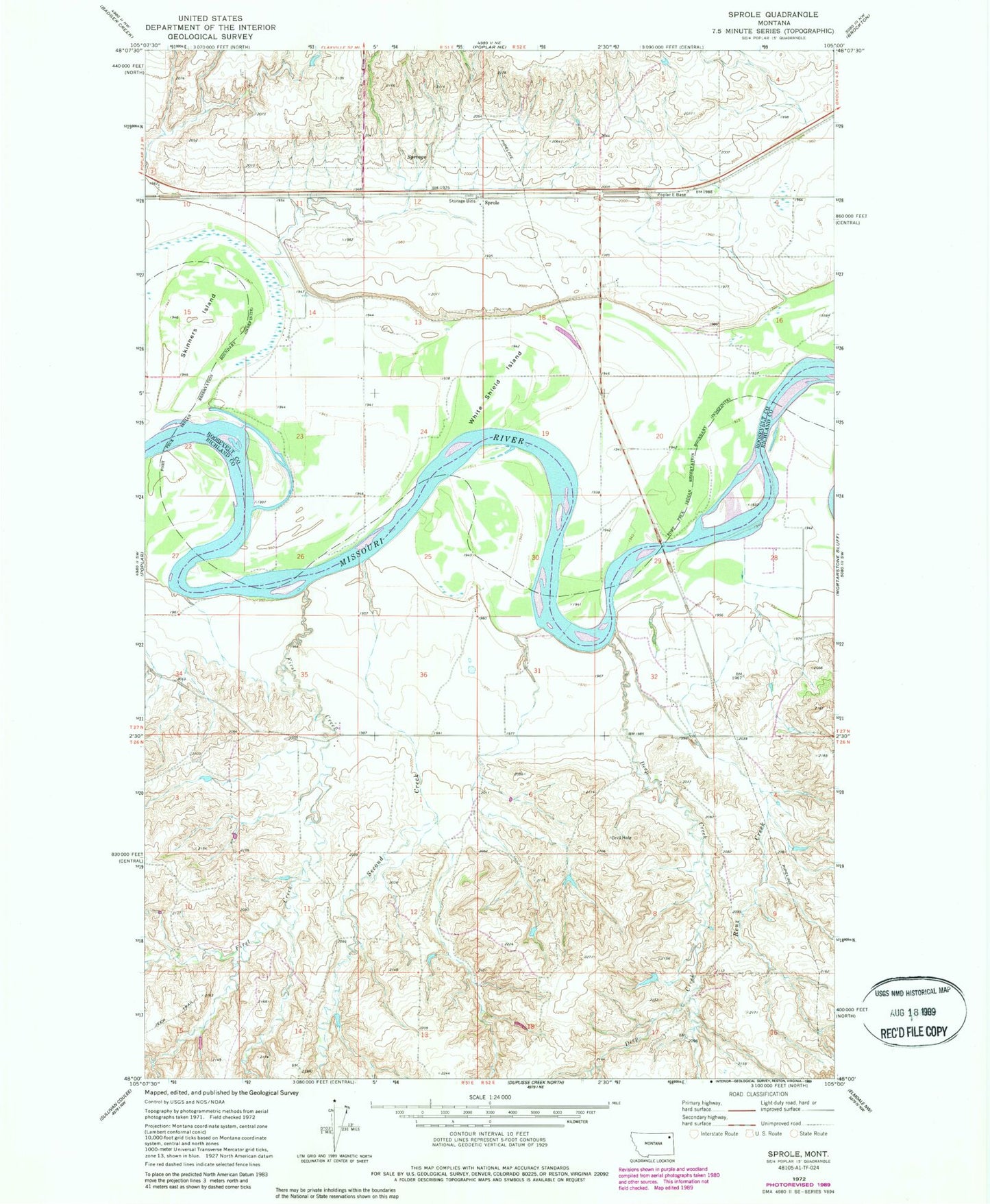
Classic USGS Sprole Montana 7.5'x7.5' Topo Map
Couldn't load pickup availability
Historical USGS topographic quad map of Sprole in the state of Montana. Map scale may vary for some years, but is generally around 1:24,000. Print size is approximately 24" x 27"
This quadrangle is in the following counties: Richland, Roosevelt.
The map contains contour lines, roads, rivers, towns, and lakes. Printed on high-quality waterproof paper with UV fade-resistant inks, and shipped rolled.
Contains the following named places: 26N48E15BCCC01 Well, 26N51E02AABA01 Well, 26N51E13AA__01 Well, 26N51E13AA__02 Well, 26N52E05ACCB01 Well, 26N52E05BA__01 Well, 26N52E05CA__01 Well, 26N52E06CD__01 Well, 27N51E10DA__01 Well, 27N51E10DB__01 Well, 27N51E11CC__01 Well, 27N51E11CD__01 Well, 27N51E12AB__01 Well, 27N51E13CB__01 Well, 27N51E14BD__01 Well, 27N51E25DD__01 Well, 27N51E26DD__01 Well, 27N51E35DD__01 Well, 27N52E07CD__01 Well, 27N52E07DA__01 Well, 27N52E07DABB01 Well, 27N52E07DABB02 Well, 27N52E08AC__01 Well, 27N52E08DA__01 Well, 27N52E09AC__01 Well, 27N52E09AD__01 Well, 27N52E09BB__01 Well, 27N52E09DC__01 Well, 27N52E16AD__01 Well, 27N52E16BA__01 Well, 27N52E17BB__01 Well, 27N52E17CB__01 Well, 27N52E18AB__01 Well, 27N52E18AD__01 Well, 27N52E18CA__01 Well, 27N52E28AB__01 Well, 27N52E28AB__02 Well, 27N52E28AB__03 Well, 27N52E28BA__01 Well, 27N52E31CA__01 Well, 27N52E32AD__01 Well, 27N52E32CC__01 Well, Bilger Creek, Colgan Creek, Davis Dam, Deep Creek, Deertail Indian Village, First Creek, Ivys Island, Poplar Bridge, Renz Creek, Second Creek, Skinners Island, Sprole, Sprole Elevator, White Shield Island