
MyTopo
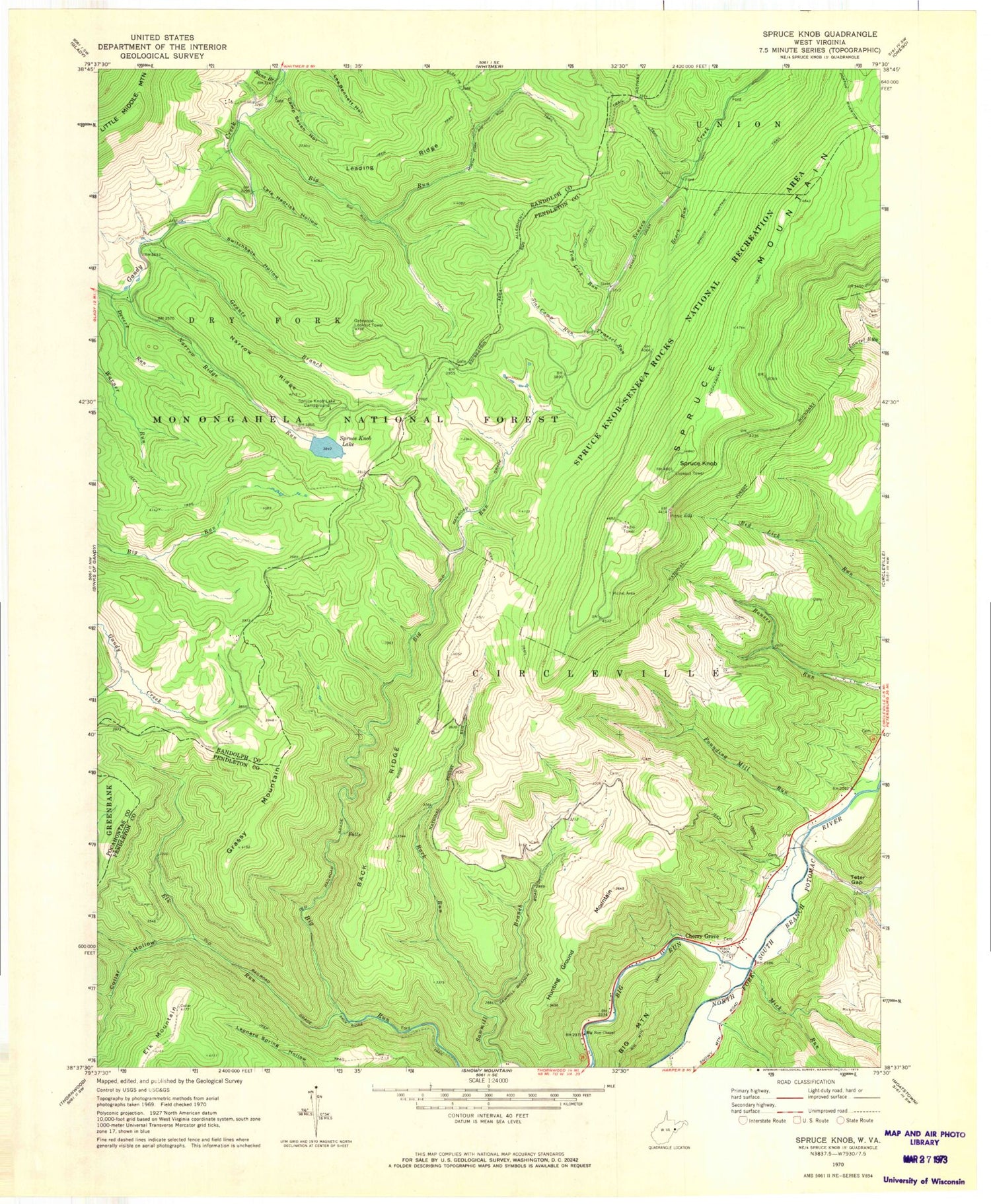
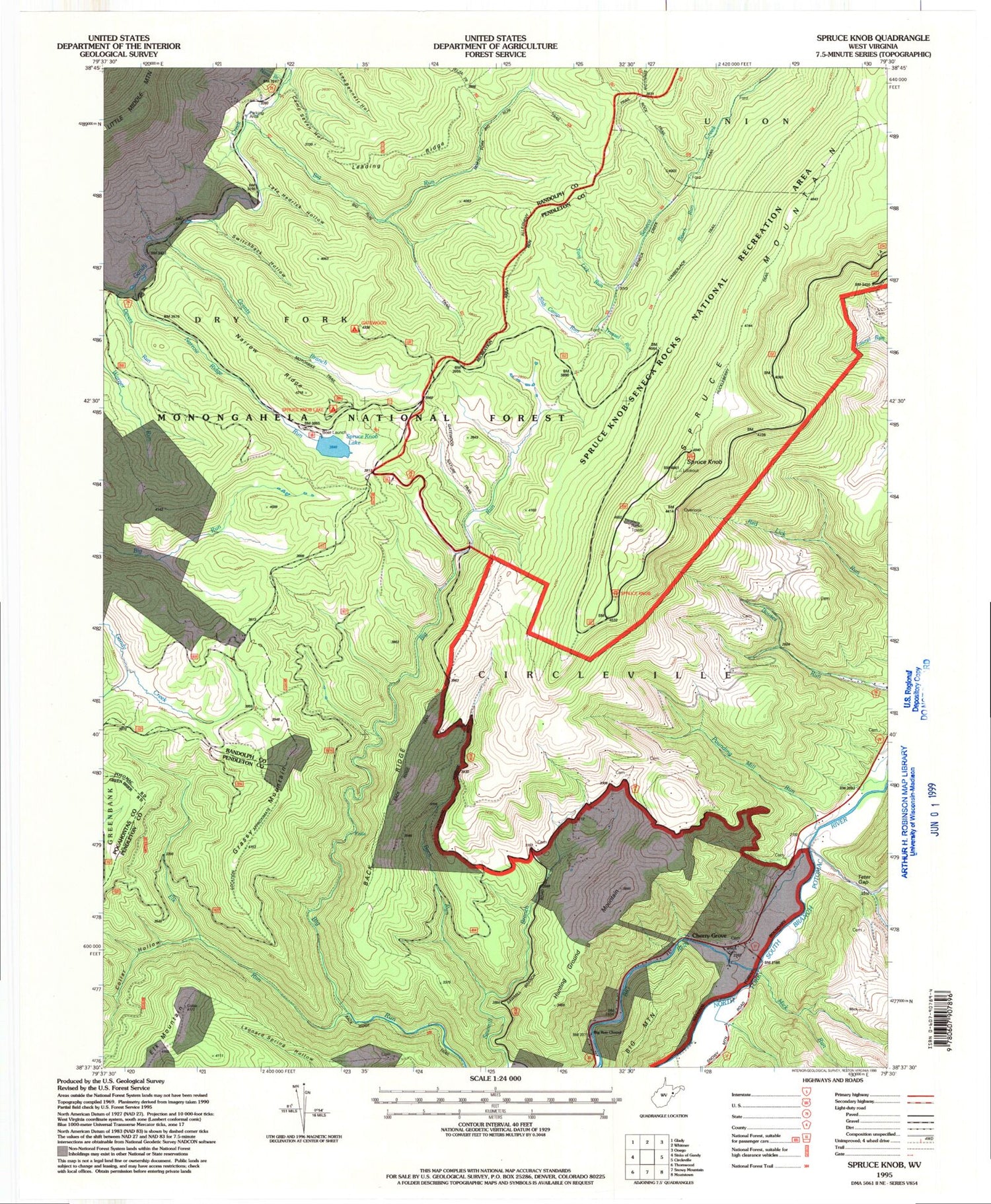
USGS Classic Spruce Knob West Virginia 7.5'x7.5' Topo Map
Couldn't load pickup availability
Historical USGS topographic quad map of Spruce Knobin the states of West Virginia, Pennsylvania, Maryland, Virginia. Scale: 1:24000. Print size: 24" x 27"
This quadrangle is in the following counties: Pendleton, Pocahontas, Randolph.
The map contains contour lines, roads, rivers, towns, lakes, and grids including latitude / longitude and UTM / MGRS. Printed on high-quality waterproof paper with UV fade-resistant inks.
Contains the following named places: Allegheny Mountains, Back Ridge, Back Ridge Trail, Back Run, Beech Run, Big Run, Big Run, Big Run Chapel, Big Run Trail, Camp Seven Hollow, Cherry Grove, Collar Hollow, Devers Run, Elk Run, Grants Branch, Grassy Mountain, Horton Riverton Trail, Huckleberry Trail, Hunting Ground Mountain, Lafe Hedrick Hollow, Leading Ridge, Mick Run, Nans Branch, Narrow Ridge, North Fork Big Run Trail, Pounding Mill Run, Slab Camp Run, Spruce Knob, Spruce Knob Lake, Spruce Knob Lake Campground, Spruce Mountain, Switchback Hollow, Teter Gap, Teter Run, Tom Lick Run, Trussel Run, Spruce Knob Picnic Area, Gatewood Group Campground, Gatewood Nature Trail, Elk Mountain, Narrow Ridge, Gatewood Lookout Tower, Spruce Knob Lake Dam, Spruce Mountain Spring, Big Spring, Judy Spring, Allegheny Mountains, Allegheny Mountains, Allegheny Mountains, Dayton Police Department


